
The Dictionary of Sydney was archived in 2021.
Narellan

Citation
Persistent URL for this entry
To cite this entry in text
To cite this entry in a Wikipedia footnote citation
To cite this entry as a Wikipedia External link
Narellan
Narellan is one of the growing suburbs on Sydney's south-west urban fringe, the traditional land of the Tharawal and Gundungurra people. Narellan lies in the central part of the Camden municipality, although it was part of Nepean Shire Council until that body was abolished in 1948. Narellan is surrounded in the north by the new suburbs of Harrington Park, in the east by Narellan Vale, and to the west and south the older areas of Cobbitty and Elderslie.
Early settlement
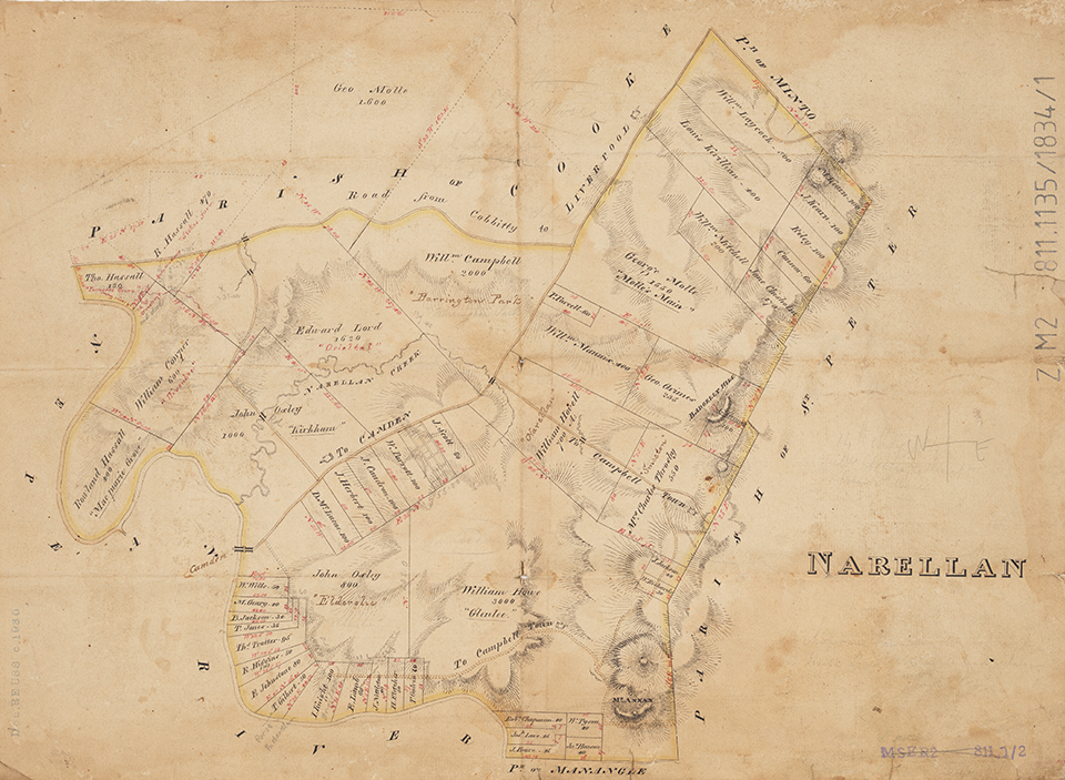
The [media]name Narellan is used for the village, the district and the parish, and was probably derived from William Hovell's 1816 grant of 700 acres (283 hectares) called Narralling. Most of the parish of Narellan was granted to settlers by Governor Macquarie between 1810 and 1818.
In 1827 Robert Hoddle and John Oxley had surveyed the site of the village, which was set out in a rectilinear plan, and marked the site of a church, school and courthouse. By 1839 a lockup had been built, and sly grog shops had sprung up along the Great South Road, although outside the village boundaries. By 1830 the Benches of Magistrates were issuing inn licences throughout the colony, and the earliest licence in Narellan was granted to Thomas Avery, an associate of Mrs Herbert, for the Travellers' Rest from 1830–32.
A church school was built in 1839 on church land under the supervision of Reverend Robert Frost, who was foundation headmaster of The King's School at Parramatta and rector of St Peter's Church of England, Campbelltown, from 1839. By 1842 there were 45 children being taught under the capable hand of Mr Samuel Turton, and in 1846 this had increased to 96 children. The school was also used by the Reverend Thomas Hassall for church services. In 1875 a government national school was established on the site for the courthouse, and later became Narellan Public School. Edmund Blacket designed St Thomas's Church of England in 1879, which was consecrated in 1884. It was set on the highest point in the village with vistas of the surrounding countryside, reminiscent of an English country village. The church and the public school had significant open space around them, some of which still exists. Further educational developments had to wait until the twentieth century and the construction of Macarthur Anglican School (1978) adjacent to St Thomas's church, which had ceased to function as a church.
The first village allotments were offered for sale in 1843 for £20, but the development of Camden effectively suffocated the development of Narellan village. Even by 1847 the Sydney Morning Herald stated that the village only had a pound, an inn, a few mechanics' shops and a school house that served as a church on Sundays. The Narellan post office opened in 1856 under the management of Charles Nott and was located on the Great South Road (later Camden Valley Way). In 1913 the residents of the village had formed the Narellan and District Progress Association.
Grand rural estates
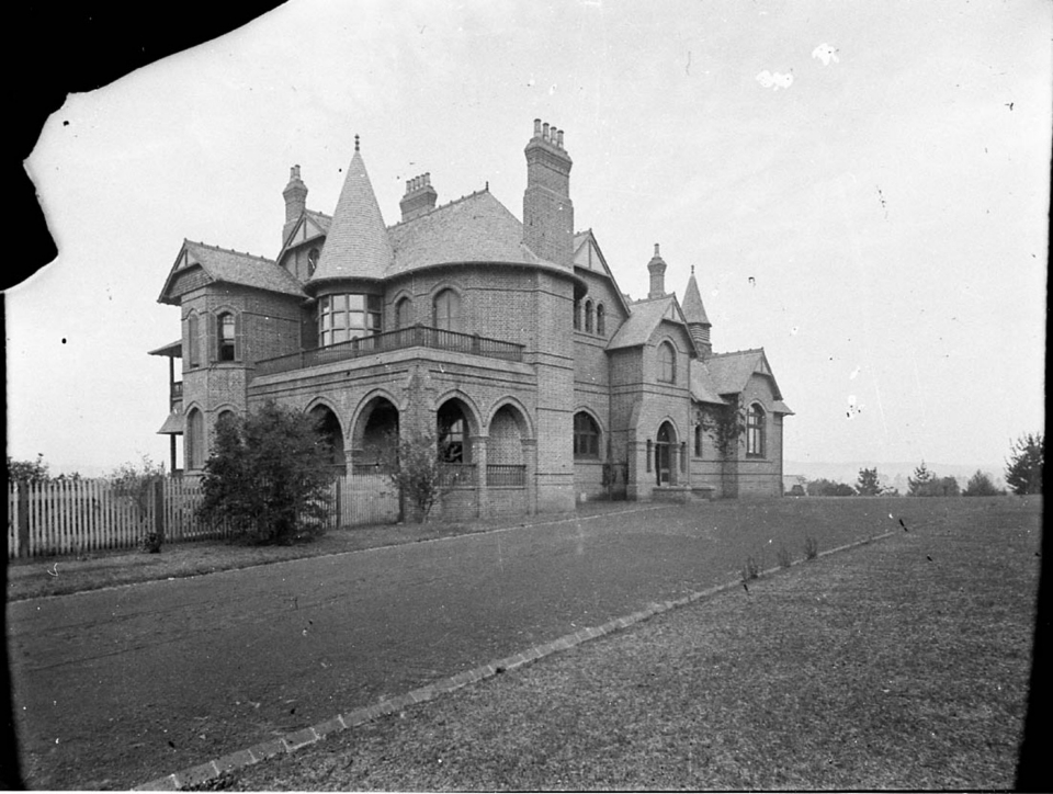
The most significant cottage in Narellan is Ben Linden. It is a rare example of the Federation style in the Narellan area. It was constructed in 1919 by George Blackmore and has served variously as a private residence, a school (1930s), a guest house (1940s), private maternity hospital (1950s) and a convalescent home (1960s).
Farming in [media]the local area consisted of vineyards, orchards and dairying. The village was surrounded by a number of estates of the landed gentry, most notably Denbigh, Harrington Park, Smeeton, Kirkham, Orielton, Gledswood, Wivenhoe, Camelot, and Studley Park.
Railway and industry
Narellan railway station was the hub of activity in the village and the centre of the local economy. The station was the next stop after Grahams Hill, and the fourth station after leaving Camden on the branch-line between Camden and Campbelltown. The locomotive (affectionately known as Pansy) had 24 services each weekday, which were a mixture of passenger and goods services. The tramway operated from 1882 until 1963, when a number of branch lines in the Sydney area were shut. Adjacent to the station were a timber mill and stockyards, and milk was loaded daily for the Sydney market.
In 1941, coal handling facilities were relocated from Camden, and coal screening and loading bins were constructed opposite the Narellan station. These facilities handled coal brought by road from the Burragorang Valley mines, and by the 1970s Narellan had become the main centre for the local coal industry. It had administration facilities, workshops and an associated housing development (1988) (and some of these facilities still exist). Coal handling was eventually transferred to Glenlee.
During World War II, the defence establishments in the local area included the Narellan Army Camp on the Great Northern Road and the Eastern Command Training School at Studley Park. The soldiers would come into the village hotel or catch the train to Campbelltown, so they could go into Sydney for their weekend leave.
The village remained quite small up until the 1950s and was unable to compete with the commercial and administrative dominance of Camden. Even in the 1960s there were only three retail businesses in the village – a general store, a hotel and a butchery – although a brick works had been opened in the village in 1949.
Twentieth-century growth
Narellan started to grow under the Sydney Region Outline Plan (1968) and the administration of the Macarthur Development Board, which, jointly with Camden Municipal Council, released land on the Somerset Park Estate (1985). The promotional literature claimed that there was a need to preserve the 'rural and historic charm of the district'.
By the 1990s commercial development in Narellan had usurped the dominance of Camden, and Narellan had become the commercial centre of the local district. The development of a retail mall at Narellan town centre, in 1995, encouraged commercial growth, with the addition of professional services fronting Camden Valley Way, the traditional strip shopping area of the village. Another 50 shops were added in 1999, and 20 more in 2001. Traffic congestion in central Narellan caused by these developments has been relieved by the recent opening of an extension of Narellan Road. There have also been extensive land releases in surrounding suburbs, for example, Harrington Park and Narellan Vale.
References
Pam Browne, 'Narellan, A Not So Poorer Cousin', In Macarthur, Autumn, 2007, pp 8–10
PJ Mylrea, Camden district: a history to the 1840s, Camden Historical Society, Camden NSW, 2002
Camden Historical Society website, www.camdenhistory.org.au, viewed 6 February 2009