
The Dictionary of Sydney was archived in 2021.
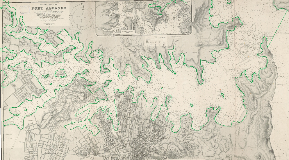
Comparison of chart of Port Jackson by Pullen and Gubbins in 1890 with modern mean high water mark, in green 2013
Contributed By
(Geographic Information System (GIS) created by Phil Mulhearn 2013.) (Modern Sydney Harbour mean high water mark outline, courtesy of Port Authority of NSW 2013) ('Australia-East coast. Port Jackson 1890, Compiled by Lieutenants T. F. Pullen and G. W. Gubbins, H.M.S. Lark, from information supplied by the New South Wales', National Library of Australia, MAP JOHNSTON SPECIAL COL./21. http://nla.gov.au/nla.map-jsc21)