1. The Dictionary of Sydney
  2. Multimedia
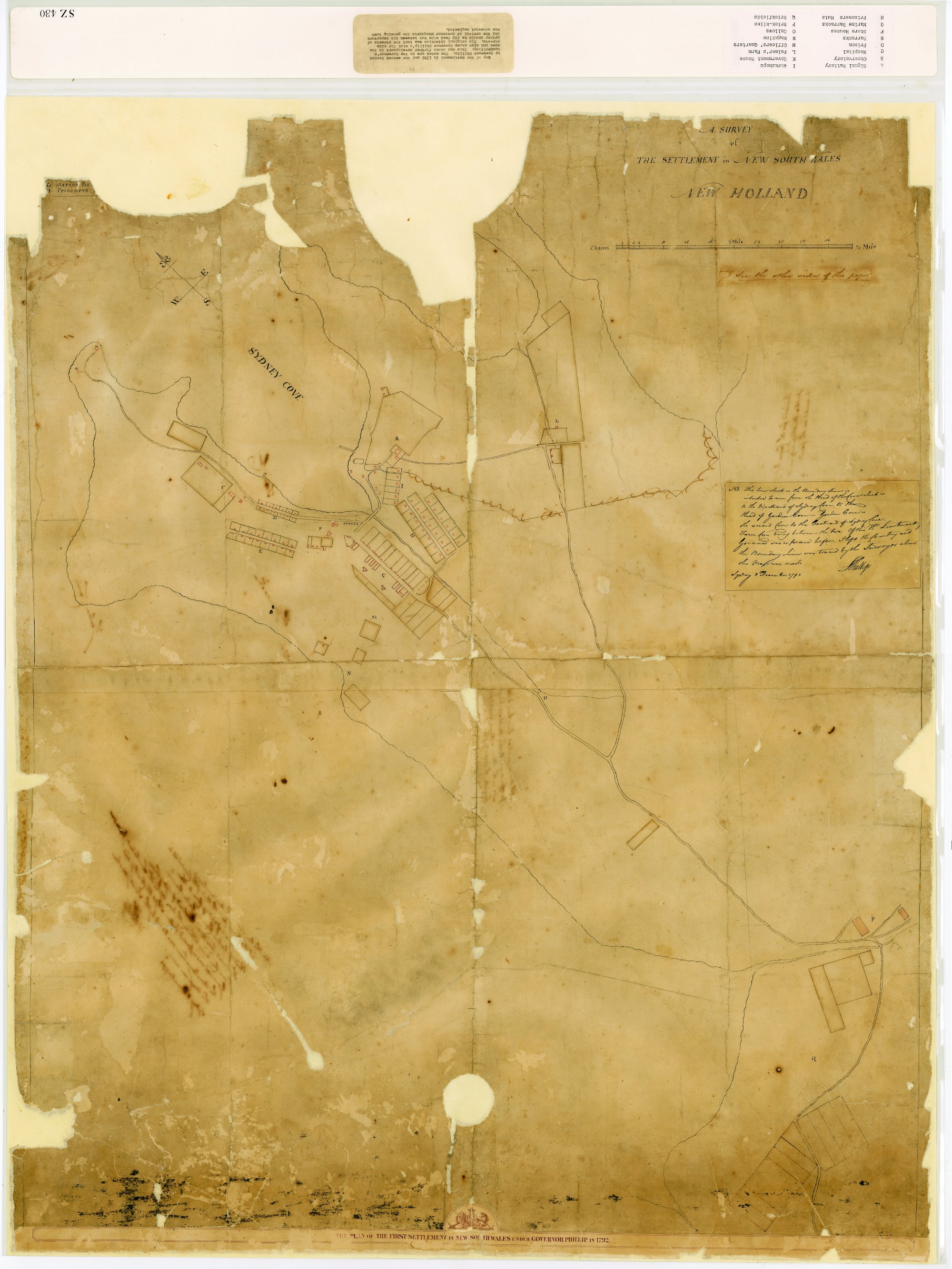
  3. Phillip's Map of Sydney Cove 1792

Phillip's Map of Sydney Cove 1792

By
Arthur Phillip
Contributed By
State Archives & Records New South Wales
[CGS 13859, [SZ430]]

Browse

  • Browse
    • Artefacts
    • Buildings
    • Events
    • Natural Features
    • Organisations
    • People
    • Places
    • Structures
    • Entries
    • Multimedia
    • Subjects
    • Roles
    • Contributors
Connections
Appears in
Built environment Planning Roads
Subjects
Exploration Maps

Footer

  • Home
  • About
  • Copyright
  • Contact

Footer Secondary

  • Contribute
  • Donate

Phillip, Arthur

British naval officer who became first Governor of New South Wales, leading the colony for five difficult years.

State Archives & Records New South Wales

Statutory body established by the State Records Act 1998. The Act provides for the creation, management and protection of the records of public offices of the State and for public access to those records.

Based at Kingswood, State Archives and Records NSW manage and provide access to the New South Wales State archives collection, a unique and irreplaceable part of Australia's cultural heritage dating back to 1788.


Built environment

Built over tracks, campsites, rock art and middens used for thousands of years before the dispossession of the Aboriginal people, Sydney's early haphazard development was given form by public buildings. As public transport developed, suburbs spread, and throughout the twentieth century, town planners struggled with developers to direct the form and extent of the city. After World War II, city buildings got taller, outer suburbs sprang up ever further away, and issues of heritage and architecture were contested. In the twenty-first century, concerns about environment, urban density, public transport and renewed infrastructure are driving change.

Planning

From an accidental city without a plan, Sydney has become a city with many plans. The early town grew without controls, but later governments tried to regulate building and development, and keep up with necessary services and infrastructure. From 1900, resumptions, zoning and regulation were used to shape the city and its suburbs.

Roads

Starting as a tiny settlement on the edge of a great continent, Sydney developed roads as Europeans moved out into the hinterland. They became gateways to the port and city that Sydney Town grew into.

Maps

Exploration