  1. The Dictionary of Sydney
  2. Multimedia
  3. Atlas of the Suburbs of Sydney - Drummoyne 1889...

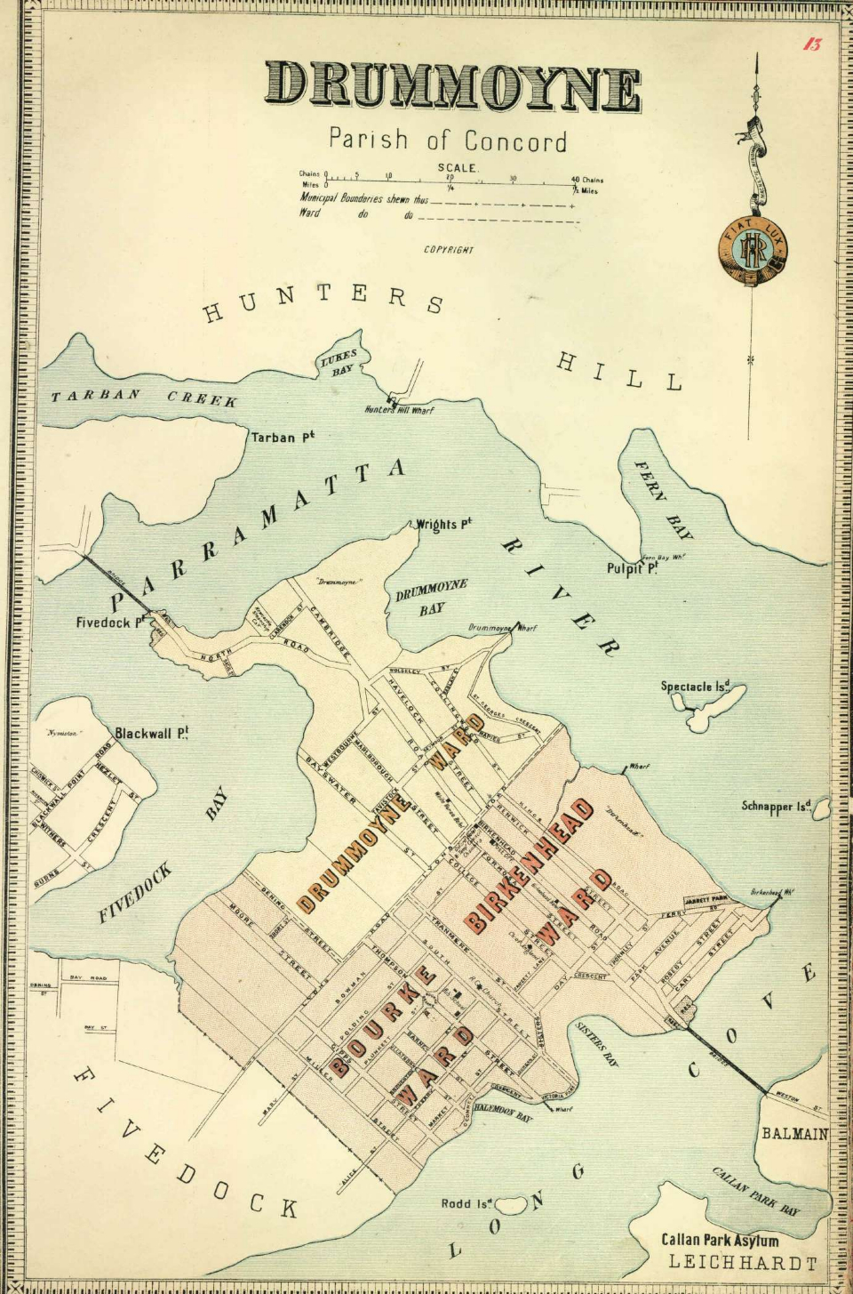
Atlas of the Suburbs of Sydney - Drummoyne 1889-1894

By
Higinbotham & Robinson
Contributed By
City of Sydney Archives

Browse

  • Browse
    • Artefacts
    • Buildings
    • Events
    • Natural Features
    • Organisations
    • People
    • Places
    • Structures
    • Entries
    • Multimedia
    • Subjects
    • Roles
    • Contributors
Connections
Appears in
Atlas of the Suburbs of Sydney
Subjects
Maps
Places
Drummoyne
Artefacts
Atlas of the Suburbs of Sydney

Footer

  • Home
  • About
  • Copyright
  • Contact

Footer Secondary

  • Contribute
  • Donate

Higinbotham & Robinson

City of Sydney Archives

The City of Sydney Archives holds items from as early as 1842 when the Municipal Council of Sydney was established, and manage, preserve and provide access to more than 1 million items, including documents, photographs, maps, plans and data. The collection consists of City of Sydney corporate archives, items collected from the community relating to the City of Sydney local area and published reference material. Use the links to go directly to the City of Sydney's website.

Atlas of the Suburbs of Sydney

Published by commercial map makers Higinbotham, Robinson and Harrison in the late nineteenth century, the maps of the Atlas of the Suburbs of Sydney provide a portrait of the city's municipalities during a period of rapid growth and suburbanisation.

Maps

Drummoyne

Inner western residential suburb surrounded by water on three sides. William Wright, merchant, whaler and sealer, named his land Drummoyne Park in 1853 after his family home on the Clyde in Scotland.

full record »

Atlas of the Suburbs of Sydney

Series of late-nineteenth-century commercial maps of municipalities created by Sydney map publishers Higinbotham, Robinson and Harrison.

full record »