1. The Dictionary of Sydney
  2. Multimedia
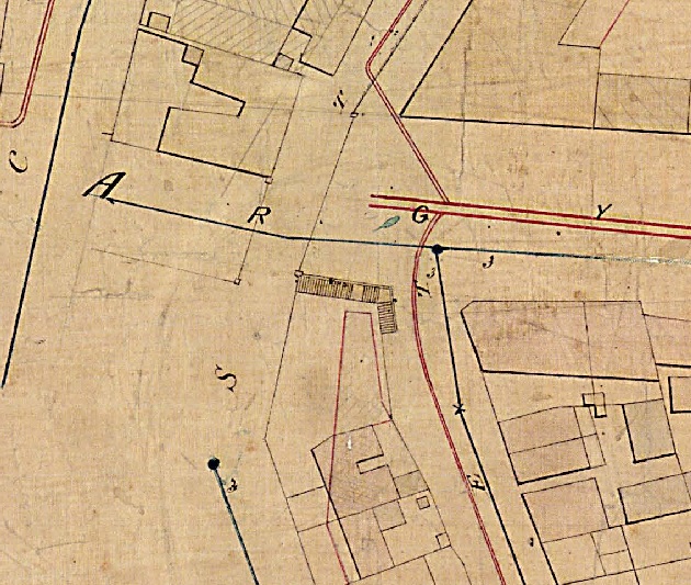
  3. Detail of trigonometrical study of The Rocks sh...

Detail of trigonometrical study of The Rocks showing Playfair Stairs 1855 - 1865
Contributed By
City of Sydney Archives
[Detail of City of Sydney – Trigonometrical Survey, 1855-1865: Block B2, CRS1042/4]
(Detail of City of Sydney – Trigonometrical Survey, 1855-1865: Block B2 )

Browse

  • Browse
    • Artefacts
    • Buildings
    • Events
    • Natural Features
    • Organisations
    • People
    • Places
    • Structures
    • Entries
    • Multimedia
    • Subjects
    • Roles
    • Contributors
Connections
Appears in
Playfair Stairs
Subjects
Footpaths Maps
Structures
Playfair Stairs
Places
The Rocks

Footer

  • Home
  • About
  • Copyright
  • Contact

Footer Secondary

  • Contribute
  • Donate

City of Sydney Archives

The City of Sydney Archives holds items from as early as 1842 when the Municipal Council of Sydney was established, and manage, preserve and provide access to more than 1 million items, including documents, photographs, maps, plans and data. The collection consists of City of Sydney corporate archives, items collected from the community relating to the City of Sydney local area and published reference material. Use the links to go directly to the City of Sydney's website.

Playfair Stairs

Playfair Stairs in The Rocks was an unusually shaped stairway, which did not fit neatly into the typical stairway typologies of the city. The stairway bent around the corner into Cambridge Street like an elbow.

Footpaths

Maps

Playfair Stairs

full record »

Set of steps built to link the higher Gloucester Street with Cambridge Street, The Rocks at the lower level on the south-east of Argyle Cut. 

The Rocks

full record »

Suburb located north of the central business district on the western shore of Sydney Cove. Characterised by a precinct of restored nineteenth-century buildings which are a major tourist attraction, it was recognised as a separate suburb in 1993.