1. The Dictionary of Sydney
  2. Multimedia
  3. Plan of valuable farms at Kissing Point 1845
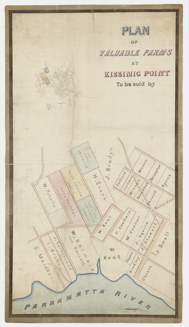
Plan of valuable farms at Kissing Point 1845

By
William Meadows Brownrigg
From the collections of the
State Library of New South Wales
[M M3 811.1422/ 1845/ 1]
(Mitchell Library)

Browse

  • Browse
    • Artefacts
    • Buildings
    • Events
    • Natural Features
    • Organisations
    • People
    • Places
    • Structures
    • Entries
    • Multimedia
    • Subjects
    • Roles
    • Contributors
Connections
Appears in
Ryde
Subjects
Advertising Maps Real Estate
Places
Kissing Point Ryde
Natural features
Parramatta River

Footer

  • Home
  • About
  • Copyright
  • Contact

Footer Secondary

  • Contribute
  • Donate

Brownrigg, William Meadows

Surveyor, estate agent and lithographic printer. 

State Library of New South Wales

Ryde

Wallumetta to its traditional owners, the Wallumedegal, the land that became Ryde was settled early and provided food to the growing town. From the 1870s, subdivision started, and the railway brought more development from 1886. In the twentieth century, Ryde became suburban and one of Sydney's earliest shopping centres was built there in 1957.

Maps

Real Estate

Advertising

Kissing Point

Area on the Parramatta River, originally inhabited by the Wallumedegal people, where 10 emancipated convicts, including brewer James Squire, were granted land in 1792.

full record »

Ryde

full record »

Residential and commercial suburb on north shore of Parramatta River, named after the town on the Isle of Wight where Mary Turner, an early resident in the area had been born. It was the third British settlement in Australia after Sydney and Parramatta.

Parramatta River

full record »

Major tributary of Sydney Harbour, which flows east from Blacktown Creek to meet Port Jackson between Greenwich and Birchgrove. The river is tidal to Charles Street Weir at Parramatta, 30 kilometres from Sydney Heads.