
The Dictionary of Sydney was archived in 2021.
Roads

Citation
Persistent URL for this entry
To cite this entry in text
To cite this entry in a Wikipedia footnote citation
To cite this entry as a Wikipedia External link
Roads
By the first decade of the twenty-first century, metropolitan Sydney was one of the largest cities in the world in terms of area, reaching across 4,000 square kilometres, although its population is only around 4.1 million. But two centuries ago, the convict colony at Sydney Town was a small isolated community on the edge of what was then seen as a hostile land, and so control and containment were uppermost in the minds of the authorities.
In such a colony, roads were of vital importance, for economic reasons and for the maintenance of public order. This aspect was recognised early. In the first months of the colony, in April 1788, Governor Phillip instructed the Surveyor-General, Augustus Alt, to draft a plan for Sydney's streets. His was a splendid vision:
The principal streets are placed so as to admit a free circulation of air, and are two hundred feet wide…
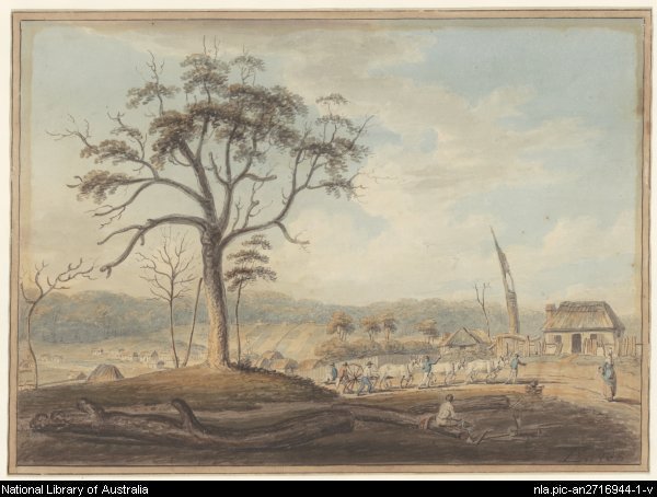
[media]This did not occur, and in the first decades of Sydney Town's existence, the roads just grew, largely following either ground contours or Aboriginal tracks.

The first roads
Possibly the first reference to actual road construction was in May 1788, when George Barrington, the Superintendent of Convicts, reported 'in the course of this month the storehouse was completed and a road to the wharf', although a few months later he noted that, due to heavy rains, 'the very roads were unable to be passed'.
The problem of ensuring adequate food supplies for the colony and transporting essential goods and foodstuffs into and around the city led to some major road developments. Seeking better agricultural land, Governor Phillip had journeyed up the Parramatta River and set up a farm at Rose Hill, and produce from it was transported back down the river to Sydney Town. The growth of Parramatta, as Rose Hill was renamed, soon temporarily outstripped the original settlement at Sydney Cove, with its population reaching 1970 at the end of 1792, compared with 1170 in Sydney.
[media]Although water transport probably remained the most reliable means of getting between Sydney and Parramatta, between 1789 and 1791 a track was formed between the two towns, and this became the basis for 'the road to Parramatta', which was laid out about 1797 under the direction of Surveyor-General Alt. It was remade in 1806 and again in 1810. Close to Parramatta, the road runs about a mile north of the original track.
When other arable land in the west and northwest of the Cumberland Plain was exploited, and settlement was established in the vicinity of Windsor and Richmond on the Hawkesbury River, another track was developed between Parramatta and Windsor – this became known as the Windsor Road.
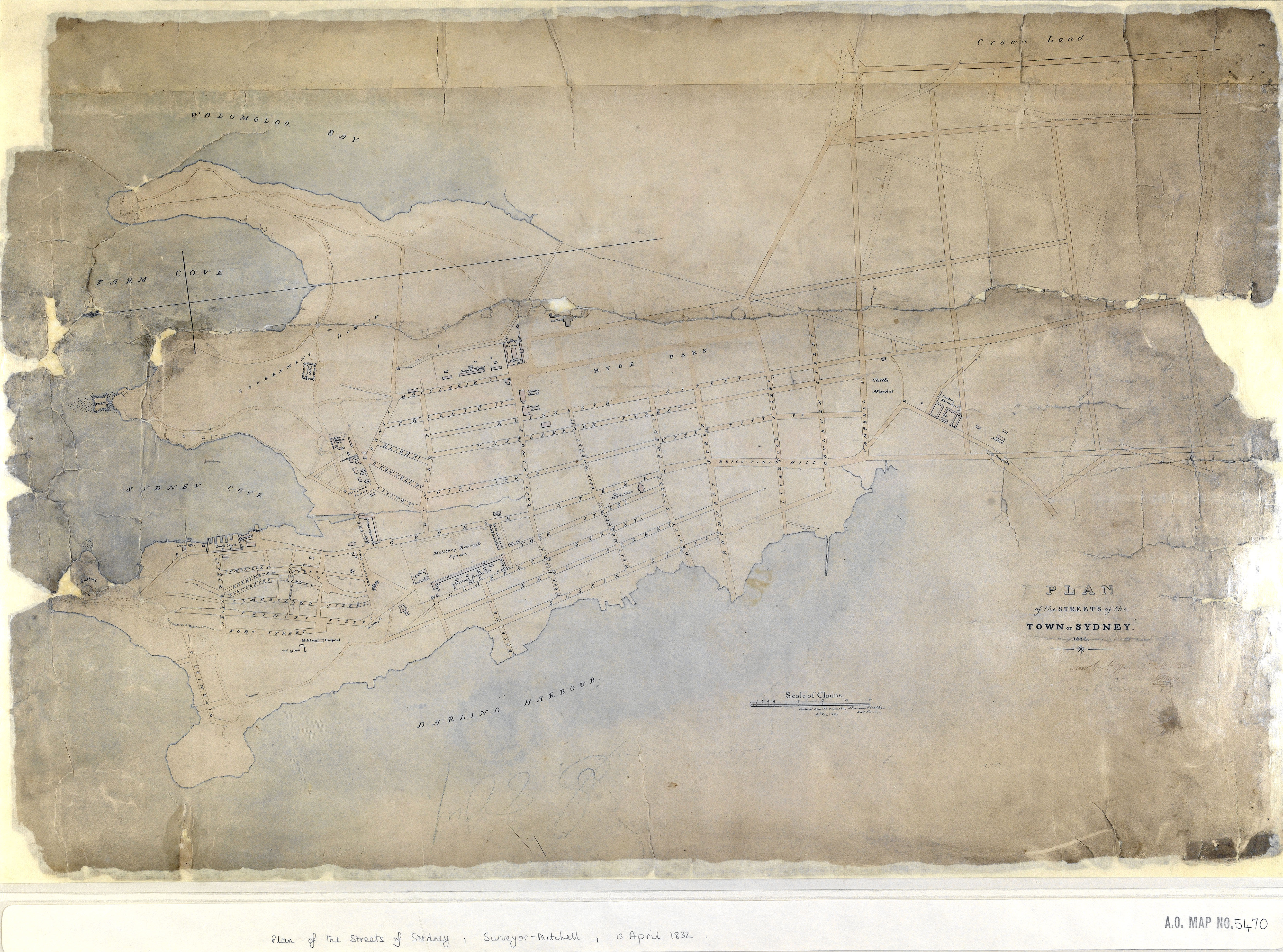
City streets and major roads
When Macquarie took office in 1810, he attempted to impose some order on the city's streets, and a grid pattern began to be superimposed on the southern, eastern and western ends of the ever-expanding town. The early colony also needed accessible and reliable roads to the interior, and Macquarie made extensive use of private contractors for these 'major' roads. In May 1810, James Harrex was contracted to build a toll road from Sydney through Parramatta to the Hawkesbury River: Harrex did not complete his contract due to his conviction for stealing livestock. William Roberts, an entrepreneurial ex-convict, was contracted to build a road from Sydney to Liverpool in 1813, and by April 1814, a road from Liverpool to [media]the Western Road near Parramatta (later to be called Dog Trap Road and then Woodville Road) was in progress.

The creation of a road east to strategic South Head had been on the authorities' agenda for some time. Roberts had earlier been contracted to build a road to the South Head, but it was not completed. Macquarie, aware of the importance of this link, partly for defence concerns, and partly to access the signal station and the planned lighthouse, had this road built in 1811, using convict and military labour, on a track first cut in 1803. This was the first 'rural road' that Macquarie ordered to be built: the area round the lighthouse, completed in 1816, was almost uninhabited bush for the first half of the nineteenth century.
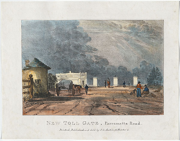
To pay for these road constructions, toll gates were built at the points where the roads entered the town. Tolls were collected for the remuneration of the private contractors who had built the roads. Over time, as the city expanded, the toll gates moved outwards. The one originally at the beginning of what is now Oxford Street (at Hyde Park), was later moved out near the Victoria Barracks.[media] Similarly, the toll gate that was originally at King and Pitt streets moved west as the town expanded, to a position near the Benevolent Asylum on the Parramatta road at Chippendale, and eventually by the late 1850s, to the junction of the Cooks River Road (now City Road) and Parramatta Road. These toll gates marked what could be called the 'gateways' to Sydney, the meeting points where the roads from the interior of the colony led back into the streets of the city.
Growth along the roads
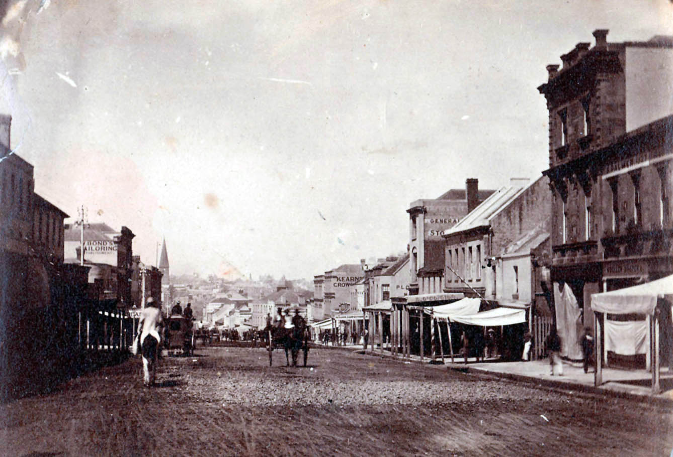
[media]While Sydney itself was initially only a small settlement, with a population of around 10,000 in 1810, over the following decades the city expanded, and settlement infill occurred, largely out along the skeleton of the roads. Between 1870 and 1890, the number of suburban municipalities almost doubled, with most of the newly incorporated areas west of the city, reflecting a residential boom during the 1870s and 1880s.
The terrain of many areas hindered or slowed development and suburban development was first evident in the region to the south-west of old Sydney Town, because the land was less rugged or capped with shale, permitting easier building. [media]In time, there were changes to access to the east; a new road was constructed closer to the shoreline, called the New South Head Road, with the older one becoming the Old South Head Road. In 1875, as lower Old South Head Road, close to the city, became a major shopping hub, this part of it was renamed Oxford Street.

[media]The gateway roads have now been there for two centuries, but what was once Sydney Town is now a very small part of greater Sydney, which has continued to expand. In 1871, when the Sydney region had a population of around 135,000, over half the metropolitan population still lived within the boundaries of the City of Sydney. Yet 20 years later, metropolitan Sydney had a population of 383,283, and the City accounted for only 29 per cent of it. By the first decade of the twenty-first century, with greater Sydney's population at 4.1 million, the estimated residential population of the City of Sydney local government area is about 150,000 people.

Changing names and functions
[media]The gateway roads that previously took travellers into and out of Sydney Town remain the central structure of the major distributor roads that cover the whole metropolitan area. Many now inner-city roads were once gateways, with changing perceptions of their function reflected in name changes.
Broadway provides perhaps the clearest example. It was first referred to as Parramatta Road – the road to Parramatta – then became Parramatta Street, as housing was built along it and commercial development occurred. Eventually, after the city toll gates were moved from Pitt Street to City Road , Chippendale – then the western end of Sydney Town – it came to be known as George Street West, linking it indisputably to the city. [media]The name Broadway was acquired when George Street West was widened in the 1930s. So from today's perspective, George Street leads to Broadway, which becomes Parramatta Road, which in turn becomes part of the Great Western Highway. Alongside much of it now runs the high-speed Western Motorway (M4).

Similar renamings have taken place elsewhere: running south-west off the Parramatta Road at Ashfield was the Liverpool Road, which became the Hume Highway. Running near it for much of its length within the metropolitan area now is the South Western Motorway (M5). Cooks River Road, [media]running south off Parramatta Street, later Broadway, was renamed City Road, which becomes King Street as it passes through Newtown, and then becomes the Princes Highway.

On the northern side of the harbour, Milsons Point wharf, for ferries from the city, was accessed by Alfred Street which led up to North Sydney. This was the start of the Great North Road, which was later renamed the Pacific Highway. [media]The building of the Sydney Harbour Bridge, opened in 1932, created a new gateway into the central business district, and its rail and road links allowed for far greater development of the suburbs north of the harbour.

New ideas, particularly those advocating a complete functional separation of the different forms of traffic, are reflected in much of the new motorway and freeway construction that has taken place over the past few decades.
[media]At the start of the twenty-first century, Sydney's major roads are often in the news, because of accidents or congestion, or their ugliness, or because of financing problems, as with the Cross City Tunnel or the Lane Cove Tunnel. The old gateways to Sydney Town are now suburban streets, while the new gateways are many kilometres from Sydney's central business district, at the start of the freeways and motorways that speed people and goods into the historic heart of the metropolis.

References
Rosemary Broomham, Vital connections: a history of NSW roads from 1788, Hale & Iremonger, Sydney, 2001
Terry Kass, Roads and Traffic Authority Heritage and Conservation Register: Thematic History, second edition 2006, available at http://www.rta.nsw.gov.au/environment/downloads/heritage/rta_thematic_history.pdf , viewed 13 December 2010
Garry Wotherspoon (ed), Sydney's Transport: Studies in Urban History, Hale & Iremonger, Sydney, 1983
Department of Main Roads, The Roadmakers - A History of Main Roads in New South Wales, Sydney, 1976