  1. The Dictionary of Sydney
  2. Multimedia
  3. Glebe Island Bridge at Johnson's Bay, Sydney c1878

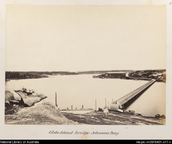
Glebe Island Bridge at Johnson's Bay, Sydney c1878

Contributed By
National Library of Australia
[nla.pic-vn3916401-s11]

Browse

  • Browse
    • Artefacts
    • Buildings
    • Events
    • Natural Features
    • Organisations
    • People
    • Places
    • Structures
    • Entries
    • Multimedia
    • Subjects
    • Roles
    • Contributors
Connections
Appears in
Glebe Island
Subjects
Bridges
Natural features
Glebe Island
Places
Glebe
Structures
Blackbutt Bridge Glebe Island Bridge

Footer

  • Home
  • About
  • Copyright
  • Contact

Footer Secondary

  • Contribute
  • Donate

National Library of Australia

Glebe Island

From abattoir to shipping terminal, Glebe Island has been an intrinsic part of the development of industrial Sydney.

Bridges

Glebe Island

full record »

Rocky outcrop bounded by White Bay to the west and north and Johnstons Bay to the east and south and linked to Balmain by causeway in 1840s. It was the site of abattoirs from 1850s to 1912, then levelled and used as wharves.

Glebe

full record »

Inner-city suburb named for its original status as Anglican church land granted to Richard Johnson, chaplain of the first fleet in 1790. The Glebe Point area became fashionable in the nineteenth century, while the southern part of Glebe became a working class district.

Glebe Island Bridge

full record »

Electrically operated swing bridge designed by Percy Allen, bridging Rozelle and Pyrmont over Johnstons Bay. It replaced Blackbutt bridge and was later replaced by the Anzac bridge.

Blackbutt Bridge

First bridge linking Pyrmont with Glebe Island which was replaced by the Glebe Island bridge.

full record »