  1. The Dictionary of Sydney
  2. Multimedia
  3. View of Sydney from Pyrmont, New South Wales c1880

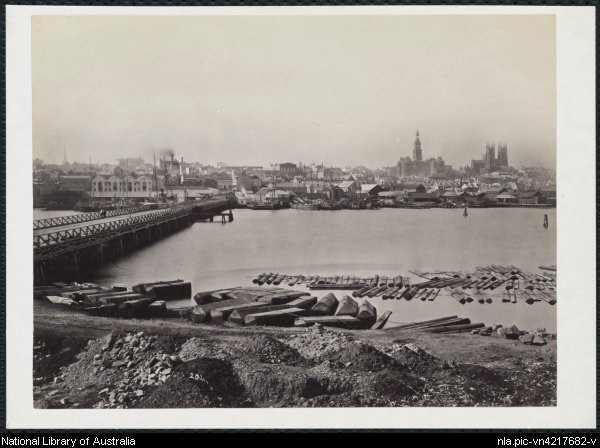
View of Sydney from Pyrmont, New South Wales c1880

By
Charles Bayliss
Contributed By
National Library of Australia
[nla.pic-vn4217682]

Browse

  • Browse
    • Artefacts
    • Buildings
    • Events
    • Natural Features
    • Organisations
    • People
    • Places
    • Structures
    • Entries
    • Multimedia
    • Subjects
    • Roles
    • Contributors
Connections
Appears in
Pyrmont bridge Transport
Subjects
Bridges
Structures
Pyrmont Bridge 1857
Places
Darling Harbour Pyrmont

Footer

  • Home
  • About
  • Copyright
  • Contact

Footer Secondary

  • Contribute
  • Donate

Bayliss, Charles

National Library of Australia

Transport

Sydney's transport has been shaped by the geography of the city, changing economic and social needs, technological limitations and advances, and political considerations. From walking tracks and animal haulage to the commuting city of today, transport has also shaped the city itself, opening up new areas and choking others. Carts, ferries, trains, trams, buses and cars have all figured in Sydney's transport history.

Pyrmont bridge

The Pyrmont bridge was one of the most technologically advanced swing bridges in the world when it opened in 1902.

Bridges

Pyrmont Bridge 1857

Wooden pile bridge with an iron centre swing span which crossed Cockle Bay. It was demolished for the new bridge in 1899.

full record »

Darling Harbour

full record »

Waterway to the west of the city once surrounded by wharves, goods yards, woolstores and factories which contributed enormously to the city's economic wealth. The former rail lines and goods yards were transformed from commercial port to a recreational and pedestrian precinct in the 1980s.

Pyrmont

Peninsular inner-west suburb between Darling Harbour and Johnston's Bay. Quarried for its sandstone, it later became a heavily industrialised working-class enclave, then gentrified as industry declined.

full record »