1. The Dictionary of Sydney
  2. Multimedia
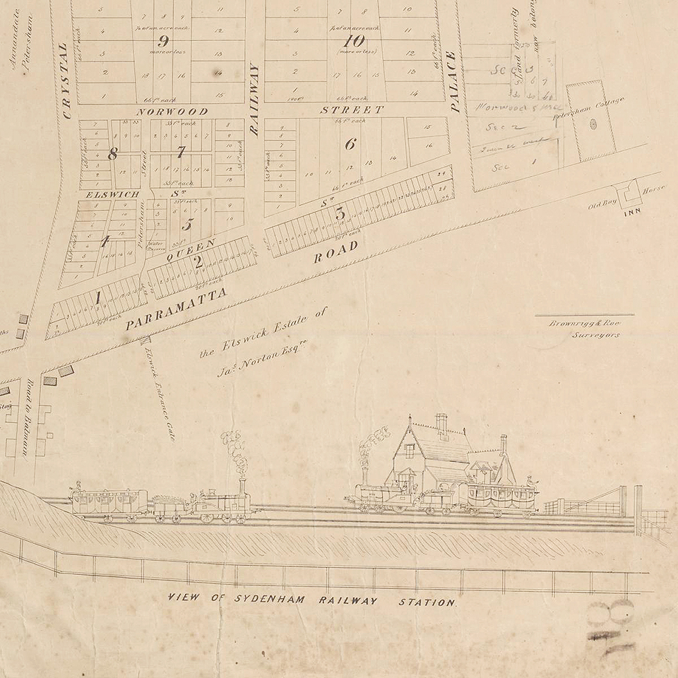
  3. Detail from plan of Petersham (originally calle...

Detail from plan of Petersham (originally called Sydenham) showing railway station c1855
By
Brownrigg & Roe
Contributed By
National Library of Australia
[nla.map-rm4275]
(Detail of 'Plan of Sydenham [Petersham], Parramatta Road, 3 miles from Sydney' c1855)

Browse

  • Browse
    • Artefacts
    • Buildings
    • Events
    • Natural Features
    • Organisations
    • People
    • Places
    • Structures
    • Entries
    • Multimedia
    • Subjects
    • Roles
    • Contributors
Connections
Subjects
Maps Railway stations Real Estate Subdivisions
Places
Petersham

Footer

  • Home
  • About
  • Copyright
  • Contact

Footer Secondary

  • Contribute
  • Donate

Brownrigg & Roe

National Library of Australia

Railway stations

Real Estate

Subdivisions

Maps

Petersham

Inner-west residential suburb on the southern side of Parramatta Road, named in 1794 by Lieutenant-Governor Francis Grose after his home village in Surrey, England. Developed after the railway station opened in 1857, it is now a centre of Sydney's Portuguese community.

full record ยป