1. The Dictionary of Sydney
  2. Multimedia
  3. Map showing First Branch or Macdonald River, wi...

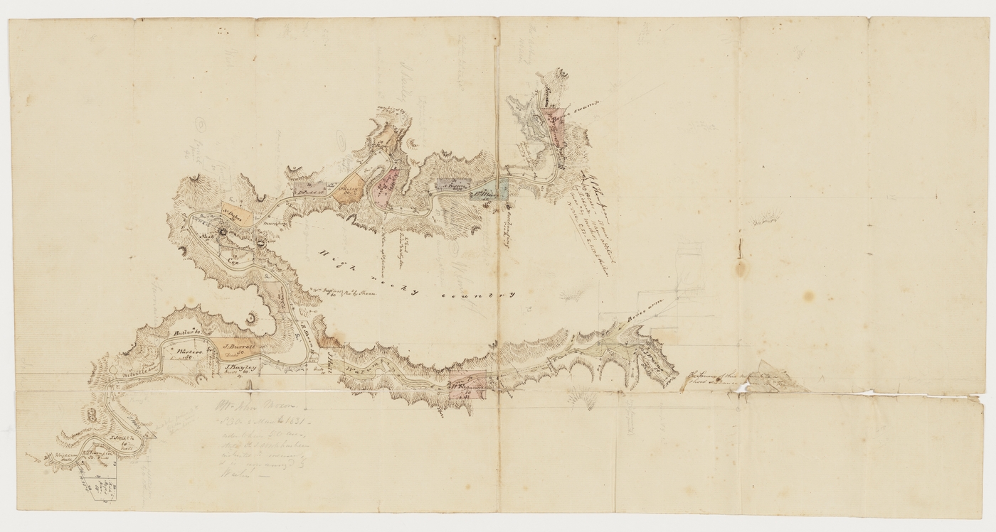
Map showing First Branch or Macdonald River, with land holdings 1831
From the collections of the
State Library of New South Wales
[D Ca 83/20]
(William Dixson manuscript collection)

Browse

  • Browse
    • Artefacts
    • Buildings
    • Events
    • Natural Features
    • Organisations
    • People
    • Places
    • Structures
    • Entries
    • Multimedia
    • Subjects
    • Roles
    • Contributors
Connections
Subjects
Agriculture Maps Real Estate Rivers and Catchments Water
Natural features
Boree Swamp in 1831 Macdonald River (Gunanday) St Albans Common Thompson Creek
Places
Hawkesbury district St Albans Thompson's farm, Gununday
See Also
Boree Swamp and Thompson's farm on the Macdonald River 1831 Walumbine Swamp and Boree Arm in 1831

Footer

  • Home
  • About
  • Copyright
  • Contact

Footer Secondary

  • Contribute
  • Donate

State Library of New South Wales

Maps

Rivers and Catchments

Agriculture

Water

Real Estate

Macdonald River (Gunanday)

Gunanday, or the Macdonald River, is a tributary of the Hawkesbury River (Dyarubbin) that rises on on the eastern slopes of Mellong Range in the Great Dividing Range. It flows east then south of the Hunter Valley for about 120 km and into the Hawkesbury River at Wisemans Ferry. It was referred to as Lower, or First Branch in early European records. By the 1830s it had been renamed after former convict John Macdonald who had been given a land grant in the area.

full record »

Hawkesbury district

Area surrounding the Hawkesbury River to Sydney's north and north-west, which was important in early colonial agriculture and the site of the early towns of Richmond and Windsor.

full record »

Boree Swamp in 1831

full record »

Swamp off Thompson's Creek on the higher Macdonald River (Gununday) that surrounded Matthew Pearson Thompson's farm. 

Thompson Creek

Creek in the Macdonald Valley, a tributary of the higher Macdonald (Gununday) River.

full record »

Thompson's farm, Gununday

Sixty acre farm settled by Matthew Pearson Thompson and his family in 1822,  in a natural valley amphitheatre at the confluence of the Macdonald (Gununday) River and Thompson Creek.

full record »

St Albans Common

The St Albans, or Wallambine, Common on the Macdonald River is a 1035 hectare reserve on a swamp at the convergence of the Macdonald River and Mogo Creek just north of the St Albans village. It was gazetted as Common land in 1853.

full record »

St Albans

full record »

Historic rural village in the Macdonald Valley, north of Wisemans Ferry. Founded on the site of a bullock wharf on the Macdonald River (Gununday), the settlement was officially named after the English city St Albans in 1841. The area has been referred to by locals as the 'Forgotten Valley' as it has been by-passed over time by all the major road and rail routes leading north from Sydney.