1. The Dictionary of Sydney
  2. Multimedia
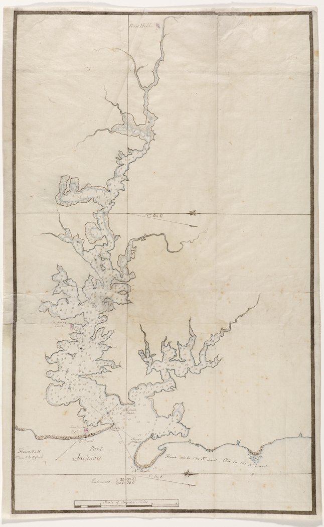
  3. Port Jackson 1788

Port Jackson 1788

By
William Bradley
From the collections of the
State Library of New South Wales
[a138497 / Safe 1/14, 6]
(Charts from Bradley's journal `A Voyage to New South Wales', 1802) ( Mitchell Library)

Browse

  • Browse
    • Artefacts
    • Buildings
    • Events
    • Natural Features
    • Organisations
    • People
    • Places
    • Structures
    • Entries
    • Multimedia
    • Subjects
    • Roles
    • Contributors
Connections
Appears in
Charting the Sydney Harbour Shoreline Early Hydrographers of Sydney
Subjects
Maps
Natural features
Lane Cove River Port Jackson
Places
Homebush Bay
Artefacts
Chart of Port Jackson 1788 First Fleet

Footer

  • Home
  • About
  • Copyright
  • Contact

Footer Secondary

  • Contribute
  • Donate

Bradley, William

First lieutenant on HMS Sirius, who kept a detailed journal during the early years of settlement.

State Library of New South Wales

Early Hydrographers of Sydney

Surveying the depths of Sydney Harbour was essential for safe navigation and effective transport. From 1788 until the formation of the Sydney Harbour Trust in 1901, the depths of the Harbour were charted by officers of the Royal Navy, with some help from French explorers.

Charting the Sydney Harbour Shoreline

The first charts of the shoreline of Sydney Harbour were drawn within days of the arrival of the First Fleet and surveys continued into the nineteenth century. This article compares the shorelines of four surveys with maps of the modern shoreline of Sydney Harbour, revealing the steady improvement in surveying accuracy over the eighteenth and nineteen centuries and the changing shape of Sydney Harbour

Maps

Lane Cove River

Tributary of the Parramatta River, which rises near Thornleigh, flows south and drains to Port Jackson east of Greenwich Point. There are significant mangrove communities near where the river meets Sydney Harbour.

full record »

Port Jackson

full record »

Drowned river valley that forms Sydney Harbour and includes North Harbour and Middle Harbour. Long inhabited by the Gadigal, Cammeraygal, Wangal and Eora people, Port Jackson was renamed by Captain Cook in 1770, although his ship did not enter the Heads.

Homebush Bay

full record »

Residential and commercial suburb on the Parramatta River which included Sydney Olympic Park. The name was discontinued in 2009 when it was split into Wentworth Point and Sydney Olympic Park.

Chart of Port Jackson 1788

full record »

Chart by William Bradley in his journal 'A Voyage to New South Wales'.

First Fleet

Fleet of eleven ships which left England in 1787 to found a penal colony in Australia. It consisted of two Royal Navy Vessels, three store ships and six convict transports which carried over 1000 convicts, marines and seamen to the colony.

full record »