1. The Dictionary of Sydney
  2. Multimedia
  3. Plan of the land on the east side of the northe...

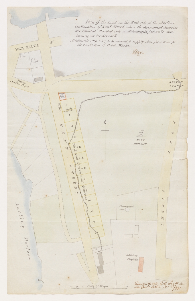
Plan of the land on the east side of the northern continuation of Kent Street where the Government quarries are situated ... 1833
By
Thomas Livingstone Mitchell
From the collections of the
State Library of New South Wales
[a4694001 / Ca 83/14]
(Dixson Map Collection)

Browse

  • Browse
    • Artefacts
    • Buildings
    • Events
    • Natural Features
    • Organisations
    • People
    • Places
    • Structures
    • Entries
    • Multimedia
    • Subjects
    • Roles
    • Contributors
Connections
Appears in
Fort Phillip Millers Point
Subjects
Maps Quarrying Surveying
Buildings
Fort Phillip
Organisation
Military hospital
Natural features
Observatory Hill
Places
Millers Point
Structures
Government Mill

Footer

  • Home
  • About
  • Copyright
  • Contact

Footer Secondary

  • Contribute
  • Donate

Mitchell, Thomas Livingstone

State Library of New South Wales

Fort Phillip

Standing high on Windmill Hill above The Rocks, Fort Phillip was built to defend the colony from threats coming from the ocean to the east, and the hinterland to the west. Though the guns remained there until the 1820s, the fort was never finished, and was more useful as a signal and telegraph station by 1840, when it was partly demolished.

Millers Point

Called Ta-Ra by its first inhabitants, the Cadigal, Millers Point was named for the windmills that were built on its heights, and their owner, John Leighton, known as Jack the Miller. By the 1850s Millers Point was a maritime enclave, with almost all residents and employers focused on the wharves and the trade they brought. Through plague, depression and war, the community at Millers Point retained its cohesion, but the changes brought by gentrification are harder to predict.

Quarrying

Maps

Surveying

Fort Phillip

full record »

Hexagonal fort built on Windmill Hill from 1804, but never finished.

Military hospital

Hospital established by Governor Macquarie in 1815 just west of Fort Street on Observatory Hill. It remained in use until 1850 when the military moved to Victoria Barracks.

full record »

Observatory Hill

Hill at the top of The Rocks, west of Sydney Cove, which is the highest point overlooking Port Jackson. With commanding views both east and west, it was the site of one of Sydney's first windmills from 1796 before being replaced with a fort in 1803. By 1849 an observatory had also been constructed which can still be visited.

full record »

Millers Point

full record »

Inner-city suburb on the western side of the Harbour Bridge's southern approaches. It was named for the windmills that were built on its heights, and their owner, John Leighton, known as Jack the Miller.

Government Mill

Third government windmill which stood in front of Fort Phillip which was built for Governor King by Nathaniel Lucas. It was described as an octagonal smock mill with propellers rotating on a post to gain the best advantage from prevailing winds.

full record »