1. The Dictionary of Sydney
  2. Multimedia
  3. Wests Creek 1843

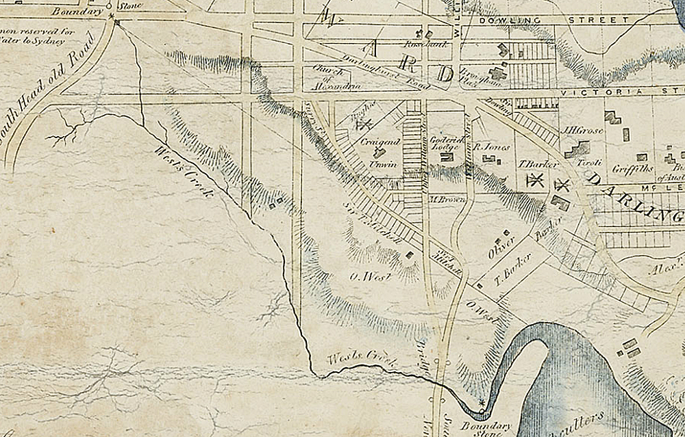
Wests Creek 1843

By
William Henry Wells
From the collections of the
State Library of New South Wales
[a3998001 / Z/M2 811.17/1843/2]
(Detail of Map of the City of Sydney c1843 by WH Wells)

Browse

  • Browse
    • Artefacts
    • Buildings
    • Events
    • Natural Features
    • Organisations
    • People
    • Places
    • Structures
    • Entries
    • Multimedia
    • Subjects
    • Roles
    • Contributors
Connections
Subjects
Maps Rivers and Catchments Water
Natural features
Rushcutters Bay West's Creek
Places
Paddington

Footer

  • Home
  • About
  • Copyright
  • Contact

Footer Secondary

  • Contribute
  • Donate

Wells, William Henry

State Library of New South Wales

Rivers and Catchments

Maps

Water

West's Creek

full record »

Stream that ran through Thomas West's land into the western side of Rushcutters Bay, and appearing in maps from the mid nineteenth century as Rushcutters Creek.  In 1842 it was fixed as the municipal boundary with the City of Sydney and the line remains the boundary today although the creek itself has been redirected and is now part of the drainage system.

Rushcutters Bay

Bay about two kilometres east of Sydney Cove so named because convicts cut rushes there for thatching. Now noted as the site of a major harbour marina.

full record »

Paddington

full record »

Inner-east residential suburb, named for the London borough, with 3,800 terrace houses built between 1860 and 1890. It was one of the earliest Sydney suburbs to be valued for its heritage buildings, many of which have been restored.