1. The Dictionary of Sydney
  2. Multimedia
  3. Detail showing the Botany Reservoir from the 'P...

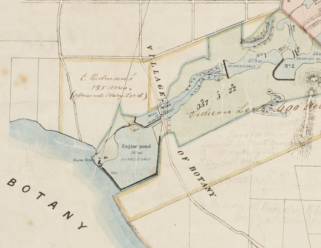
Detail showing the Botany Reservoir from the 'Plan of the Botany and Lachlan Watersheds' 1875
From the collections of the
State Library of New South Wales
[NSL ZM3 811.18ghhd/1875/1 (detail)]
(Mitchell Map Collection)

Browse

  • Browse
    • Artefacts
    • Buildings
    • Events
    • Natural Features
    • Organisations
    • People
    • Places
    • Structures
    • Entries
    • Multimedia
    • Subjects
    • Roles
    • Contributors
Connections
Subjects
Maps Water Water supply
Natural features
Botany Bay
Buildings
Botany Pumping Station
Structures
Botany Reservoir Engine Pond Mill Pond
Places
Botany

Footer

  • Home
  • About
  • Copyright
  • Contact

Footer Secondary

  • Contribute
  • Donate

State Library of New South Wales

Water supply

Water

Maps

Botany Bay

full record »

Large bay south of the city of Sydney, into which the Cooks and Georges rivers run.

Botany Pumping Station

full record »

Pumping station with three steam powered pumps constructed to pump water to reservoirs at Crown Street and Paddington from 1859. Remains of the building can still be seen beside General Holmes Drive, Botany.

Botany Reservoir

full record »

Reservoir built on the site of Simeon Lord's Engine Pond to augment the Botany Bay Swamps Scheme. The Botany pumping station on the western edge of the reservoir delivered water to the city.

Engine Pond

Dam constructed by Simeon Lord on the watercourse draining into Botany Bay. It is now traversed by Southern Cross Drive just east of Sydney Airport runway.

full record »

Mill Pond

Dam constructed by Simeon Lord in the watercourse draining into Botany Bay beside what is now Southern Cross Drive.

full record »

Botany

Industrial and residential suburb on the northern shore of Botany Bay, immediately east of Sydney Airport. Originally seen as a country retreat, it saw industry flourish in the post-Second World War era.

full record »