1. The Dictionary of Sydney
  2. Multimedia
  3. Ancillary map from subdivision plan of Sydenham...

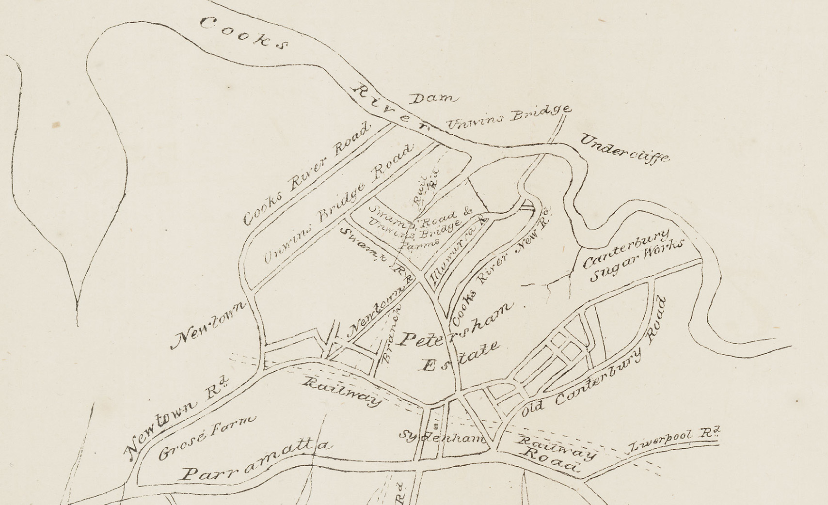
Ancillary map from subdivision plan of Sydenham farms on Swamp Road and Unwin's Bridge Road c1850
From the collections of the
State Library of New South Wales
[M2 811.1826/1840/1 (detail)]
(Detail of 'Sydenham farms. Swamp Road and Unwin's Bridge Road. Plan no. 1 c1850') (Mitchell Map Collection)

Browse

  • Browse
    • Artefacts
    • Buildings
    • Events
    • Natural Features
    • Organisations
    • People
    • Places
    • Structures
    • Entries
    • Multimedia
    • Subjects
    • Roles
    • Contributors
Connections
Subjects
Agriculture Maps Real Estate Suburbanisation
Natural features
Cooks River Gumbramorra Swamp
Places
Camperdown Canterbury Canterbury Sugarworks Dulwich Hill Marrickville Newtown Petersham Petersham estate Sydenham

Footer

  • Home
  • About
  • Copyright
  • Contact

Footer Secondary

  • Contribute
  • Donate

State Library of New South Wales

Maps

Agriculture

Suburbanisation

Real Estate

Gumbramorra Swamp

Swamp on the north of the Cooks River in the Marrickville valley between Marrickville and Sydenham. Most of the swamp had been drained and the land resumed and developed by the early 20th century, but flooding in the area continues to be an issue. Sydenham Road, that runs from Sydenham through Marrickville, was originally called Swamp Road.

full record »

Sydenham

Small inner-west suburb named after the district in London. Becoming an industrial and residential suburb after the railway came through in 1884, it was partially depopulated by the aircraft noise of Sydney Airport during the 1990s.

full record »

Cooks River

full record »

River that flows through south-west Sydney, starting at Graf Park, Yagoona, through to Botany Bay at Kyeemagh. The river was extensively polluted by industry and its course was changed to accommodate the runways of Sydney Airport.

Marrickville

Inner-western residential suburb with an industrial heritage on the Cooks River, named after the Marrick estate of Thomas Chalder which was subdivided in 1855. The post-Second World War period saw the influx of mainly non-English speaking people, attracted by the availability of factory work and cheap housing.

full record »

Dulwich Hill

Inner western residential suburb taking its name from Dulwich in London. It is now the terminus of the Inner West Light Rail.

full record »

Newtown

Inner-west suburb which developed along the main road south from Sydney. It became a prosperous shopping district in the late 19th century, and later a working-class and migrant suburb, now gentrified.

full record »

Petersham

Inner-west residential suburb on the southern side of Parramatta Road, named in 1794 by Lieutenant-Governor Francis Grose after his home village in Surrey, England. Developed after the railway station opened in 1857, it is now a centre of Sydney's Portuguese community.

full record »

Canterbury Sugarworks

full record »

One of the oldest factory complexes in Australia, the site in Sugar House Road Canterbury has housed a variety of manufacturing and processing companies including sugar, bacon and engineering before conversion to residential apartments.

Canterbury

full record »

Inner-western suburb bisected by the Cooks River which was a hub of industry during the nineteenth century. The area's first land grant was to the Rev. Richard Johnson, Chaplain of the First Fleet, who named it as a tribute to Canterbury in England.

Camperdown

Inner-western suburb, home to the University of Sydney and Royal Prince Alfred Hospital, as well as high-density residential dwellings, mainly gentrified workers' terraces and apartment buildings. It is named after a naval battle in which Governor Bligh took part in 1797.

full record »

Petersham estate

Estate established by Robert Wardell by buying up land grants between Petersham and the Cooks River. The estate eventually measured over two thousand acres but was subdivided after his murder in 1834.

full record »