1. The Dictionary of Sydney
  2. Multimedia
  3. Detail of plan of the City of Sydney showing th...

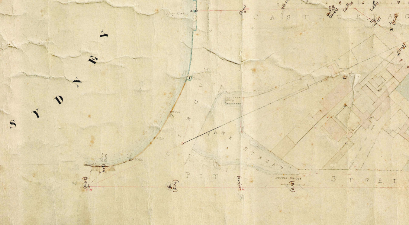
Detail of plan of the City of Sydney showing the wooden bridge over the Tank Stream 1855
Contributed By
City of Sydney Archives
[City of Sydney - Detail Plans, 1855: Sheet 4 (01/01/1855 - 31/12/1855) (detail)]
(A-00880178)

Browse

  • Browse
    • Artefacts
    • Buildings
    • Events
    • Natural Features
    • Organisations
    • People
    • Places
    • Structures
    • Entries
    • Multimedia
    • Subjects
    • Roles
    • Contributors
Connections
Subjects
Bridges Maps Rivers and Catchments
Natural features
Sydney Cove Tank Stream
Structures
Circular Quay Tank Stream bridge
Places
Circular Quay The Rocks

Footer

  • Home
  • About
  • Copyright
  • Contact

Footer Secondary

  • Contribute
  • Donate

City of Sydney Archives

The City of Sydney Archives holds items from as early as 1842 when the Municipal Council of Sydney was established, and manage, preserve and provide access to more than 1 million items, including documents, photographs, maps, plans and data. The collection consists of City of Sydney corporate archives, items collected from the community relating to the City of Sydney local area and published reference material. Use the links to go directly to the City of Sydney's website.

Maps

Bridges

Rivers and Catchments

Tank Stream

full record »

The fresh water course which supplied the fledgling colony, emptying into Sydney Cove. It was named for three storage tanks which were constructed in the sandstone beside the stream during a drought in 1790. By 1828 the stream had been polluted to such an extent that it could no longer be used as a source of water and was diverted into a sewer, and by the 1870s it had been completely covered. The Tank Stream still flows in a covered storm water drain.

Tank Stream bridge

full record »

Bridge across the Tank Stream that divided early Sydney. The first timber log bridge was built by convicts in October 1788 and improved in April 1792 after it had been damaged. In the middle of 1803 construction of a stone bridge to replace the timber bridge began, and was completed in 1804 by stonemason Isaac Peyton. The workmanship was poor and the bridge collapsed later in the year, requiring rebuilding. By 1811 the bridge had been widened, with numerous modifications to follow. By 1860 the stream, now little more than a foetid sewer, had been covered over.

Sydney Cove

full record »

Small bay on the southern shore of Port Jackson, which became the site for the European settlement in Sydney.

Circular Quay

full record »

Quay built between 1837 and 1855 and originally known as Semi-circular Quay, because of the shape of the stoneworks built with convict labour to stabilise the new shoreline reclaimed from mudflats.

Circular Quay

full record »

Area of Sydney's central business district that surrounds the quays built on reclaimed land from the 1830s.

The Rocks

full record »

Suburb located north of the central business district on the western shore of Sydney Cove. Characterised by a precinct of restored nineteenth-century buildings which are a major tourist attraction, it was recognised as a separate suburb in 1993.