The Dictionary of Sydney was archived in 2021.
The road west
Citation
Persistent URL for this entry
To cite this entry in text
To cite this entry in a Wikipedia footnote citation
To cite this entry as a Wikipedia External link
The road west
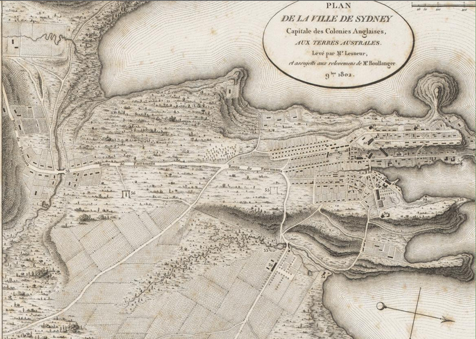
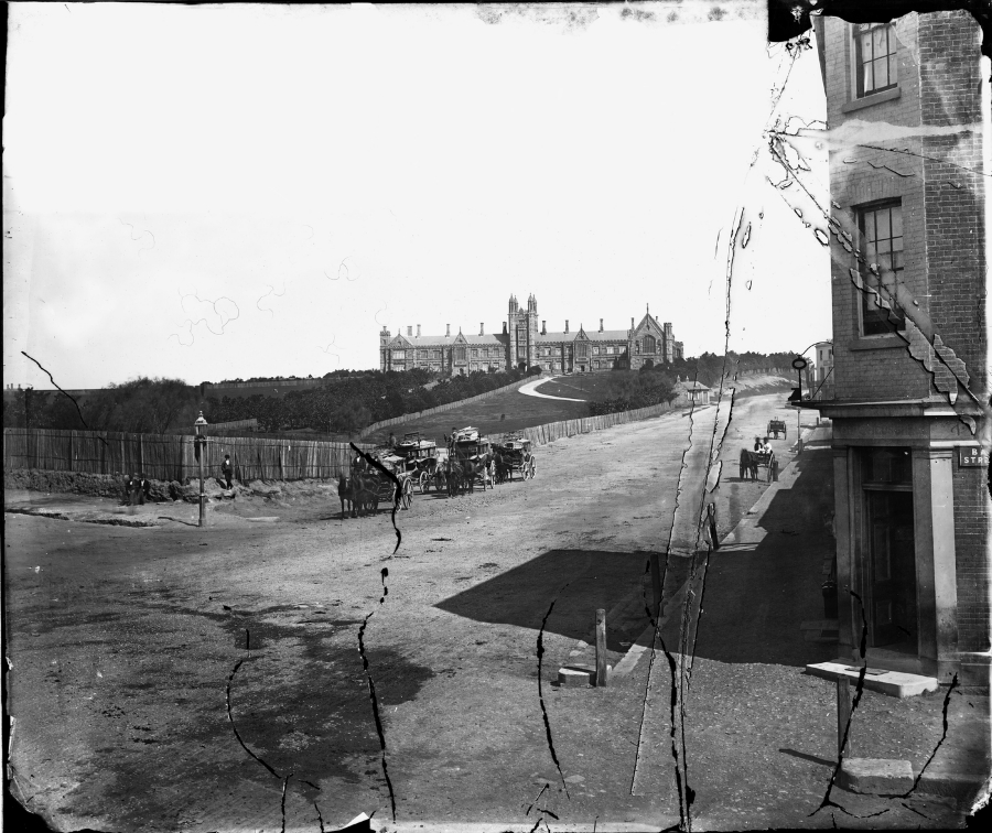
Leaving Sydney's [media]central business district and going south, an intrepid traveller passes along George Street to Broadway, at which point the road turns west and becomes the Parramatta Road, and also the start of the Great Western Highway. The road, as its early name implied, connected the settlement at Sydney Town with its early satellite, originally named Rose Hill but later Parramatta, a town once considered as a possible capital for the colony.
But as Sydney's population increased, the city boundaries moved out, and the road now passes through numerous suburbs of metropolitan Sydney – Glebe, Camperdown, Annandale, Petersham, Leichhardt, Haberfield, Ashfield, Croydon, Burwood, Strathfield, Homebush, Auburn, Granville, and Parramatta, then on to Mays Hill, Wentworthville, Pendle Hill, Prospect, Blacktown, Eastern Creek, Mt Druitt, St Marys, Werrington, Kingswood, Penrith and Emu Plains, before rising into the Blue Mountains and the townships there.
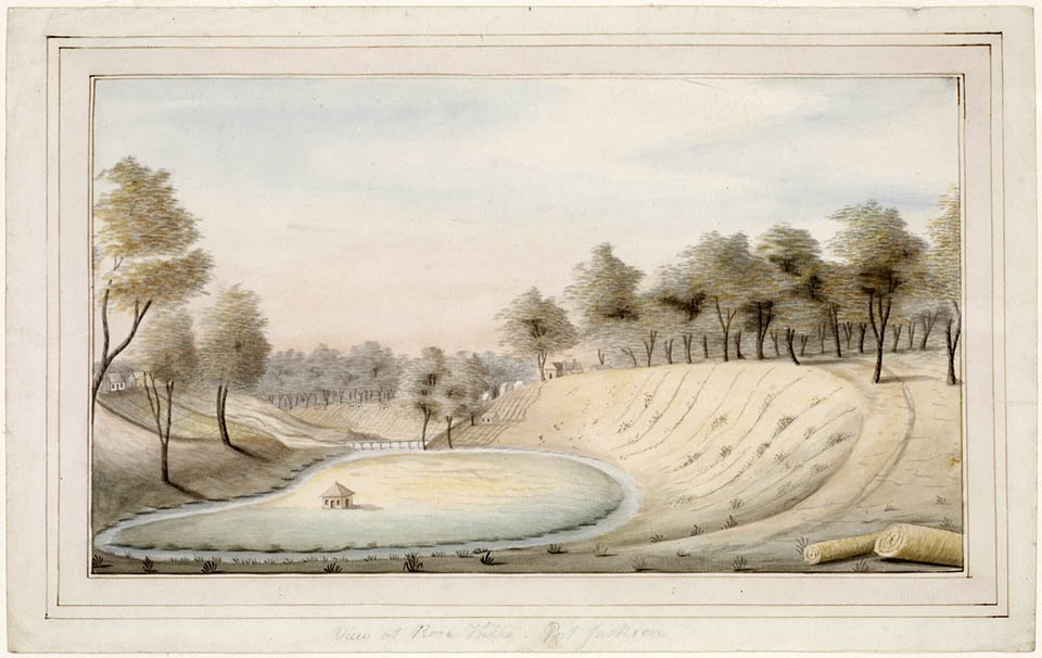
[media]It was necessity that led to the foundation of Rose Hill and the road to it. With the failure of two sowings of food crops in Sydney Town, Governor Phillip needed to find land better suited to agriculture, and in November 1788 the governor established Rose Hill west of Sydney on the Parramatta River. The lines of this new settlement were laid out two years later, and it was renamed Parramatta.
Initially the river was the main form of transport to Parramatta: the Rose Hill Packet ferried people and goods up the Parramatta River from 1789. The first overland connection between Parramatta and Sydney was a three-metre-wide track carved through the bushland by convict labour in the years between 1789 and 1791. By 1791 this track followed a similar route to the modern Parramatta Road, skirting the swamps on the southern edges of Iron Cove and Hen and Chicken Bay.
Lieutenant-Governor Grose, who succeeded Phillip, decided that one way of addressing the food shortage was to develop private farming, and in 1793 he began granting land to military personnel: the first grants were to the west of Sydney Town at Kangaroo Ground (now Petersham), followed by other grants at Liberty Plains and Concord, all on the road to Parramatta. By late 1793 a stockade had been established halfway between Sydney and Parramatta, near the current site of St Luke's Oval (on the northern side of Parramatta Road), as an overnight resting place for the convict working parties, and in October of that year Grose sent workmen and convicts there to form a timber yard.
The Parramatta Road
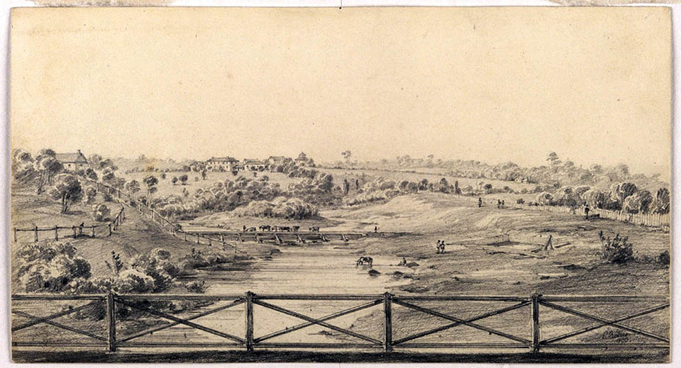
By 1794, this [media]bush track had been widened and cleared to make it more suitable for carriages. This track, known as the Parramatta Road, lay to the south of the river and was required to cross the many tributaries and creeks that flowed from it. By the early years of the nineteenth century, the road between Sydney Town and Parramatta was reported as being
almost every where wide enough for three carriages to pass abreast, and bridges have been thrown over such parts of it, as are interrupted by the waters: so that the traveller meets with no obstacle on his journey. [1]
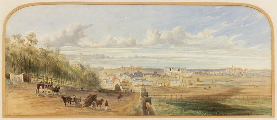
[media]The Parramatta Road was now a major thoroughfare for the colony, with a constant stream of people and goods passing back and forth. Soon, hotels for travellers and settlements around various nodal points – such as brickworks and timberyards – began to develop. By 1822, it was reported that Parramatta Road was 15 miles long with 37 bridges along its length, and stagecoach services had taken over from river transport as the main means of travel between the two settlements.
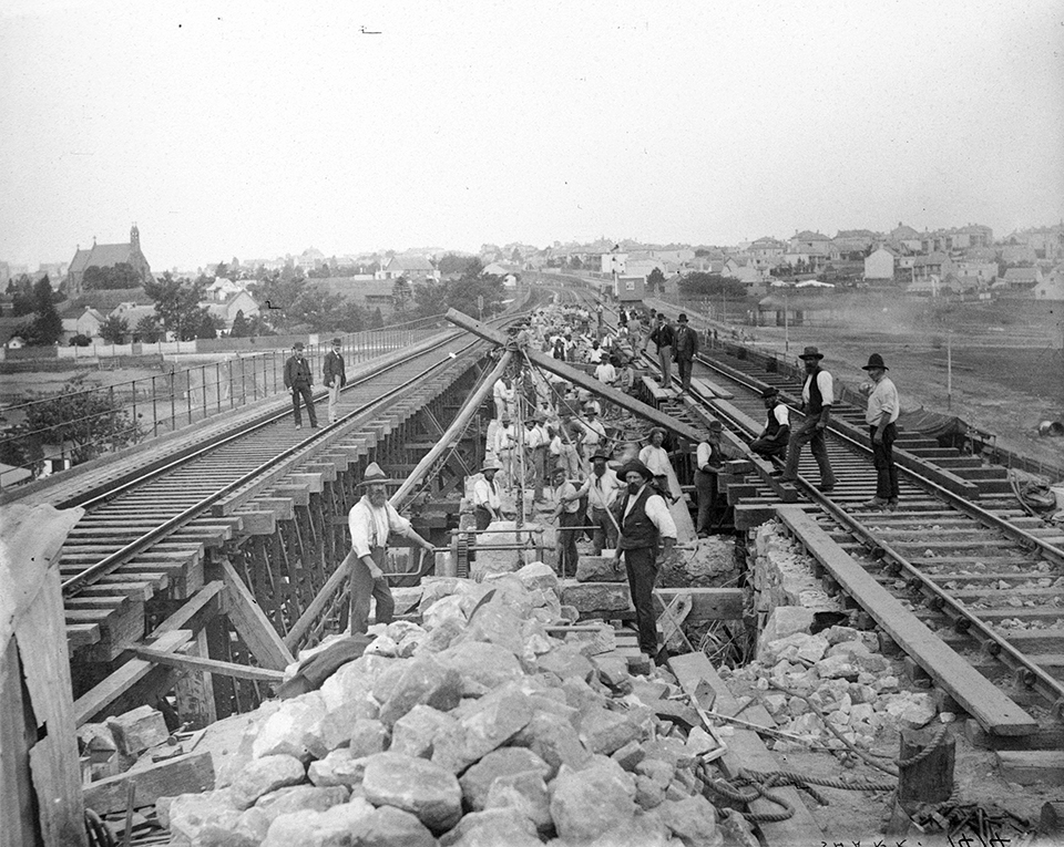
[media]The existence of the road, and its increasing traffic, led to a gradual opening up of more suburbs along the way. By the 1820s, the convergence of Parramatta and Liverpool Roads, each carrying an increasing volume of traffic, saw Ashfield start to develop as an area attractive to settlers seeking a rural environment within easy reach of Sydney. This 'suburb creation process' along the road was reinforced by the construction of the colony's first railway line, from Sydney to Parramatta Junction (terminating at the Dog Trap Road, around a mile from the centre of Parramatta, near Granville Station). This was begun in 1855, and the line was opened on 26 September that year, with intermediate stations at Newtown, Ashfield, Burwood and Homebush.
[media]By 1865, Parramatta Road was considered to be one of three main roads leading into Sydney (the other main roads led from the north and south into Sydney). At this time, the road as it passed through Taverners Hill (in the vicinity of Battle Bridge) was described as 'notoriously bad, needed ballasting and metalling' while the route from Ashfield to Parramatta was described as being in 'good order – metalled'. [2] [media]The sandstone arch known as Battle Bridge was constructed about 1873 and probably replaced an earlier timber bridge across Battle Creek (or Long Cove Creek) at the bottom of Taverners Hill.
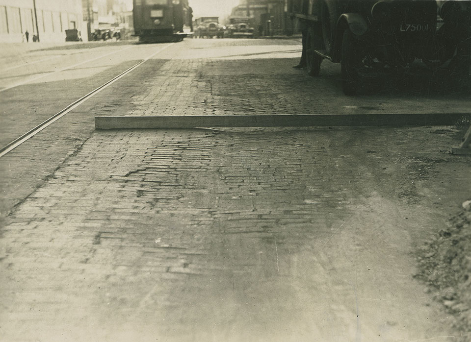
But the construction of the railway to Parramatta in the 1850s also meant that Parramatta Road began to suffer neglect, as goods and people were increasingly moved by rail. [media]This situation lasted until the 1920s, when the growing prevalence of motor transport necessitated major repairs and ongoing maintenance for the road, and from this time, Parramatta Road was regularly upgraded and improved: in 1921, for example, it was 'regraded and reformed throughout', with particular attention paid to the section between Ashfield and Parramatta. [3]
From road to freeway
The massive growth in motor traffic in the decades after World War II, necessitated by more suburban spread to areas not served by rail transport, and facilitated by the advent of hire purchase, led to extreme and increasing congestion on this important communication corridor, effectively destroying its role as a local 'high street' for the various suburbs it passed through. While local councils struggled with ways of dealing with Parramatta Road's deteriorating streetscape in their own areas, the ever-increasing congestion on the road led to the state government to commence, from the 1960s, a process of freeway construction – in this case the Western Motorway, alongside the Parramatta Road – and this has allowed the possibility of life to return to this gateway road to central Sydney.
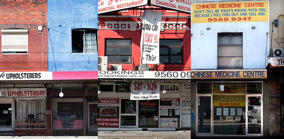
In the late twentieth century, the Inner Metropolitan Regional Organisation of Councils looked at ways of revitalising the link to the west. If this succeeds, perhaps Sydney may see once again a resurgence of the role that Parramatta Road held for much of its history, [media]as the focus of street life for the various communities along its way.
References
Tony Prescott, 'The Road to Parramatta', Heritage Office website, http://www.heritage.nsw.gov.au/heritagensw/aug98/3_art.htm, viewed 11 March 2009
The Roadmakers: A History of Main Roads in New South Wales, Department of Main Roads, Sydney, 1976
Notes
[1] Francis Peron, 'Account of Port Jackson and Sydney Town, New South Wales', translation quoted in The literary panorama, vol 10, Charles Taylor, London, 1809, col 921
[2] The Roadmakers: A History of Main Roads in New South Wales, Department of Main Roads, Sydney, 1976, p 47
[3] The Roadmakers: A History of Main Roads in New South Wales, Department of Main Roads, Sydney, 1976, p 68
.


