1. The Dictionary of Sydney
  2. Multimedia
  3. Gladesville Bridge at the time of its official ...

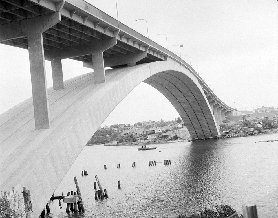
Gladesville Bridge at the time of its official opening, October 1964
By
Paul Percival
From the collections of the
State Library of New South Wales
[d7_17540 / APA 17540]
(Mitchell Library)

Browse

  • Browse
    • Artefacts
    • Buildings
    • Events
    • Natural Features
    • Organisations
    • People
    • Places
    • Structures
    • Entries
    • Multimedia
    • Subjects
    • Roles
    • Contributors
Connections
Appears in
River Cycles - A History of the Parramatta River
Subjects
Bridges Civil engineering Rivers and Catchments
Natural features
Parramatta River
Places
Drummoyne Gladesville Huntleys Point
Structures
Gladesville bridge

Footer

  • Home
  • About
  • Copyright
  • Contact

Footer Secondary

  • Contribute
  • Donate

Percival, Paul

State Library of New South Wales

River Cycles - A History of the Parramatta River

Prior to European settlement, the waterway we now call the Parramatta River was a shared food source, a highway and a territorial boundary for the Wangal, Wallemudegal, Gammeraygal and Burramattagal peoples. Colonisation dramatically reshaped the ecology of the river; the natural cycles of climate and tide that had long influenced the waterway have been joined by other diverse social forces; economic, cultural and technological. Agriculture, river transport, land development and heavy industry have left a long term legacy despite recent environmental remediation.

Bridges

Civil engineering

Rivers and Catchments

Parramatta River

full record »

Major tributary of Sydney Harbour, which flows east from Blacktown Creek to meet Port Jackson between Greenwich and Birchgrove. The river is tidal to Charles Street Weir at Parramatta, 30 kilometres from Sydney Heads.

Drummoyne

Inner western residential suburb surrounded by water on three sides. William Wright, merchant, whaler and sealer, named his land Drummoyne Park in 1853 after his family home on the Clyde in Scotland.

full record »

Gladesville

Residential suburb located on the northern banks of the Parramatta River, named after ex-convict John Glade who had a farm in the area from about 1806. The original Gladesville Bridge, completed in 1881, was replaced in 1964.

full record »

Huntleys Point

Small inner north-western suburb at western end of Gladesville Bridge. Alfred Huntley built Point House there in 1851.

full record »

Gladesville bridge

full record »

Concrete-arch bridge across the Parramatta River between Drummoyne and Huntleys Point. Until 1980, at 305 metres, it was the longest concrete arch span in the world and it was the first large bridge to be designed by computer.
It was designed by Tony Gee at Maunsell and Partners together with construction by Stuart Brothers jointly with Reed and Mallik of the UK, it was opened by HRH Princess Marina of Kent in 1964. In 2015 it was declared an International Historic Civil Engineering Landmark.