1. The Dictionary of Sydney
  2. Multimedia
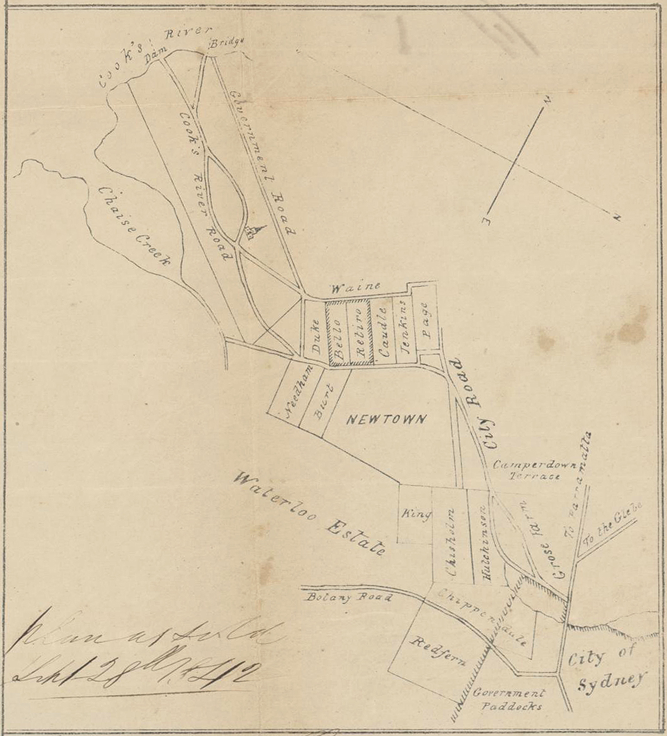
  3. Plan of the Newtown area, September 1842
Plan of the Newtown area, September 1842

By
Raphael Clint
Contributed By
National Library of Australia
[nla.map-f171 (detail)]
(Detail of Plan of the villa Bello Retiro on the Cook's River Road for sale by auction by Mr Stubbs, on the 28 September 1842)

Browse

  • Browse
    • Artefacts
    • Buildings
    • Events
    • Natural Features
    • Organisations
    • People
    • Places
    • Structures
    • Entries
    • Multimedia
    • Subjects
    • Roles
    • Contributors
Connections
Subjects
Maps
Buildings
Bello Retiro St Peter's Anglican church St Peters
Natural features
Cooks River Sheas Creek
Places
Alexandria Camperdown Chippendale Cleveland Paddocks Erskineville Grose Farm Newtown Redfern St Peters Tempe Waterloo
Structures
Cooks River dam Unwin's Bridge

Footer

  • Home
  • About
  • Copyright
  • Contact

Footer Secondary

  • Contribute
  • Donate

Clint, Raphael

National Library of Australia

Maps

St Peter's Anglican church St Peters

full record »

Church designed by Thomas Bird. Its foundation stone was laid 13 July 1839 and the church was completed in November 1839.

Cooks River

full record »

River that flows through south-west Sydney, starting at Graf Park, Yagoona, through to Botany Bay at Kyeemagh. The river was extensively polluted by industry and its course was changed to accommodate the runways of Sydney Airport.

Sheas Creek

Creek now confined to a stormwater channel flowing from Alexandria into the Alexandra Canal.

full record »

Alexandria

Largely industrial inner-city suburb located south of Sydney's central business district, named after Princess Alexandra, wife of Edward, Prince of Wales (later King Edward VII). By the 1940s, it was the nation's largest industrial district, and called itself the "Birmingham of Australia".

full record »

Camperdown

Inner-western suburb, home to the University of Sydney and Royal Prince Alfred Hospital, as well as high-density residential dwellings, mainly gentrified workers' terraces and apartment buildings. It is named after a naval battle in which Governor Bligh took part in 1797.

full record »

Chippendale

full record »

Inner-city suburb on the land of the Gadigal people which was developed for farming and industry with dense, working-class housing during the nineteenth century, now undergoing gentrification.

Erskineville

Formerly industrial, now residential inner-city suburb to the southwest of central business district. The Rev. George Erskine, a Wesleyan minister, built a house here in 1830 which he called Erskine Villa.

full record »

Grose Farm

Farm granted to Lieutenant Governor Francis Grose in 1792, which gave its name to the larger area set aside for the University of Sydney in the 1850s.

full record »

Newtown

Inner-west suburb which developed along the main road south from Sydney. It became a prosperous shopping district in the late 19th century, and later a working-class and migrant suburb, now gentrified.

full record »

Redfern

Inner-city suburb located immediately south of the central business district whose sandhills were first settled by Chinese market gardeners and later by Aboriginal people who migrated to work in the local factories. Today it is a rich blend of public housing, renovated terraces, light industry and arts precincts.

full record »

St Peters

Inner western residential, commercial and industrial suburb, named after the Anglican church around which it developed. It is recognisable by the iconic chimneys of the former brickworks, now part of Sydney Park, built to take advantage of vast deposits of clay.

full record »

Tempe

Inner-west suburb on the northern bank of Cooks River which grew from the workers camp established to build the Cooks River dam in 1839. By the 1850s it was also home to limeburners, woodsmen and fishermen.

full record »

Waterloo

Southern inner-city suburb characterised by industry in the nineteenth century and public housing in the twentieth, now undergoing gentrification.

full record »

Unwin's Bridge

Bridge originally constructed by convict labour in 1836 for Frederick Wright Unwin across the Cooks River at Bayview Avenue, Tempe. It was replaced by the present bridge in 1891.

full record »

Cooks River dam

full record »

Dam constructed by convict labour at Tempe using quarried stone from the nearby cliffs. It allowed a road link to the city but quickly caused problems of pollution and flooding.

Bello Retiro

full record »

A large house with outbuildings, stables etc. built in the early 1830s on the Cooks River Road near Newtown by Alexander Brodie Spark, and then owned by businessman John Lord. Most of its grounds were subdivided into building allotments in the early 1840s and the house was renamed Holmwood in the 1850s. The building had been demolished by 1893.

Cleveland Paddocks

Farmland from the 1820s in the area of Regent, Cleveland and Devonshire streets around Cleveland House. A part of the paddocks became Prince Alfred Park in 1865.

full record »