1. The Dictionary of Sydney
  2. Multimedia
  3. Birds eye view of general wharfage scheme west ...

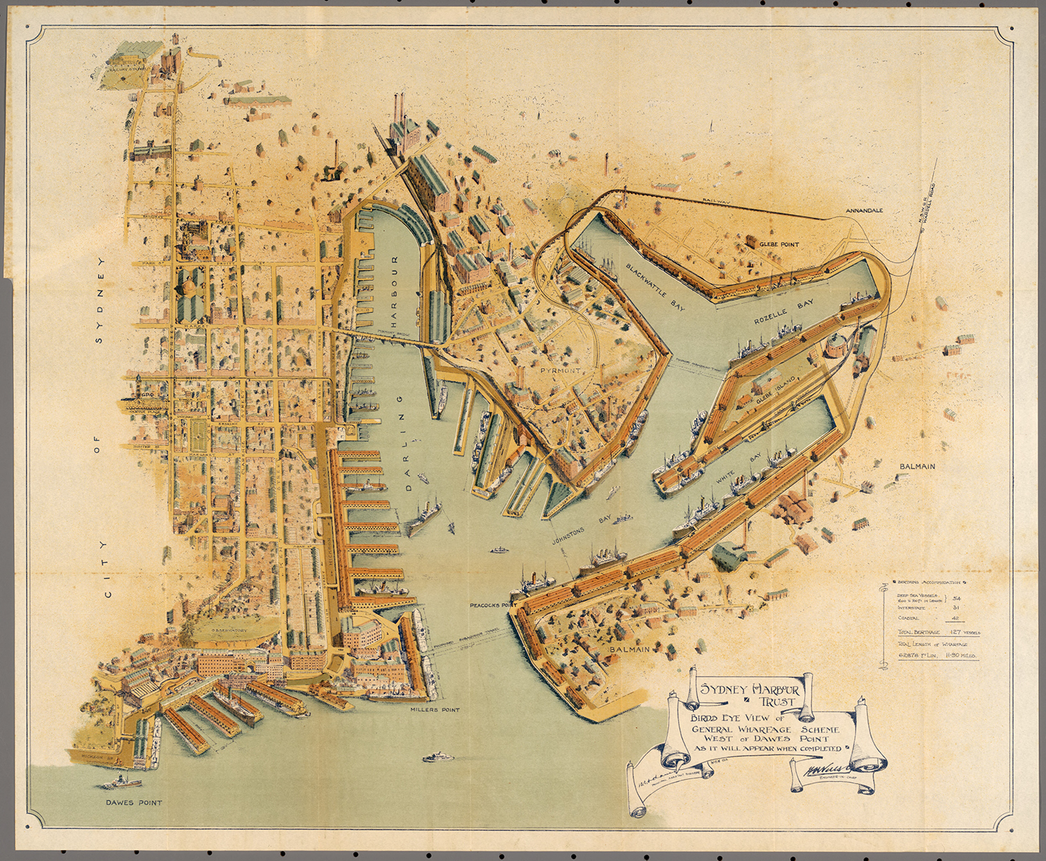
Birds eye view of general wharfage scheme west of Dawes Point as it will appear when completed, published 1913
By
Sydney Harbour Trust
W E Adams
H D Walsh
Contributed By
National Library of Australia
[MAP RM 2757]
(Published by the Sydney Harbour Trust Commissioners, 1913)

Browse

  • Browse
    • Artefacts
    • Buildings
    • Events
    • Natural Features
    • Organisations
    • People
    • Places
    • Structures
    • Entries
    • Multimedia
    • Subjects
    • Roles
    • Contributors
Connections
Subjects
Shipping Transport
Natural features
Blackwattle Bay Dawes Point Glebe Island Glebe Point Johnstons Bay Rozelle Bay Walsh Bay White Bay
Places
Darling Harbour Glebe Island abattoir Millers Point Pyrmont
Structures
Walsh Bay wharves

Footer

  • Home
  • About
  • Copyright
  • Contact

Footer Secondary

  • Contribute
  • Donate

Sydney Harbour Trust

Adams, W E

Walsh, H D

National Library of Australia

Shipping

Transport

Blackwattle Bay

Bay on the southern shore of Sydney Harbour, west of Darling Harbour and east of Rozelle Bay.

full record »

Dawes Point

full record »

Headland on the western side of Sydney Cove.

Glebe Island

full record »

Rocky outcrop bounded by White Bay to the west and north and Johnstons Bay to the east and south and linked to Balmain by causeway in 1840s. It was the site of abattoirs from 1850s to 1912, then levelled and used as wharves.

Glebe Point

Headland in Rozelle Bay marking the northern end of the suburb of Glebe.

full record »

Johnstons Bay

Bay between Rozelle and Pyrmont first spanned by the Glebe Island Bridge, and later the Anzac Bridge.

full record »

Rozelle Bay

Small bay east of Blackwattle Bay in Sydney Harbour, surrounded by Rozelle, Annandale and Glebe. Much of the natural shoreline of the bay has been extended by land reclaimed for maritime use.

full record »

Walsh Bay

full record »

Bay on the western side of Dawes Point in Sydney Harbour, west of Sydney Cove.

White Bay

full record »

Bay in Sydney Harbour adjacent to Rozelle and Balmain, dominated by the former White Bay Power Station.

Darling Harbour

full record »

Waterway to the west of the city once surrounded by wharves, goods yards, woolstores and factories which contributed enormously to the city's economic wealth. The former rail lines and goods yards were transformed from commercial port to a recreational and pedestrian precinct in the 1980s.

Glebe Island abattoir

Slaughterhouse on Glebe Island from the 1830s until 1915. The abattoir attracted related smelly industries and contributed to the noxious pollution of the bay, but provided fresh meat for Sydney.

full record »

Millers Point

full record »

Inner-city suburb on the western side of the Harbour Bridge's southern approaches. It was named for the windmills that were built on its heights, and their owner, John Leighton, known as Jack the Miller.

Pyrmont

Peninsular inner-west suburb between Darling Harbour and Johnston's Bay. Quarried for its sandstone, it later became a heavily industrialised working-class enclave, then gentrified as industry declined.

full record »

Walsh Bay wharves

full record »

Wharves along Hickson Road which form part of an historical port precinct comprising sheds, bond stores and bridges carved from the sandstone cliff of Dawes Point. Built of turpentine piles with ironbark beams the wharves have been converted for use as theatre and arts venues and residential apartments.