1. The Dictionary of Sydney
  2. Multimedia
  3. Birds eye view of proposed Walsh Bay wharfage s...

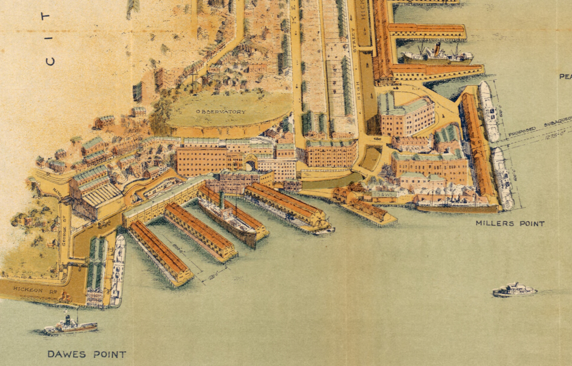
Birds eye view of proposed Walsh Bay wharfage scheme 1913
By
Sydney Harbour Trust
W E Adams
H D Walsh
Contributed By
National Library of Australia
[MAP RM 2757 (detail)]
(from 'Birds eye view of general wharfage scheme west of Dawes Point as it will appear when completed', Published by the Sydney Harbour Trust Commissioners, 1913)

Browse

  • Browse
    • Artefacts
    • Buildings
    • Events
    • Natural Features
    • Organisations
    • People
    • Places
    • Structures
    • Entries
    • Multimedia
    • Subjects
    • Roles
    • Contributors
Connections
Appears in
Millers Point
Natural features
Observatory Hill Walsh Bay
Places
Dawes Point Millers Point
Structures
Walsh Bay wharves

Footer

  • Home
  • About
  • Copyright
  • Contact

Footer Secondary

  • Contribute
  • Donate

Sydney Harbour Trust

Adams, W E

Walsh, H D

National Library of Australia

Millers Point

Called Ta-Ra by its first inhabitants, the Cadigal, Millers Point was named for the windmills that were built on its heights, and their owner, John Leighton, known as Jack the Miller. By the 1850s Millers Point was a maritime enclave, with almost all residents and employers focused on the wharves and the trade they brought. Through plague, depression and war, the community at Millers Point retained its cohesion, but the changes brought by gentrification are harder to predict.

Observatory Hill

Hill at the top of The Rocks, west of Sydney Cove, which is the highest point overlooking Port Jackson. With commanding views both east and west, it was the site of one of Sydney's first windmills from 1796 before being replaced with a fort in 1803. By 1849 an observatory had also been constructed which can still be visited.

full record »

Walsh Bay

full record »

Bay on the western side of Dawes Point in Sydney Harbour, west of Sydney Cove.

Dawes Point

full record »

Harbourside suburb at the southern end of the Sydney Harbour Bridge, adjacent to The Rocks. From the earliest days of the colony it was a significant as the site of the first observatory and one of the earliest gun placements.

Millers Point

full record »

Inner-city suburb on the western side of the Harbour Bridge's southern approaches. It was named for the windmills that were built on its heights, and their owner, John Leighton, known as Jack the Miller.

Walsh Bay wharves

full record »

Wharves along Hickson Road which form part of an historical port precinct comprising sheds, bond stores and bridges carved from the sandstone cliff of Dawes Point. Built of turpentine piles with ironbark beams the wharves have been converted for use as theatre and arts venues and residential apartments.