The Dictionary of Sydney was archived in 2021.
The road south
Citation
Persistent URL for this entry
To cite this entry in text
To cite this entry in a Wikipedia footnote citation
To cite this entry as a Wikipedia External link
The road south
The [media]road south out of Sydney is one of the exceptions to the general rule that the more important a road is, the more likely it is to have one consistent name that doesn't change. [1] In 2011, the Princes Highway is also City Road where it branches off from Broadway, and King Street where it passes through Newtown, only becoming the Princes Highway when it passes out of Erskineville into St Peters. These name changes are indications of where the 'gateways' to Sydney Town, in the form of toll gates, have existed.
The [media]development of the road south was much influenced by the requirements of populations further afield, and its ongoing renaming is a good illustration of another aspect noted in Sydney's street-naming history:
When roads ceased to be interpreted as going somewhere else, and became integrated within the built up area, the label 'Road' was often changed to 'Street'. [2]
The new town
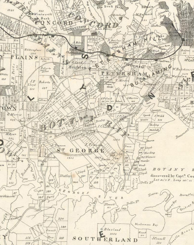
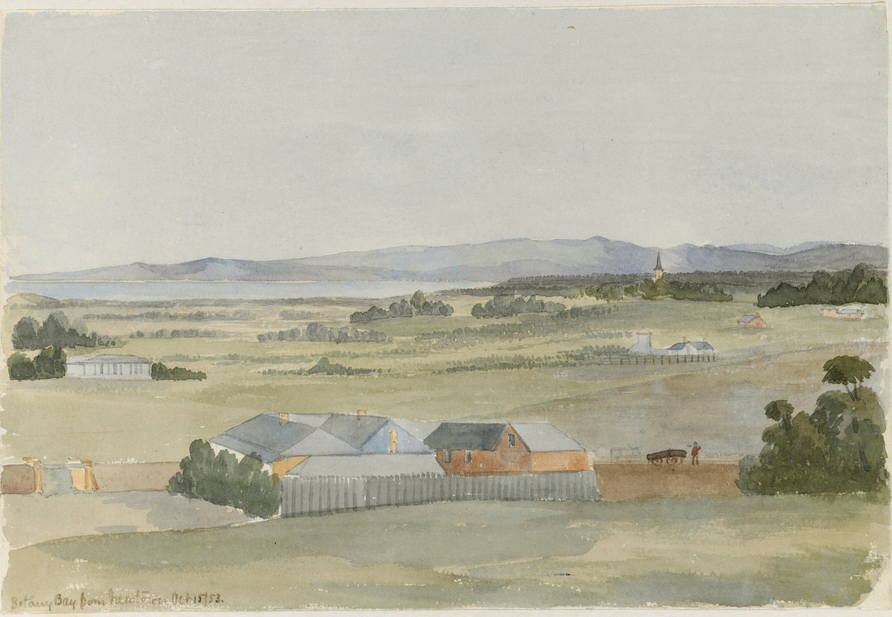
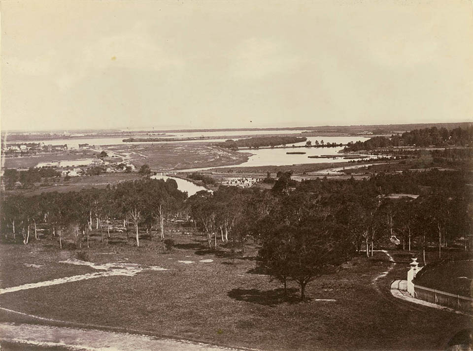
Newtown, Erskineville, St Peters and Tempe are now built-up suburban areas, but in the colony's early years they were parts of farmland in the Cooks River area, originally settled to help provide food for the inhabitants of Sydney Town. The lower Cooks River was explored as early as 1789, and given its present name by 1796. The districts surrounding the lower reaches of the river on both banks were initially known as Bulanaming. [3] A track from Sydney Town to this area passed through
an open forest of large trees with a thick belt of scrub along the banks of the creeks and in the low lying valleys. [4]
A [media]number of land grants were made in the area quite early in the colony's history. But the land proved less suitable for farming than land further west, and it was not long before the grants were subdivided into blocks, on which subsequent owners built large country residences surrounded by gardens and orchards. Tempe House at Arncliffe, built in 1835–36, is a prime example of this. But from the late 1830s, even many of these estates began to be subdivided.
By 1832, the [media]road was considered 'fair travelling for a gig' as far as Cooks River, and the various subdivisions prompted some high street development. Gradually an incipient suburb began to form around two hamlets, changing the district from an area of country villas. One hamlet was O'Connell Town (at the present junction of Missenden Road and King Street); the other was at the present junction of Enmore Road and King Street.
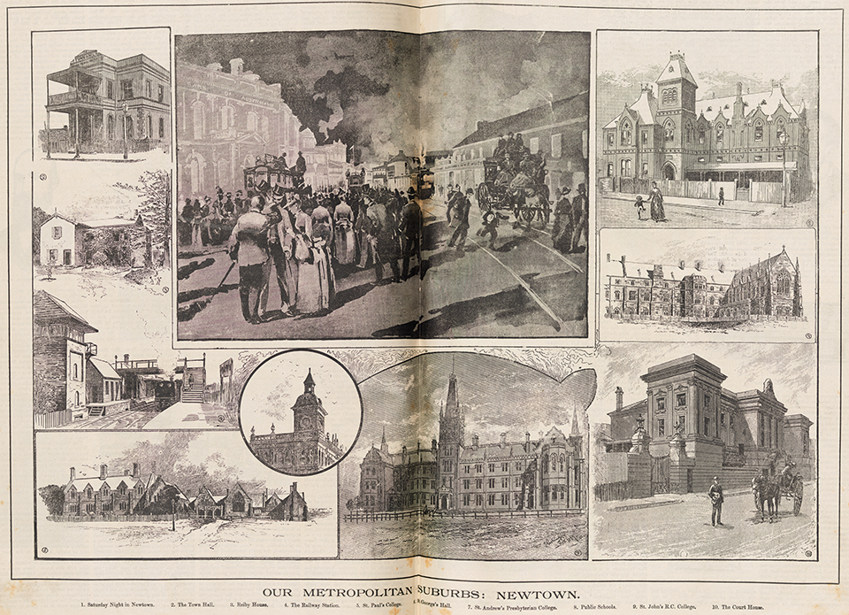
For some years these hamlets were quite separate, but at the southern one a village – a 'new town' – began to form, and over the following decades the hamlets were joined by a ribbon of buildings along the main road. The Sydney Gazette of 24 November 1834 informed its readers that 'the neighbourhood about the spot known as Devine's farm has obtained the name of Newtown'. The name 'Newtown' has been attributed to local merchant, John Webster, who set up his store on what was then still little more than a bullock track that was referred to as the Bulanaming Road.
From Bulanaming Road to King Street and City Road
Bulanaming Road had been [media]renamed in the 1820s, with the section from Bligh Street (now Carillon Avenue) to May Street in St Peters renamed King Street in honour of Governor King. But it was also generally known as the Cooks River Road until the mid-nineteenth century. In 1858, WS Jevons reported that Newtown was
a large suburb of rather superior character... the high street (having) an important appearance similar to that of many villages in the neighbourhood of London. There are good shops, chapels, road side residences. There is a post office, railway station and the terminus of a line of omnibuses. [5]
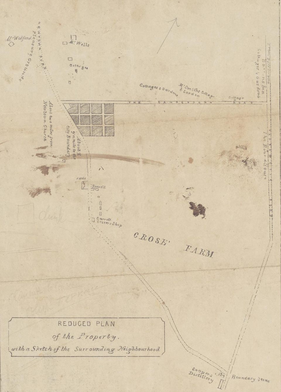
In 1863 [media]there were at least 558 individual property owners in the area, and Newtown was Sydney's fourth most populous suburb by 1892. [6] Newtown's main road, King Street, was one of the first suburban shopping destinations outside the city.
The twin [media]roles of a road to the south of the colony and a local high street produced ongoing confusion about the road's name in the later nineteenth century. Several options were in common usage: although that part of Cooks River Road between Carillon Avenue and May St had been renamed King Street, it could still be referred to as either Cooks River Road or Newtown Road. In 1902 it all became, officially, Newtown Road. In 1907 part of it was named City Road, although the name Newtown Road was still being used in the 1920s. In 1931 that part of the road between Cleveland St and Carillon Avenue was also renamed City Road.
South of Cooks River
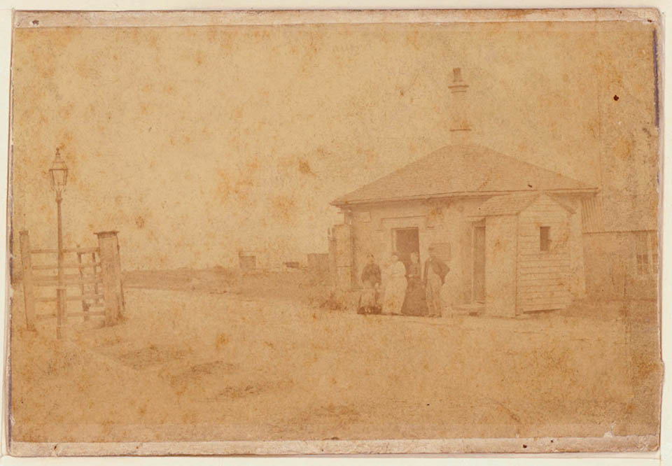
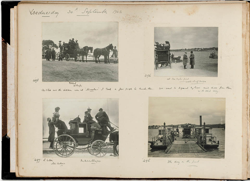
Further [media]along the road south, ferries and punts across intervening rivers were a major impediment to travellers in the early years. A dam on the Cooks River at Tempe was completed in 1840, and although it allowed traffic on Cooks River Road (now Princes Highway) to cross, it proved a considerable nuisance through both floods and pollution. A toll gate was [media]erected there, indicating where the 'entrance' to Sydney Town was located. A new bridge was built there in 1891. A proposal for a bridge across the Georges River was also considered in 1891 but there was only a ferry service until the 1920s, by which time the increase in motor traffic caused serious delays in crossing. Tom Uglys Bridge was completed in 1929.
The [media]existence of this road south helped in the opening up of suburbs along it. Today, leaving the city, and travelling south, one goes along George Street to Broadway, then City Road to King Street which passes through Newtown and Erskineville to St Peters, where it becomes the Princes Highway, and then passes through Sydenham, Tempe, Wolli Creek, Banksia, Rockdale, Kogarah, Beverley Park, Carss Park, Blakehurst,[media] crossing the Georges River via Tom Uglys Bridge, then through Sylvania, Gymea, Kirrawee, Sutherland and Loftus, then – skirting the Royal National Park – passing through Yarrawarrah, Engadine, Heathcote and on to Waterfall. Beyond that it continues as part of National Highway 1.
With the advent of freeways, Sydney's southern gateway is now kilometres further south than it was two centuries ago.
References
Department of Main Roads, The Roadmakers – A History of Main Roads in New South Wales, Sydney, 1976
Rosemary Broomham, Vital connections: a history of New South Wales roads from 1788, Hale & Iremonger, Sydney, 2001
Shirley Fitzgerald, 'Introduction', Sydney's Streets: a Guide to Sydney's Street Names, revised edition 2007, p 4, available at http://www.cityofsydney.nsw.gov.au/AboutSydney/documents/history/Streets/hs_streets_Intro.pdf
Marie Ryan, 'Newtown Municipality 1862–1892: Subdivision, Land Use and Services', Hons thesis, University of Sydney, available online at http://www.sydneyarchives.info/essays-a-histories/132-newtown-land-use-etc-1862-92
Notes
[1] Shirley Fitzgerald, 'Introduction', Sydney's Streets: a Guide to Sydney's Street Names, revised edition 2007, p 2, available at http://www.cityofsydney.nsw.gov.au/AboutSydney/documents/history/Streets/hs_streets_Intro.pdf
[2] Shirley Fitzgerald, 'Introduction', Sydney's Streets: a Guide to Sydney's Street Names, revised edition 2007, p 4, available at http://www.cityofsydney.nsw.gov.au/AboutSydney/documents/history/Streets/hs_streets_Intro.pdf
[3] http://www.rta.nsw.gov.au/cgi-bin/index.cgi?action=heritage.show&id=4309582
[4] Quoted in Marie Ryan, 'Newtown Municipality 1862–1892: Subdivision, Land Use and Services', Hons thesis, University of Sydney, available online at http://www.sydneyarchives.info/essays-a-histories/132-newtown-land-use-etc-1862-92
[5] Quoted in Marie Ryan, 'Newtown Municipality 1862–1892: Subdivision, Land Use and Services', Hons thesis, University of Sydney, available online at http://www.sydneyarchives.info/essays-a-histories/132-newtown-land-use-etc-1862-92
[6] Marie Ryan, 'Newtown Municipality 1862–1892: Subdivision, Land Use and Services', Hons thesis, University of Sydney, available online at http://www.sydneyarchives.info/essays-a-histories/132-newtown-land-use-etc-1862-92


