The Dictionary of Sydney was archived in 2021.
McGarvie’s list and Aboriginal Dyarubbin
Citation
Persistent URL for this entry
To cite this entry in text
To cite this entry in a Wikipedia footnote citation
To cite this entry as a Wikipedia External link
McGarvie’s List
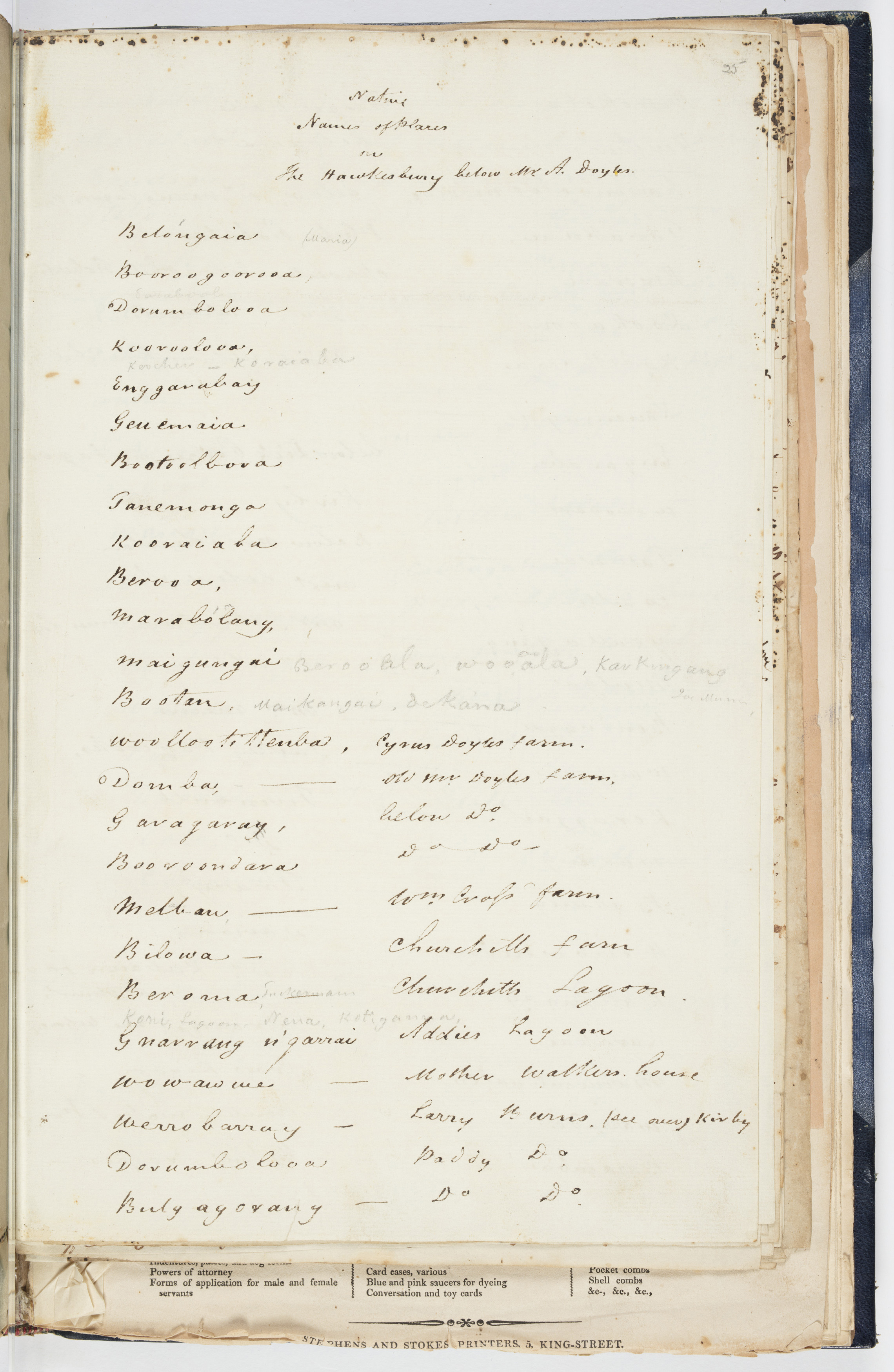
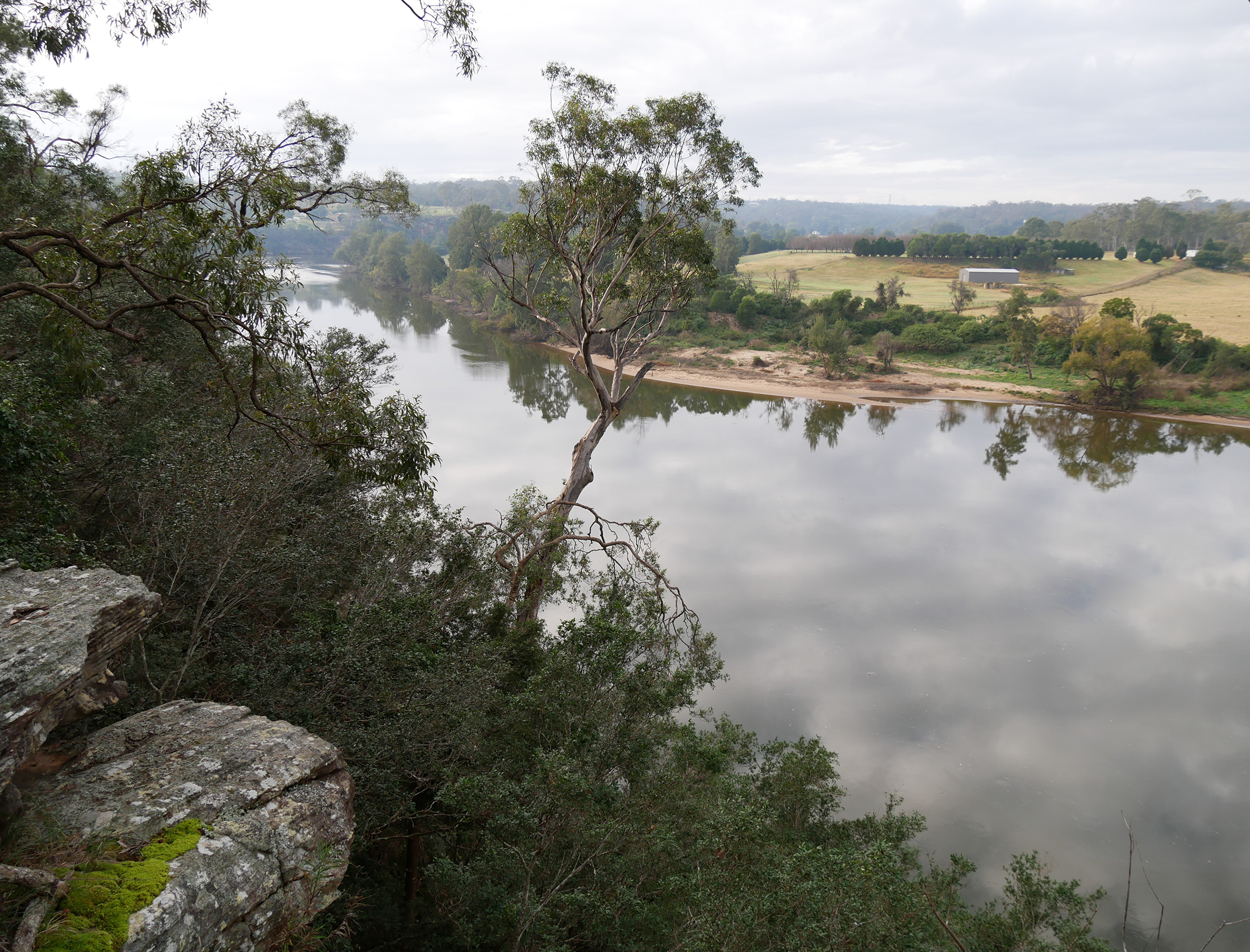
[media]Hidden away in a notebook held in the State Library of NSW's Mitchell Library is a remarkable document: a handwritten list of 178 Aboriginal names for places along Dyarubbin, the Hawkesbury River, which encircles Sydney and the Cumberland Plain on the east coast of New South Wales. The list was compiled in 1829 by the Reverend John McGarvie, Presbyterian Minister at Ebenezer and Pitt Town. McGarvie headed this list ‘Native names of places on the Hawkesbury’, and wrote the names in ink and pencil on six pages in his notebook. The words appear in geographic order, so they also record where he and his Aboriginal informant/s travelled along the riverbanks. Perhaps most important of all, McGarvie often included locational clues, like settlers’ farms, creeks and lagoons.[1] These precious details mean that these long-lost names can be relocated on the ground, restored to their places, and that one day these beautiful, rolling words might even come back into common use.
Place names have enormous significance in Aboriginal society and culture. As in all societies, they signal the meanings people attach to places, they encode history and geography, they are wayfinding devices and common knowledge. In Aboriginal culture they are also crucial elements of shared understandings of Country, ‘integral to a group’s understanding of its history, culture, rights and responsibilities for land’.[2] Often place names are parts of larger naming systems – they name places on Dreaming tracks reaching across Country. Singular names can also embed the stories of important events and landmarks involving Ancestral Beings in the landscape. Anthropologist and linguist Jim Wafer points out their use in songs, which were memory devices, or ‘audible maps’, travelling song cycles that narrate mythical journeys’.[3]
Once every place on Dyarubbin and its tributaries had an Aboriginal name, clues to the way this Country was understood, used and experienced. Now only a handful survive on maps and in common usage.[4] But Reverend McGarvie’s list might change all that.
Making the list
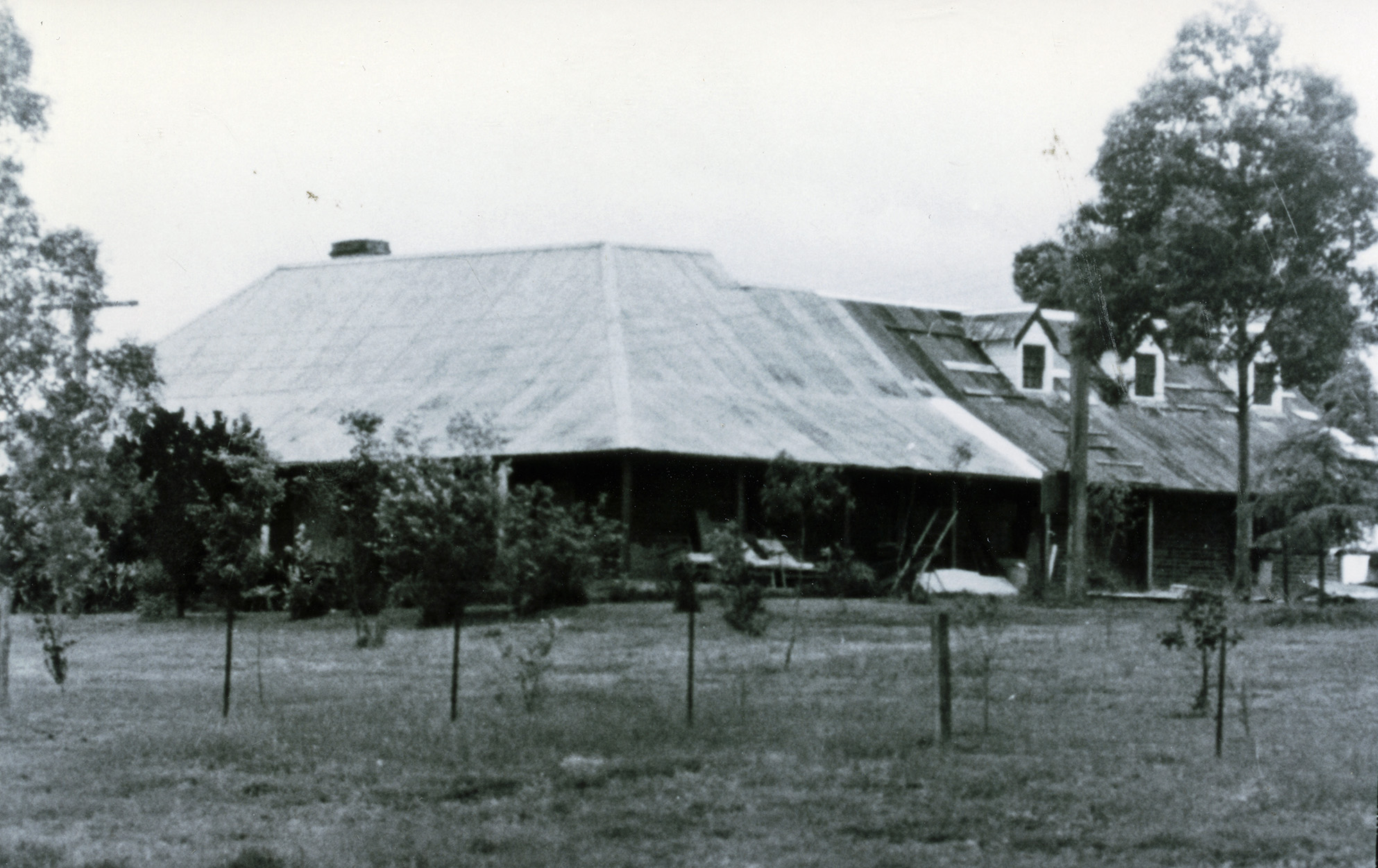
[media]The Reverend John McGarvie arrived in New South Wales in 1826, a young, newly ordained Presbyterian Minister who became the first incumbent of the Presbyterian churches at Pitt Town and Ebenezer. Until 1829, he lived at Percy Place (Mekoorabon), the house of local settler George Hall, and then moved onto Manse Farm, which still stands on Punt Road at Pitt Town today.[5]
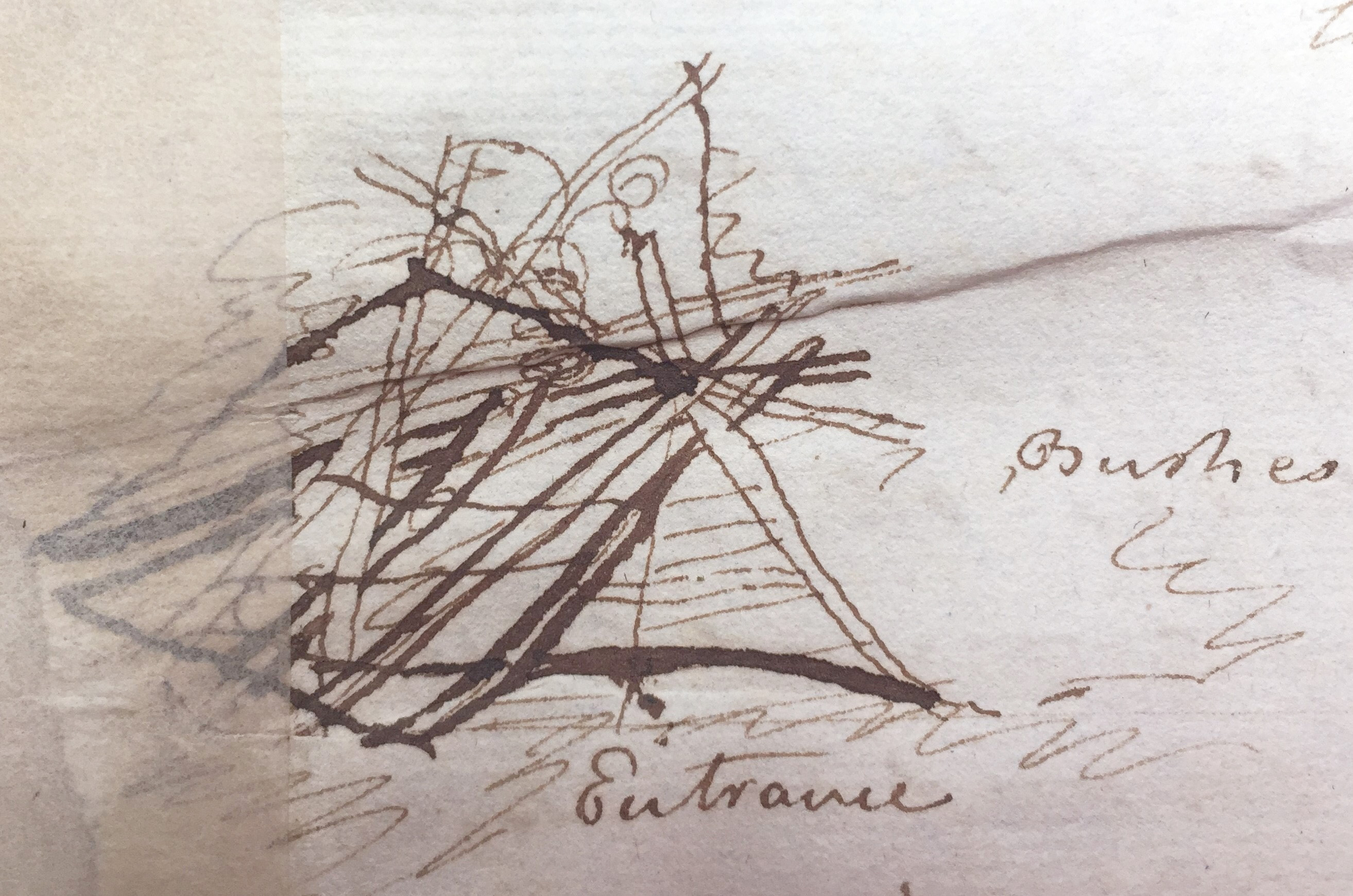
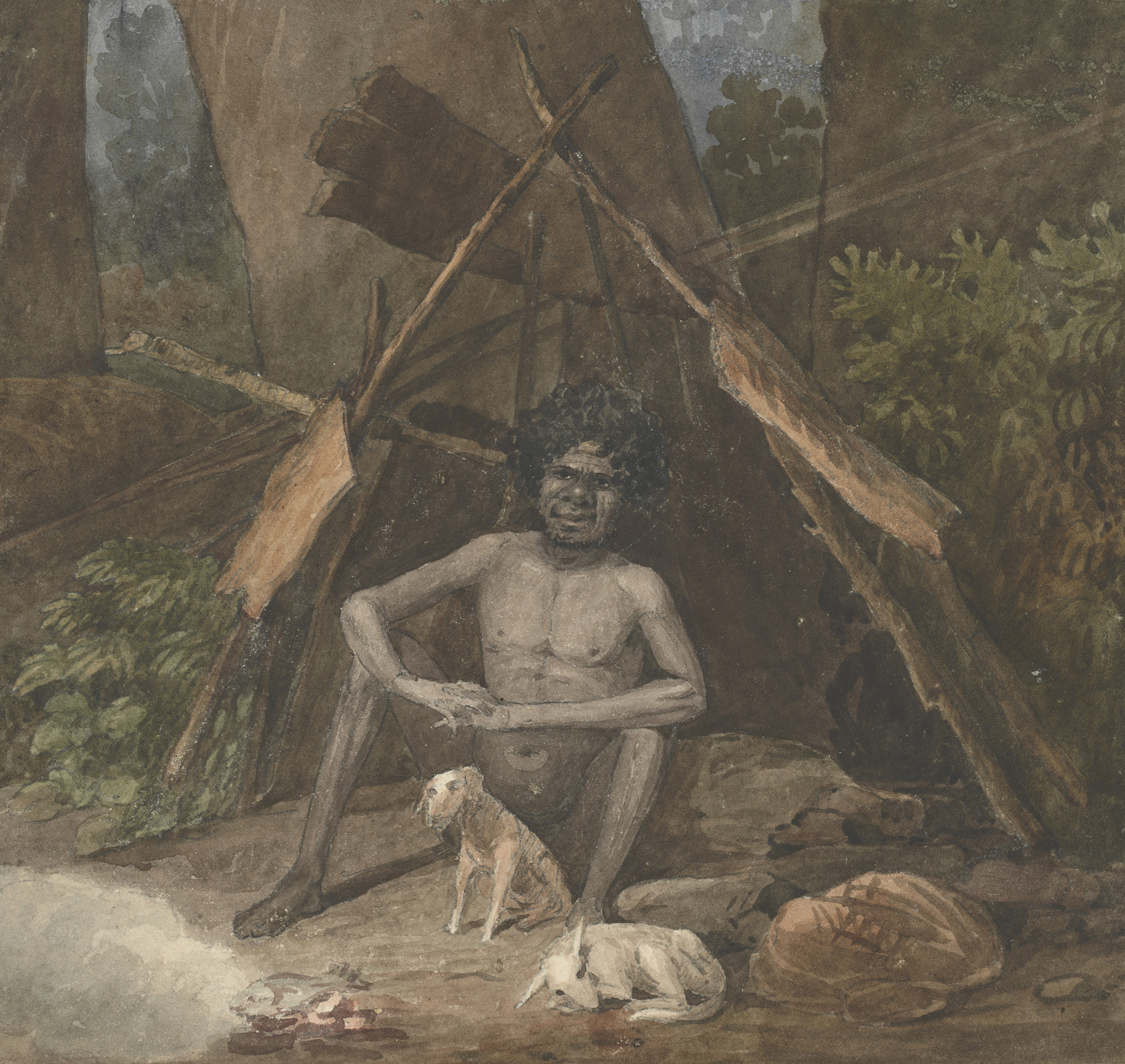
[media] [media]McGarvie met local Aboriginal people, including the group that lived around Pitt Town and sometimes camped near Percy Place. They were probably led by Kurringy, known to the settlers as ‘Black Captain’ and earlier as ‘Carbone Jack’. Kurringy had been a sailor and a rebel fighter in the last phase of the frontier war on the river. McGarvie also knew another group living further downriver at Doorumbolooa (Sackville) and Bulgagorang (Portland Head), where there was a second chapel. This was probably the group led by the famous karadji (doctor, or clever man) Yarramundi, who met Governor Phillip in 1791, and became a cross-cultural envoy. McGarvie noted seeing and meeting these people in his diary. He saw them fishing in the lagoons, sleeping on the riverbanks, building gunyas and camping in orchards and on the local common.[6]
By 1829 Dyarubbin’s Aboriginal people knew Reverend McGarvie well and they must have trusted him. When he became interested in recording their place names for the river, they shared the names with him. They had long been familiar with settlers and could speak and understand English, so it is very unlikely that they misunderstood his request for their place names.
McGarvie mentioned two men by name in his diary – Ben and Nangowrie. Ben was probably Ben Bungraa from Pitt Town – McGarvie described him as an expert local tracker. Nangowrie (also spelt Nangui and Nangoa), whom McGarvie met at Sackville (Dorumbolooa), was a member of the ‘Lower Branch Tribe’.[7] But the only person mentioned on the list itself is ‘Maria’ – her name is written right at the top. It is possible that she was the famous cross-cultural figure Maria Lock who became a landowner and the matriarch of a large family. Maria was fluent in English as well as at least two Aboriginal Languages, and she knew members of the clergy very well – they may have introduced her to Reverend McGarvie.[8] If Maria Lock was one of McGarvie’s informants, she would have had no difficulty understanding the young minister’s questions about place names, although, as we shall see, there were profound differences in the ways Aboriginal people and settlers saw and understood this Country.
Reading the names: patterns
What can the words on McGarvie’s list tell us about the Aboriginal world of Dyarubbin? In any project like this, it is essential to keep in mind the sheer complexity of both Language and cross-cultural communication. These place names, for example, could refer to the landscape and environment of Dyarubbin, or they may have been metaphors. Some appear to be archaisms – old words which fell out of general use and were only preserved as place name (this often happens with English place names too); or they may be fragments of Dreaming stories or songlines.
When linguists analyse and translate a word, they create a ‘gloss’, a summary of the meaning/s of a word, or component parts of them. 'Glossing' McGarvie’s list has revealed a wealth of information as well as intriguing and suggestive patterns – the place names are a marvellous word-window onto the Aboriginal Dyarubbin in late 1820s. They can be roughly grouped in four interrelated and often overlapping categories: the natural world; the social world; metaphors referring to the body; and names which reference the spiritual world, signifying sacred places. And when we step back and consider them together in their geographic contexts, they also coalesce as a series of zones.
The natural world
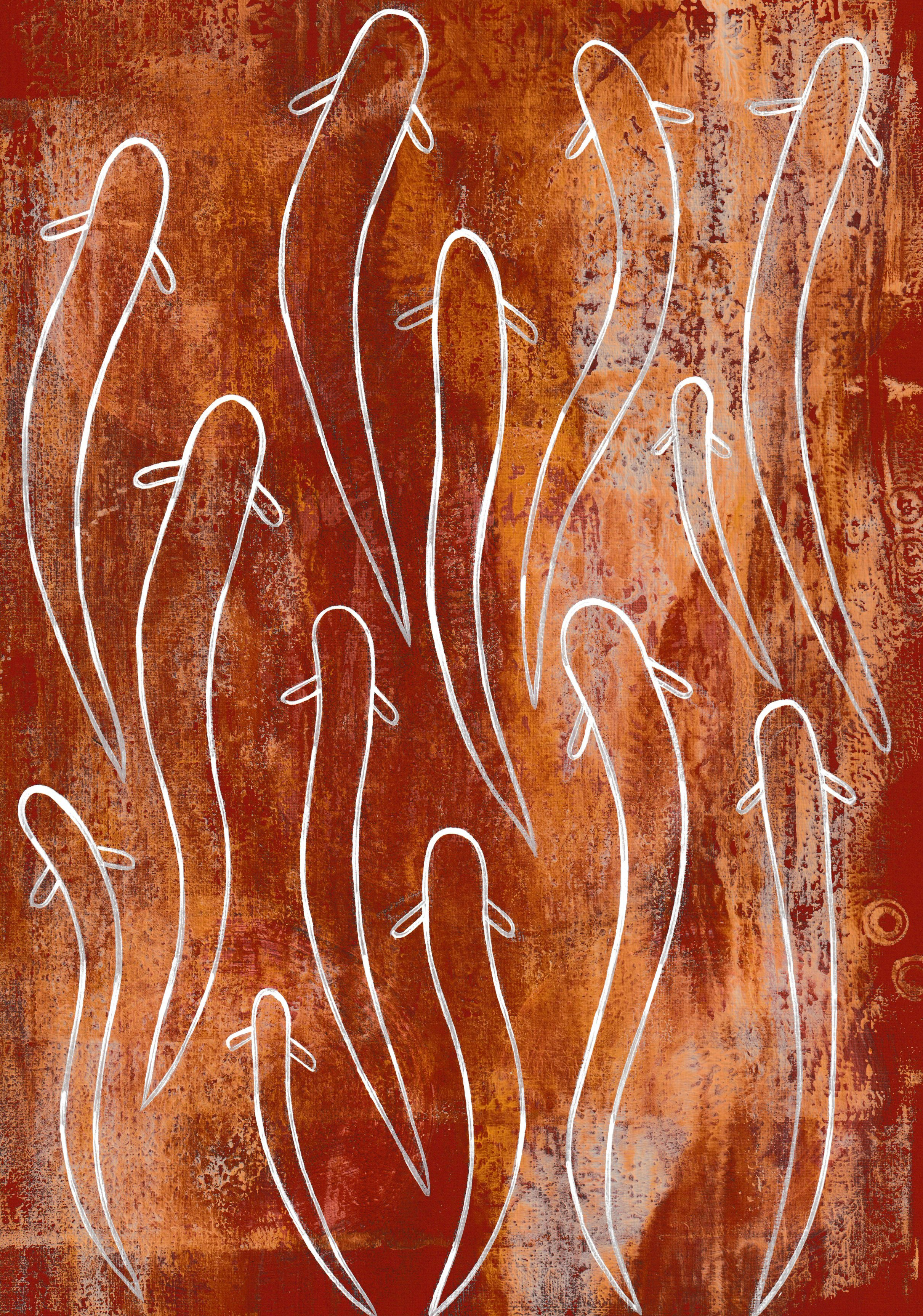
[media]Well over half the names (almost 90) signify aspects of the natural world: plants and creatures, geography and landforms, stone and earth. Some animals, birds and fish appear repeatedly: there are six places associated with karakai/bandicoots, and three referring to gulu/koalas, three guwali/cormorant places and four names invoking bara or kaniny/eels (two of them are ‘eel caves’). Places were also named for snakes, lizards, mud oysters and insects. The names reference 35 different trees and plants, too, while the suffixes seem to suggest that they were considered the inhabitants of these places. Two of the tree-places listed, Booldoorra and Karrowerry, may refer to trees that no longer grow on Dyarubbin, soft corkwood (Caldcluvia paniculosa) and plum pine (possibly Podocarpus elatus) respectively, both riverine species.
Other words name lagoons and creeks, extant forests, open, grassy patches, fern beds and places to dig for roots/yams. The landscape words describe sandy camps, hill camps, cliffs, muddy ground, soft earth, and hard, broken places. There are two, possibly four, names linked to white clay, and one possibly to red ochre. Both these materials were prized as they were used in artworks and to paint bodies for ceremony, ritual and performance.
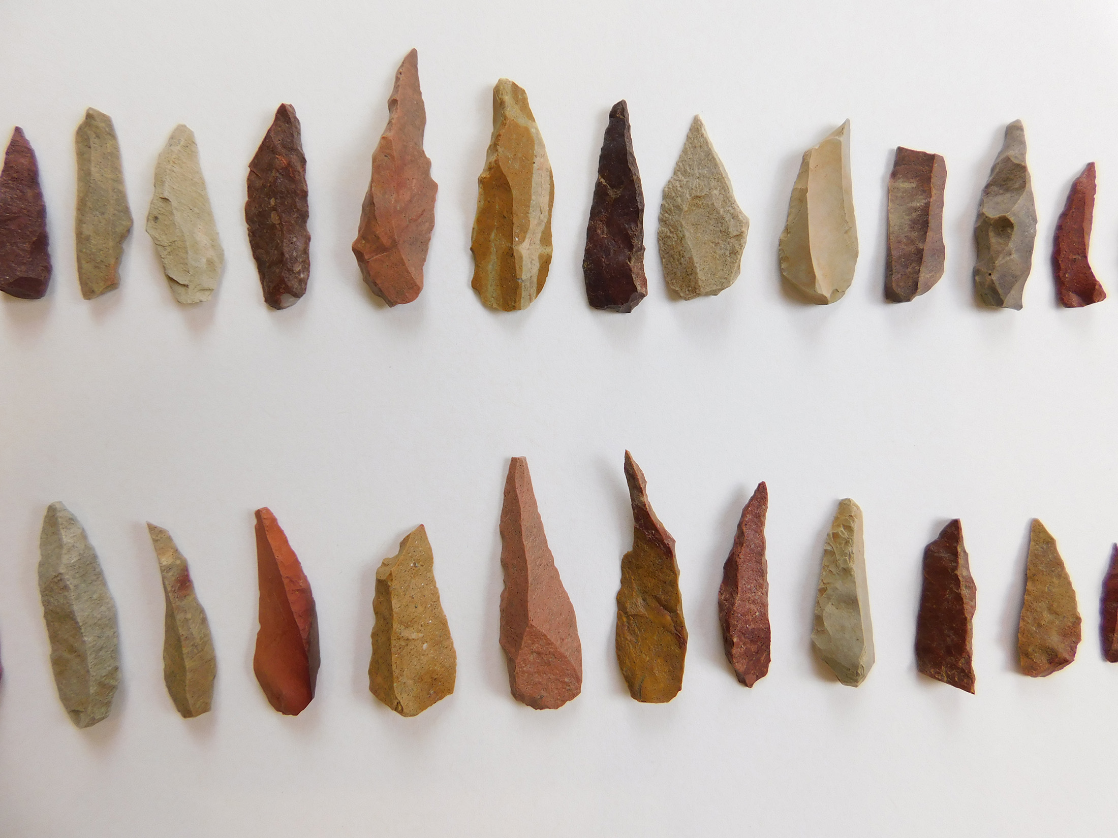
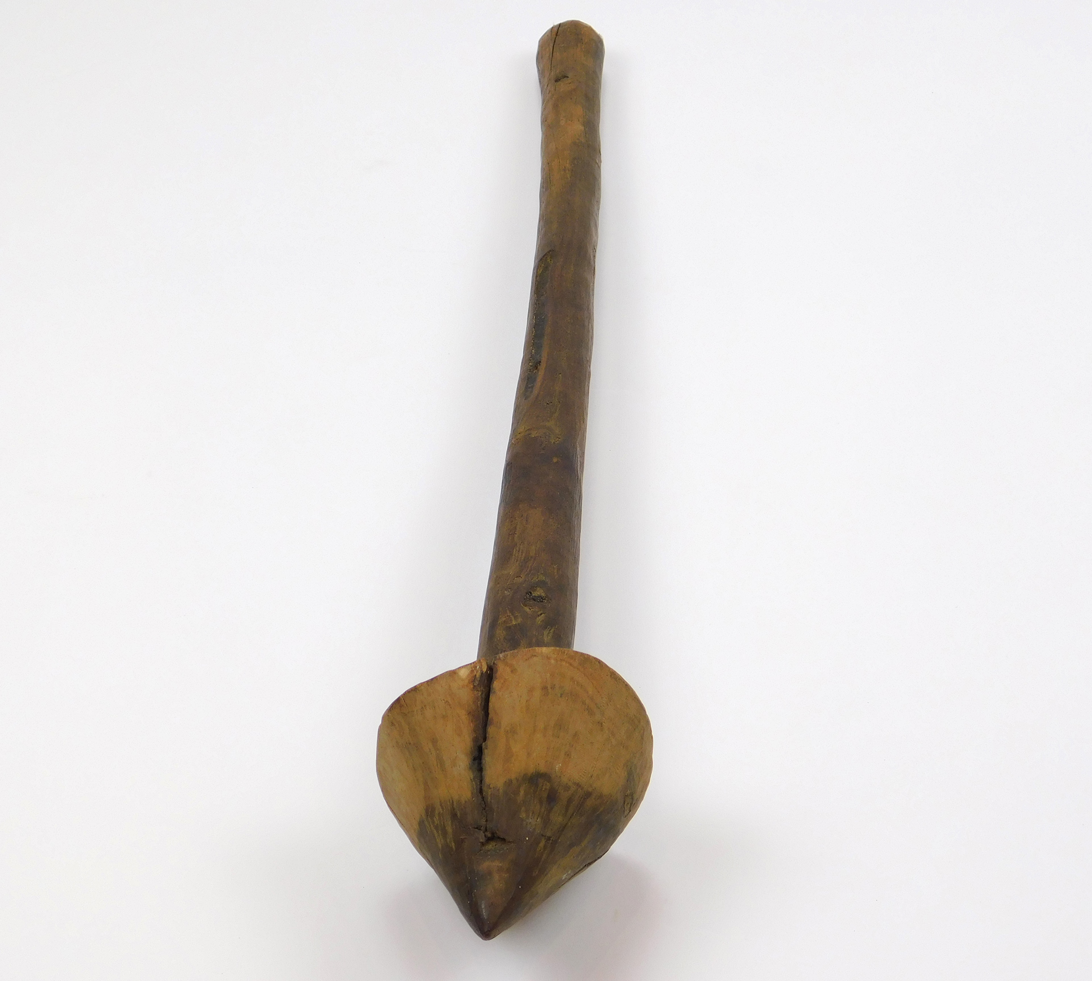
[media]The ochre/clay names touch on another insight: Aboriginal people did not strongly separate nature from people and culture, so place name meanings are often multi-layered, connecting natural, topographic and human dimensions. Another example is Curry Jong (Kurrajong), meaning fishing line or string, but also the different plants from which they were made (including kurrajong trees and brush kurrajong), and the place where they grew.[9] Since making line and nets was women’s work, Curry Jong can also be associated with women. Guldulo probably means flint/hard stone for spear points, suggesting that this area on Portland Reach was a source for the stone, as well as the spear point itself. Alternately it may signify that stone points were made here: archaeologists found points in the three rock shelters here.[10]
The social world
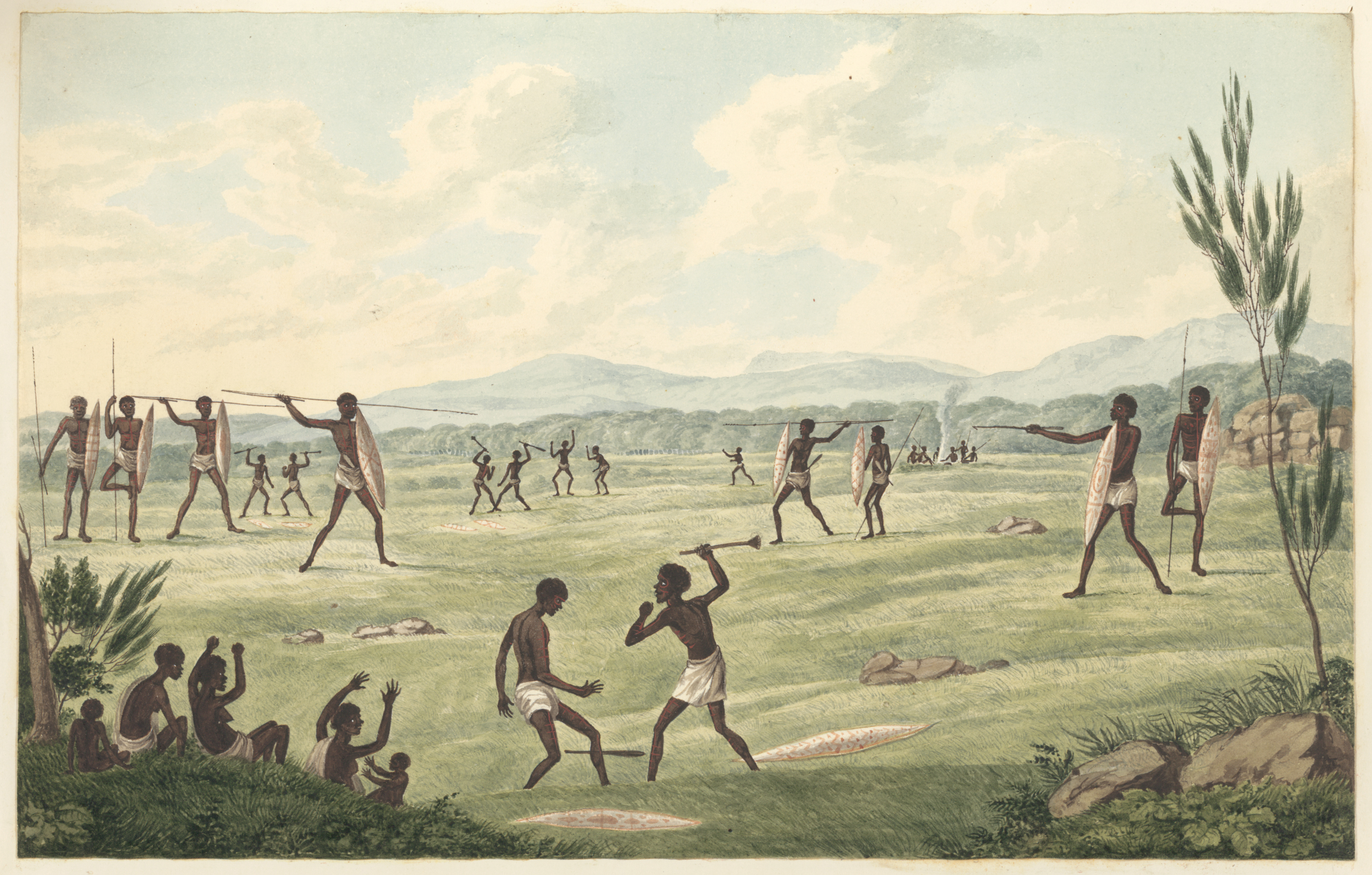
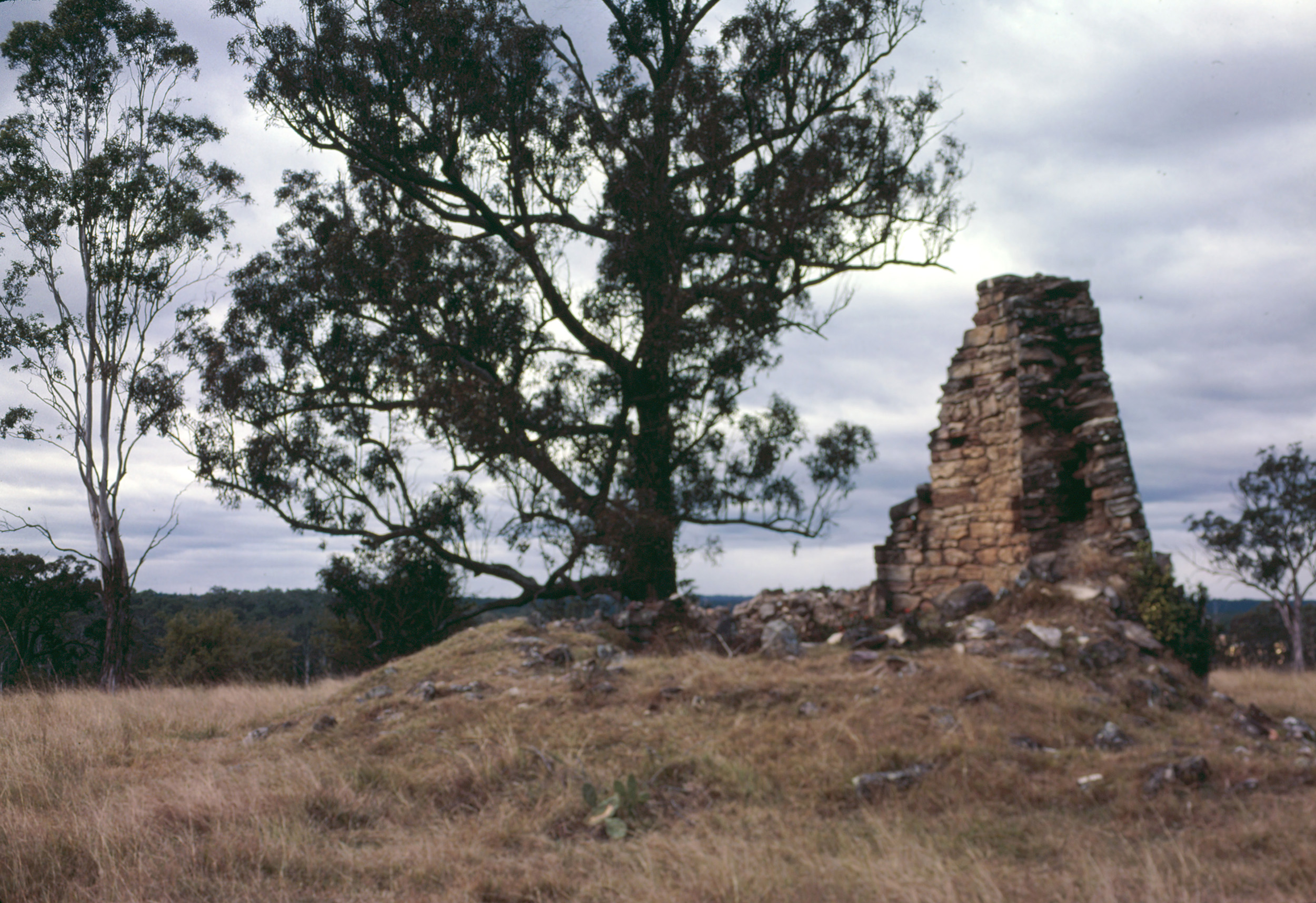
[media]At least 27 place names signify social places - three connected with corroborees and corroboree grounds (Daraluli, Towlaba and Womunga), while the name Kercher Koraiaba, on the lower reaches of Dyarubbin, suggests an open, grassy place with a contest ground, a place where Aboriginal Law was enacted. There are names indicating camps for old men, grandmothers and widows, a place where goods were traded (Nonorooko) and even a ‘little place where things are given away’ (Narang Tooloomeraba). It is possible these last two were places where Aboriginal people encountered and mixed with settlers.[media] The list also provides a name for Surgeon Thomas Arndell's stone windmill at Cattai: Daili, which has two possible meanings: ‘eat/hungry for dry stuff’ and ‘that! that one!’. The mill ground the settlers' grain into flour, which may explain the name - it was ‘hungry’ for dry wheat and corn. Its height, large vanes and prominent position on a hill above Little Cattai Creek would have also made it a landmark - 'that! that one!'.[11] Daili is important because it shows that Aboriginal Language was not only still spoken decades after the invasion, it was a living, evolving language.
[media]Social places are often inseparable from the natural world – so the word for eel (bara or barra) in the name Coolaibarra indicates it is an eel net place, and Baratollooa a place where eels were eaten. Nanemagooloo appears to mean nets/nooses for catching koalas, and nearby Koloway suggests a koala habitat. Tanekune may have been where big, flat mud oysters might be dug out with yam sticks, while other places names indicate where materials for canoes, clubs and coolamons could be found; and perhaps where these things were made.
The body and the spiritual world
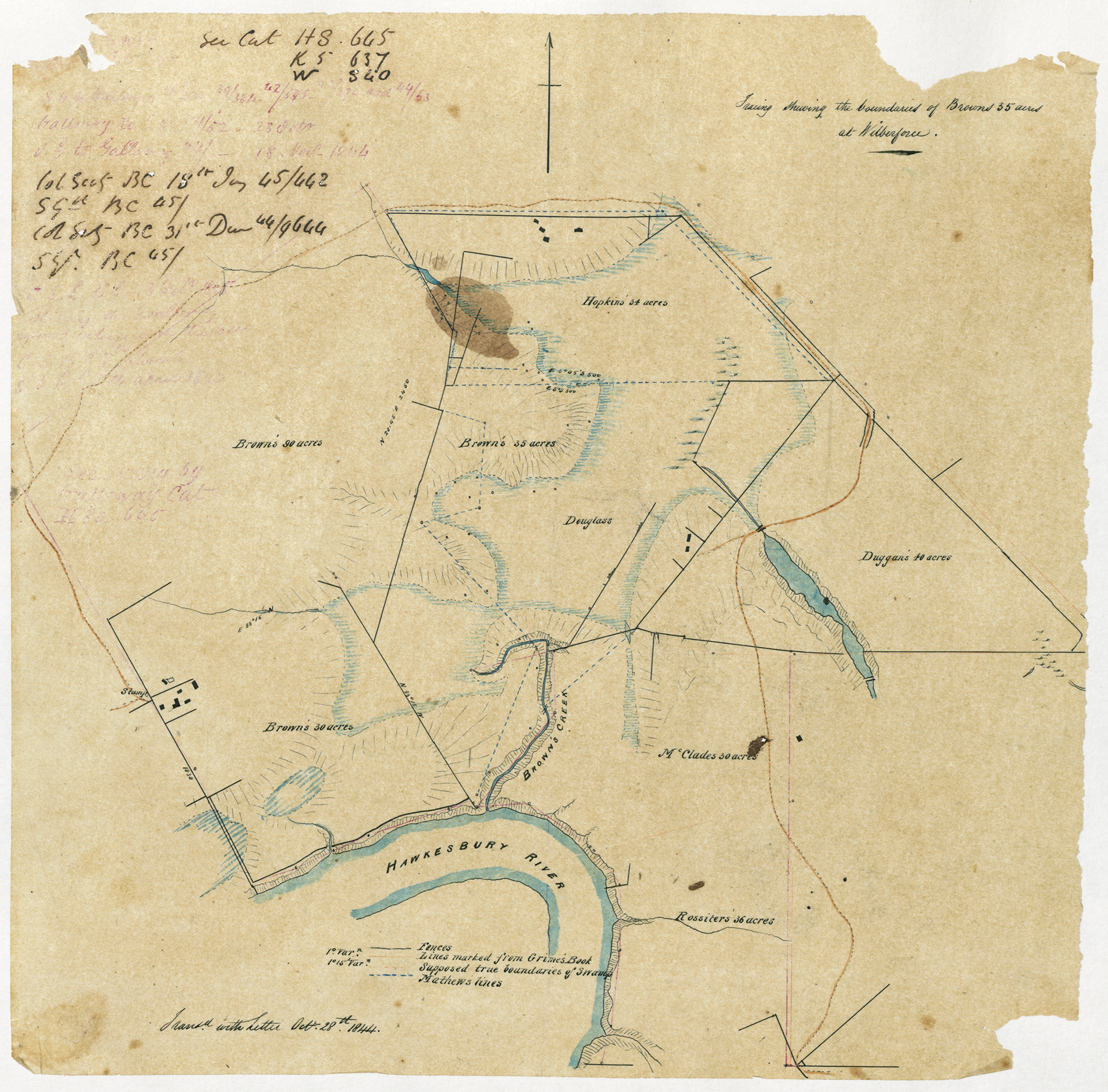
When the glosses of the words on McGarvie’s list were reconnected with Dyarubbin’s geography, an allegorical dimension began to emerge: words for parts of the body. Karkingang, meaning ‘big mouth’, is the name of the point later known as Mauns Point. Cobay, meaning ‘arm’, is the name of a lagoon near Wilberforce which, today at least, is crooked like an arm, and was once an arm of the river. McGarvie noted Nena, possibly meaning nguna ‘elbow’, close to the dramatic hairpin bend of the river at Sackville, while Koodna, meaning ‘long finger’ may refer to the long peninsula later known as Halls Point. Fingers are referenced at Mareh Mareh, a lagoon at Richmond, too. The gloss is ‘like the fingers of a hand’ and the lagoons in the area, including Yarramundi, Mareh Mareh and Pughs Lagoon, do resemble long, thin fingers reaching out over the floodplain.
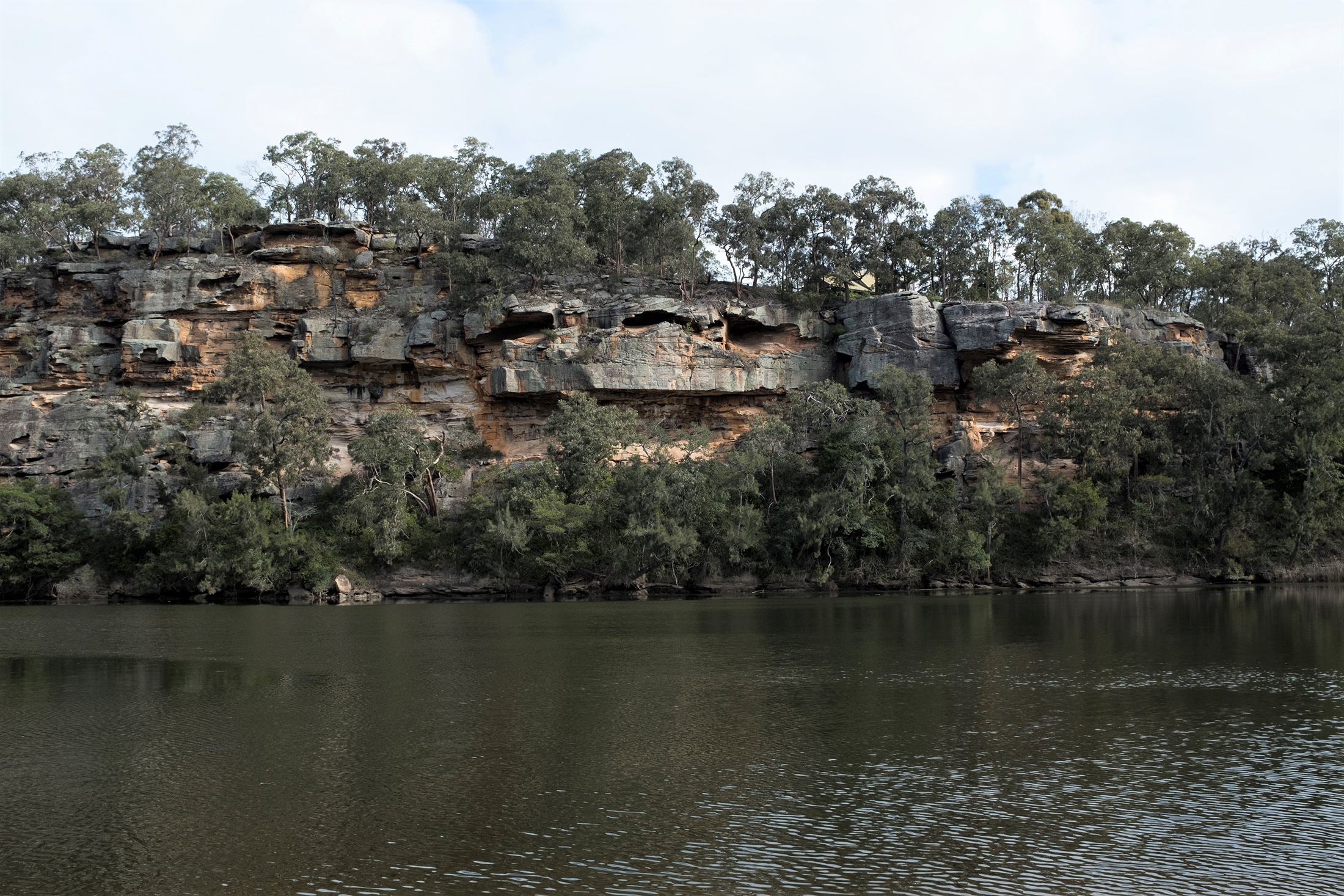
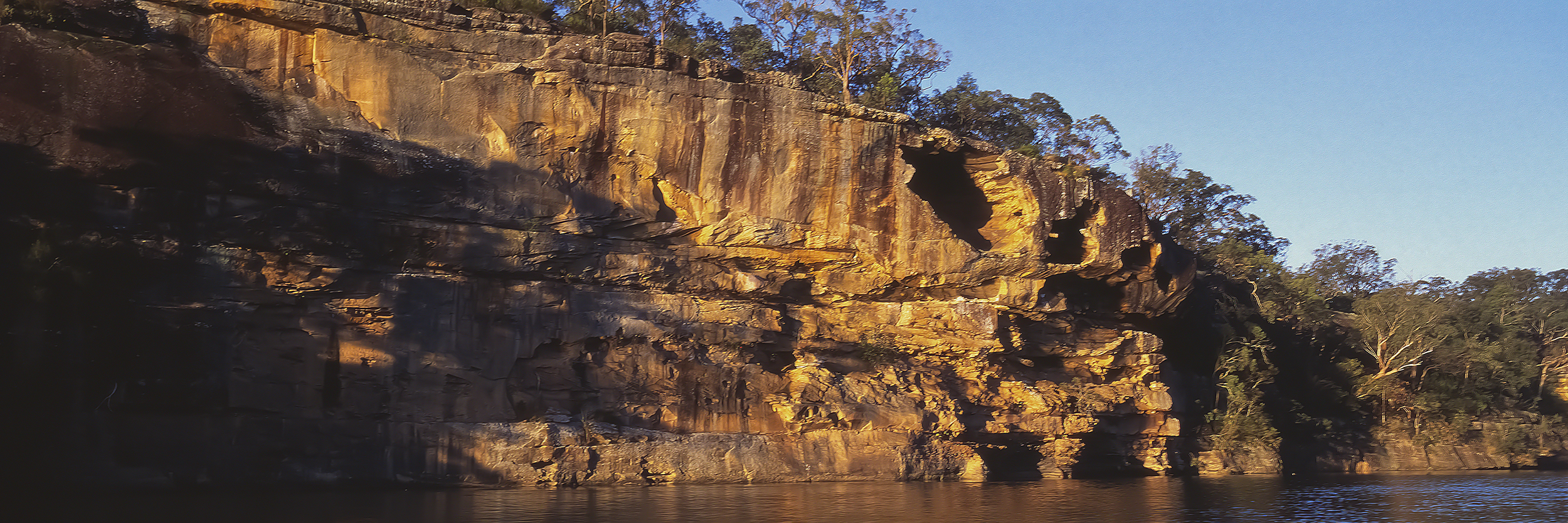
[media]Mi or may means ‘eye’ in several Languages and is associated elsewhere in Australia with springs or the sources of water. Four of the place names McGarvie collected appear to be associated with eyes: Mellagorooa, Mekorabon, Melong (now Melon Creek, a tributary of Gunanday which flows down from the Melong ranges) and Wowawme. McGarvie noted Wowawme as the name for the formidable cliffs on Dyarubbin at Sackville. Wowaw- refers to the Ancestral monster fish Waway or Wau-waiy, while ‘-me’ is the Being’s eye. Gundungurra, Hunter River and Wiradjuri stories tell of giant river monsters which inhabit deep river holes and lakes.[12] Soundings show that Dyarubbin is very deep at Wowawme, and the hollows of the cliff above look like heavily-browed eyes, watching down the river reach. Mouths, arms, elbows, fingers, eyes: together these names suggest that Darug and Darkinjung people thought of Dyarubbin as a living body.
A series of zones
Are there larger patterns in McGarvie’s list of place names? Here again, mapping the names, relocating them on Country, suggests that Aboriginal people thought of Dyarubbin: as a series of zones, each which particular characteristics.
Warretya Country
[media]For example, on the west side of the river between Sackville and Wilberforce (McGarvie’s third itinerary), are 16 named lagoons or words meaning lagoons, including five different words for types of lagoons. It was Warretya (lagoon) Country. The huge lagoon on David Brown’s farm east of Wilberforce alone had at least four different names: Karababili (ironbark), Daraluli (place for corroborees), Bendia (honey place) and Lubo, probably Wulubo (just grass, probably an open area). Dyarubbin’s many beautiful lagoons trace out the old shape and course of the river. They were originally part of the main river, but as the river slowed and narrowed over thousands of years they became ‘arms’ or lagoons (also known as billabongs) and were eventually left behind on the banks. Rich in birdlife, fish and edible plants, they were very important places for Aboriginal people, especially women, who harvested the edible roots and shoots of water plants such as cumbungi, water ribbon and common nardoo.
Dugga Country
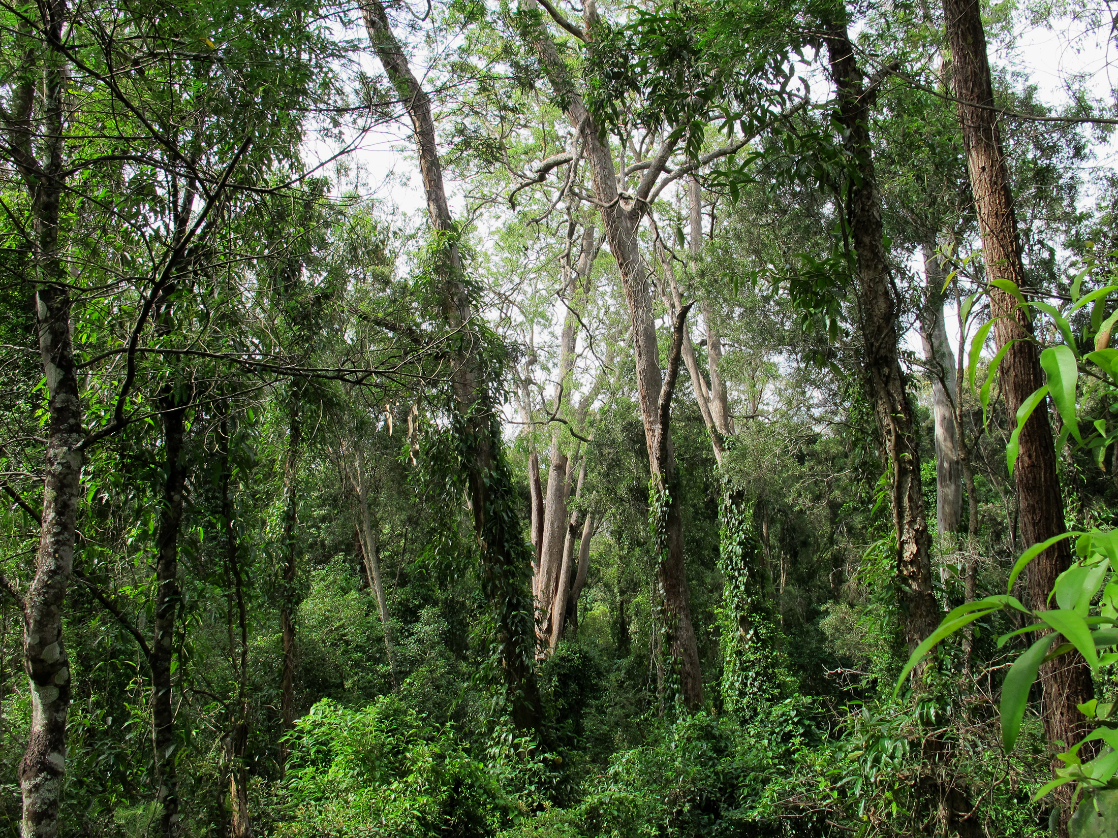
[media]There were lagoons on the opposite side of the river, too, but here the series of place names in the area from Cattai Creek to north of Little Cattai Creek indicate that this area was Dugga (brush/rainforest) Country. McGarvie listed Dugga, meaning ‘brush’, north of Little Cattai Creek, and the amplified Tuggatugga, ‘thick brush’, somewhere south of Cattai Creek. Massive river-flat forest, which the settlers called ‘brush’, once lined most of Dyarubbin’s alluvial reaches; in sheltered gullies it graded into rainforest.
[media]Some of the associated place names in this area reference the tree species which grew in these forests: coachwood, native plum tree, soft corkwood and Port Jackson or Rusty figs, and well as places named for weapons like clubs and spears which may have been fashioned from the fine, hard timbers of some of these trees.
[media]These place names suggest something highly significant about Dyarubbin’s human and ecological history. While the settler invasion is often assumed to have completely destroyed the Aboriginal landscape, converting it to cleared, farmed fields, McGarvie’s list of tree and forest names tells us that parts of the great forests survived for over three decades in this zone, and that Aboriginal people went on using them.[13] Today you can still see rare surviving pocket of dense, tall river-flat forest in Mitchell Park at Cattai and alongside Cattai Creek. Darug women come here to visit a family of scarred paperbarks and to gather native foods.
Kali yearning: salt to fresh
Somewhere on Portland Reach, McGarvie wrote down a significant name: Kali Yearning, Gali Yiruniyn, meaning ‘water becomes fresh’. The shift from salt to fresh was fundamentally important for people, animals, plants and ecologies. The brackish estuarine zones of rivers have particular ecologies, different from both freshwater upstream and saltwater downstream, and these different ecologies in turn shaped river life.[14]
It would have been a moving boundary, though, because the point where the ‘water becomes fresh’ changed with the amount of rainfall, the tides, flows from tributaries and many other factors. In fact, the process is so complex ecologists today cannot say for certain where the river became fresh in the past.[15] Kali Yearning is a rare piece of environmental information.
It was important for people to know where the fresh water was at any given time, and this is probably why three other names on McGarvie’s list signal fresh water: downstream at Kookaoon, ‘fresh water’, probably referring to a lagoon or creek; Kallangang ‘big fresh water’, a lagoon near Wilberforce; and Bardo Narang, ‘small fresh water source’, still flowing as Bardenarang Creek today.
This part of the river is a zone of transformation, exchange and mingling, for water, ecologies and people. It was also the portal to Dyarubbin’s sacred zone.
Sacred zone: Dorumbolooa and Gurangatty
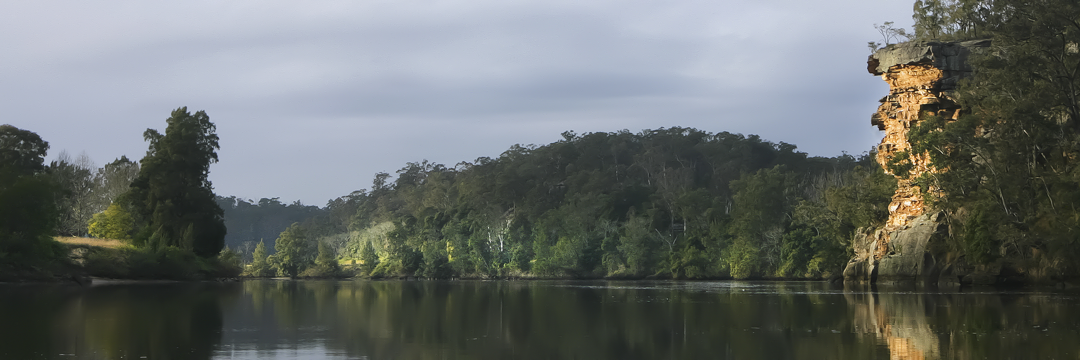
[media]One of the most compelling stories comes from the place named Dorumbolooa, and it shows how important it is to ‘see the river whole’, to combine history, geography, linguistics, archaeology and the rich knowledge and traditions of local Darug and Darkinyung people. The story is set on Dyarubbin around Sackville Reach and Portland Head, an area that is both archaeologically rich and historically significant. It’s a spectacular landscape, too, because this is where Dyarubbin re-enters the ranges, flowing uphill through its deep, sandstone gorges before turning east at Wiseman’s Ferry. Towering sandstone outcrops, which settlers named Portland Head Rock and Lovers Leap, (probably Dakal and Yerumbola respectively) stand sentinel at the gateway to this winding stone labyrinth. This was the area of the strongest Aboriginal resistance on the river, the place where the warriors’ raids were successful in driving settlers out between 1796 until 1803. And it was the place where, despite dispossesion and war, the Sackville Aboriginal people remained throughout the 19th and 20th centuries.[16][media][media]
In 1829 Reverend McGarvie was here too, asking his informants about the names of the places. At Patrick Byrne’s farm, just south of the Sackville Ferry on Tizzana Road, he wrote down Dorumbolooa. Jim Wafer first glossed this word Dorumbolooa as ‘place of the rainbow’. Later he discovered something else – the perlative suffix ‘-looa’ means more than ‘place’. It means zone, and it denotes continuing movement, so this area is the zone where the rainbow passes through.
Rainbows are important in Aboriginal spiritual life and mythology.[17] Among many Aboriginal groups, the great creator serpent appears as a rainbow, shimmering across the sky. The pioneer anthropologist RH Mathews wrote that Wiradjuri Karadji (doctors or Clever Men) followed rainbows to meet the river monster Waway/Wau-waiy in his deep river hole. We know that rainbows had supernatural importance in Aboriginal ontologies on Dyarubbin too. Like falling stars, rainbows were portents and warnings.[18]
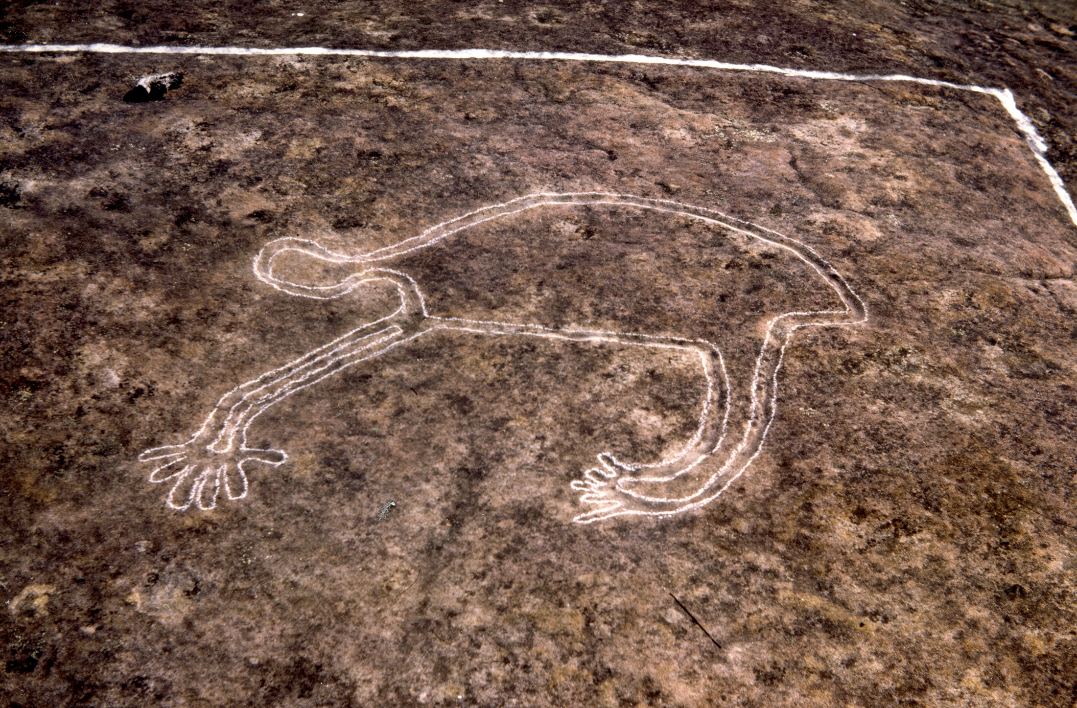
[media]We are also close to Wowawme here, Wau-waiy’s stony lair and lookout place at the hairpin bend of the river. Just downstream is Karemooloomooloo, a word meaning something like the intersection of clusters of falling stars. And in a direct south-east line from Dorumbolooa, carved on a rock platform beside Dyarubbin, is the gigantic Eel-Being Gurangatty, who very likely created the river and its valley. He may have been the same Being as Gurangatch, who in the mythology of the nearby Gundungurra people, tore up rock and earth with his powerful body in his desperate flight to escape the hunter Mirrigan, the tiger-quoll, and so created the Coxs and Wollondilly rivers.[19] The great rainbowed eel/serpent moved through this place, leaving these tremendous cliffs and chasms in his wake.
So these dramatic river reaches were not only an Aboriginal stronghold, the place they remained for the rest of the nineteenth century. The stone-walled channels here are infused and throbbing with spiritual meaning and power. Was this why the warriors fought so hard for it?
Seeing the river whole
[media]Seeing the river whole allows us to tentatively rethink that moment of exchange on the river at Sackville in 1829, and perhaps even glimpse the profound differences between settler and Aboriginal ways of seeing Country. It turns a searching light on how we record, map and think about Aboriginal sites and names.
Reverend McGarvie thought he was making a neat list of names for specific places. But the name his informant gave him also explained what happened here in the Dreaming, what was significant about this place.
Perhaps it went something like this:
He asks, notebook ready, pencil poised: And what is the name of this place, Paddy Burns’ farm?
She gestures south-east, across Burns’ farm towards Gurangatty, fixed on rock, and then sweeps her arm towards those rugged, high cliffs beside the river.
Dorumbolooa. The rainbow moves through here.
This essay follows Introducing the Dyarubbin Project: Aboriginal history, culture and places on the Hawkesbury River.
Notes
[1] Reverend John McGarvie, ‘Native Names of Places on the Hawkesbury’, in Poems and prose, 1825-1835, Reverend John McGarvie Papers, 1825-1847, Mitchell Library, State Library of New South Wales (ML MSS A 1613)
[2] Luise Hercuse, Flavia Hodges and Jane Simpson (eds), The Land is a Map, ANU Epress, Canberra, 2002, p 2.
[3] James Wafer, ‘Ghost-writing for Wulatji: incubation and re-dreaming as song revitalisation practices’, in James Wafer and Myfany Turpin (eds), Recirculating songs: revitalising the singing practices of Indigenous Australia, Hunter Press, Newcastle, 2017, 208
[4] For example, Colo, Kurrajong, Bardo Narrang, Wheeny, Yarramundi, Melong, Berowra, Cowan
[5] Jean F. Arnot, 'McGarvie, John (1795–1853)', Australian Dictionary of Biography, National Centre of Biography, Australian National University, https://adb.anu.edu.au/biography/mcgarvie-john-2399/text3169, published first in hardcopy 1967; Reverend John McGarvie, Diary on the Greenoch and in NSW 1825-1828 Mitchell Library, State Library of New South Wales, (ML MSS A1332, p 252).
[6] Reverend John McGarvie, Diary on the Greenoch and in NSW 1825-1828 , entries for 29 July, 24-5 August, 10 September, 9, 13 October 1826; 5 February, 14 March, 10 April 1827; 1 January 1828, Mitchell Library, State Library of New South Wales (ML MSS A1332); Reverend John McGarvie, Memorandum book, 1829-1830, entries for 9, 17 October, 14 November, 20 December, 1829; Mitchell Library, State Library of New South Wales (ML MSS C254), Grace Karskens, People of the River: Lost Worlds of Early Australia, Allen & Unwin, Sydney, 2020, pp 308, 311, 380, 449-50.
[7] Reverend John McGarvie, Diary on the Greenoch and in NSW 1825-1828, entries for 14 March 1827 and 1 January 1828, Mitchell Library, State Library of New South Wales, (ML MSS A1332) ; Sydney Gazette 29 September 1826; Returns of Aboriginal Natives taken at Windsor, 1832 State Archives and Records.4/2219.1, R3706, p. 14; 21 May 1834, 4/6666B.3, R3706, 218; June 1837, 4/1133.3, R3706, pp 37-8; and May 1838 R3706, 4/1133.3 pp. 93-94,
[8] Naomi Parry, 'Lock, Maria (1805–1878)', Australian Dictionary of Biography, National Centre of Biography, Australian National University, https://adb.anu.edu.au/biography/lock-maria-13050/text23599, published first in hardcopy 2005; Grace Karskens, People of the River: Lost Worlds of Early Australia, Allen & Unwin, Sydney, 2020, pp 307, 364, 376, 381-2, 385, 389-90, 392, 402. Another possibility is ‘Lame Maria’ from the ‘Richmond Tribe’, see Alfred Smith, Some Ups and Downs of an Old Richmondite, Nepean District Historical Society, Emu Plains, 2007 (f.p. 1909-1910), p 142.
[9] An English parallel is the word ‘wattle’ which refers to both flexible twigs used to weave walls in wattle and daub construction, and the trees – wattles – from which the twigs are taken.
[10] New South Wales Department of Environment and Heritage, Aboriginal Heritage Information Management System [database], 45-5-0430, 45-5-0431, 45-5-2817.
[11] Caroline Jones, Darkinyung Grammar and Dictionary: Revitalising A Language From Historical Sources, Muurrbay, Nambucca Heads, NSW, 2008, pp 154; see also Denis Gojak, ‘Arndell’s Windmill, Cattai National Park: Report on Archaeological Investigations’, Project Number 93528, unpublished report, NSW Heritage Assistance Program, 1996.
[12] R. H. Mathews, ‘Ethnological Notes on the Aboriginal Tribes of New South Wales and Victoria’, Journal and Proceedings of the Royal Society of New South Wales, vol. 38, 1904, 364; Amanda Lissarrague, A Salvage grammar and wordlist of the language from the Hunter River and Lake Macquarie, 3 vols, Muurrbay, Nambucca Heads, NSW, 2006, vol. 2, p 143.
[13] For more evidence of the survival of the river flat forest, see Grace Karskens, People of the River: Lost Worlds of Early Australia, Allen & Unwin, Sydney, 2020, pp 195-6.
[14] Paul Boon, The Hawkesbury River: A Social and Natural History, CSIRO Publishing, Melbourne, 2017, p 177-80.
[15] Personal communication: Paul Boon to Grace Karskens, email, 21 August 2020.
[16] Grace Karskens, People of the River: Lost Worlds of Early Australia, Allen & Unwin, Sydney, 2020, pp 137-8, 147ff, 521; Jack Brook, Shut Out from the World: The Hawkesbury Aborigines Reserve and Mission 1889-1946, Deerubbin Press, Berowra Heights NSW, 1999.
[17] Personal communication: Jasmine Seymour to Grace Karskens, 23 June 2018; ; A R Radcliffe-Brown, ‘The Rainbow-Serpent Myth of Australia’, The Journal of the Royal Anthropological Institute of Great Britain and Ireland, vol. 56, 1926, pp 19-25; Paul S C Taçon, Meredith Wilson and Christopher Chippindale, ‘The Rainbow Serpent in Arnhem Land Rock Art and Oral History, Archaeology in Oceania, Vol. 31, no. 3, 1996, pp 103-124..
[18] R. H. Mathews, ‘Ethnological Notes on the Aboriginal Tribes of New South Wales and Victoria’, Journal and Proceedings of the Royal Society of New South Wales, vol. 38, 1904, 364; Grace Karskens, People of the River: Lost Worlds of Early Australia, Allen & Unwin, Sydney, 2020, p 500.
[19] Martin Thomas, The Artificial Horizon: Imagining the Blue Mountains, Melbourne University Press, Melbourne, 2003, pp 91-3; Jim Smith ‘New insights into Gundungurra place naming’, in Harold Koch and Luise Hercuse (eds), Aboriginal Place Names: Naming and renaming the Australian landscape, ANU ePress, Canberra, 2009, pp 87-114.


