The Dictionary of Sydney was archived in 2021.
Aboriginal people of the Cooks River valley
Citation
Persistent URL for this entry
To cite this entry in text
To cite this entry in a Wikipedia footnote citation
To cite this entry as a Wikipedia External link
Aboriginal people of the Cooks River valley
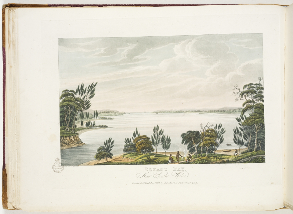
[media]The Aboriginal people of the Cooks River valley all belonged to the Eora or coastal Darug language group. [1] Within this language group were a number of clans, each identified with a part of the country. [2] The Gameygal or Kameygal clan lived on the north side of Botany Bay, probably between the mouth of the Cooks River and present day La Perouse.
To the north of the Cooks River, the country of the Gadigal or Cadigal clan extended along the shore of Port Jackson from South Head to Darling Harbour, while the Wangal clan inhabited the area between the Parramatta River and the Cooks River from Darling Harbour to Rose Hill.
The majority of scholars believe that the country to the south, between the Cooks River and the Georges River from Botany Bay to Rose Hill was associated with the Bediagal clan. At the centre of the territory was a camp near Salt Pan Creek. Pemulwuy and his son Tedbury were members of this clan. [3] One source, however, combines the clan names of Bediagal, Bidjigal and Bejigal into one group, and places their lands northwest of Parramatta near Castle Hill. [4]
Georges River old road
The Cooks River valley was crisscrossed with tracks which formed trade, social and ceremonial networks fundamental to the social and economic structure of Aboriginal society. These pathways linked sources of water and food from bays, rivers, creeks and waterholes. It is believed that clans travelled in response to the changing seasons, spending spring and summer near the coast and autumn and winter further inland. [5] Early British surveyors, Charles Grimes (1798) and James Meehan (1807), encountered and mapped an existing track from Parramatta River via Long Cove Creek to Georges River crossing the Cooks River at the Punch Bowl, the head of the tide. Other tracks branched off at this point, leading from the Cooks River to Botany Bay, Kogarah Bay and to Salt Pan Creek. [6] The farmers of the area always referred to the Georges River old road as the 'oldest road in the colony of New South Wales'. In its geography, it shows its Aboriginal origins.
Aboriginal campsites along the Cooks River
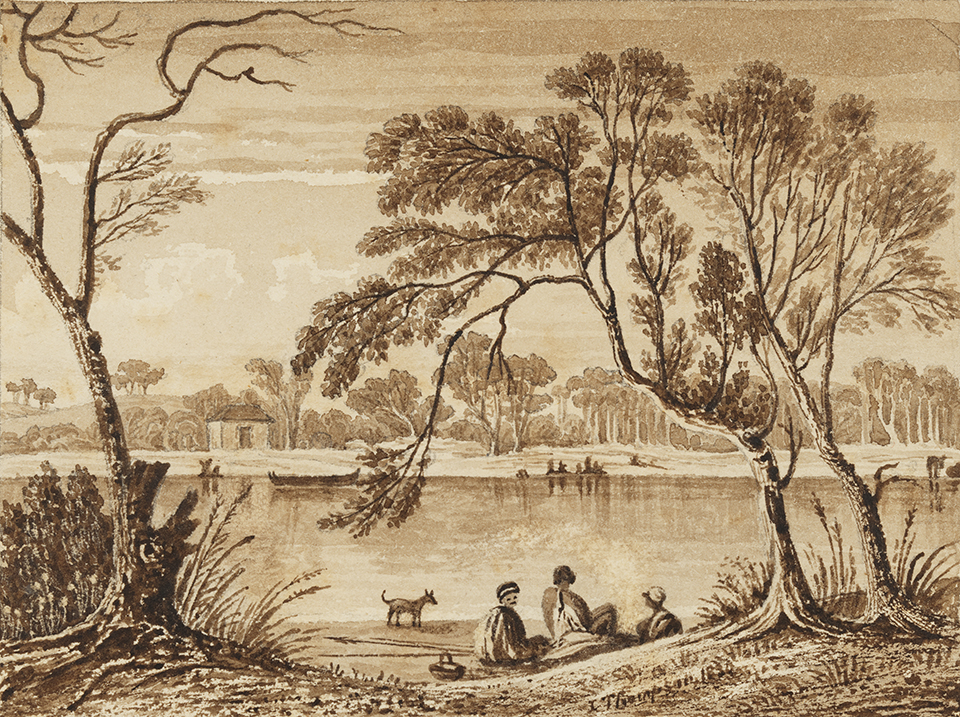
The clans spent some months of the year at regular campsites. In 1788, Watkin Tench noted in his diary: 'On the northwest arm of Botany Bay [the Cooks River] stands a village, which contains more than a dozen houses, and perhaps five times that number of people'. [7] An observer from the First Fleet described his first encounter with the inhabitants of the lower part of the river, probably between Botany Bay and Wolli Creek:
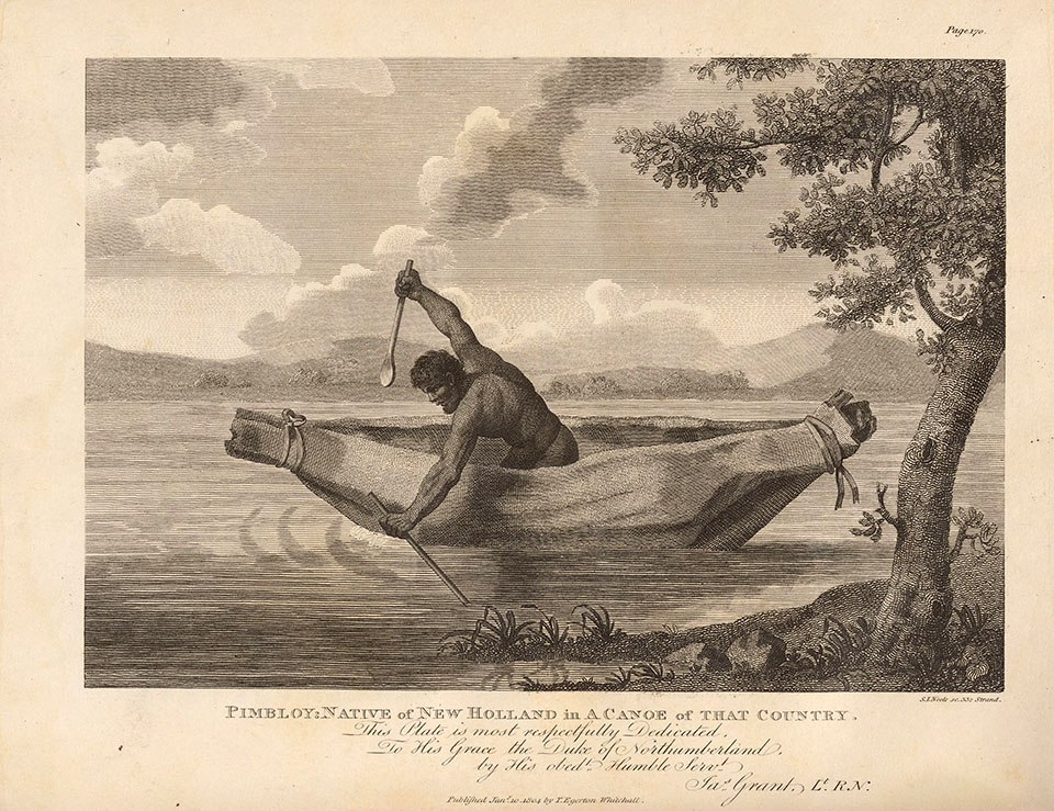
As they advanced up the first [river], numbers of natives seemed fishing in their canoes, while others were employed dressing the fish on its banks: they ran away on our peoples' approach, howling and making a strange noise, they were observed for the first time to have dogs, they are of the wolf kind, with long shaggy hair. When they found our people did not molest them, they ventured to come near us in their canoes, and when the boats were returning down the river, they ran after them along upon the beach and sometimes stopped abreast of the boats calling out as usual warraw! warraw! The country was here observed to be very low and marshy, but very fit for growing rice. [8]
Large shell middens at camp sites near the mouth of the river and in sandstone rock shelters on its north and south banks are evidence of occupation of the valley for at least between 1,000 and 4,000 years. [9] It is probable that lime-burning, quarrying and other land excavation activities since 1788 have disturbed many of the archaeological deposits, but a stone axe head was found on the site of Marrickville Golf Club, two stone artefacts were located with shell material in Kendrick Park and one rock art site remains. Within one of the sandstone caves at Undercliffe are 23 white hand stencils, two of them with forearms, and two foot stencils, a rarity in the Sydney region. There is also an extensive midden.
Hunting expeditions in Wangal country
[media]By 1790 the new colony was starving, as no store ships had arrived for two years. Governor Phillip authorised hunting expeditions to take game from the country of the Wangal, close to Sydney, known to the British as the 'kangaroo ground'. In December 1790, one party of hunters crossed at the 'treacherous' ford of the north arm of Botany Bay (Cooks River) in search of food, and built a hut of boughs for overnight shelter on the 'peninsula' (sand spit) at the river's mouth. One of the hunters, John McIntyre, the governor's gamekeeper, was feared and hated by Bennelong, a Wangal man, and his intimidation of the Eora people was well-known. Once over the river, McIntyre was stalked by five men of the Bediagal clan and was speared by Pemulwuy, a young man who had been 'lately among us...evident from his being newly shaved'. [10] The spear was barbed with small pieces of red stone, confirming that Pemulwuy belonged to one of the 'woods tribes'. A retaliatory expedition of 49 marines, sent by Governor Phillip, to 'bring in six of those natives who reside near the head of Botany Bay' crashed through the bush 'in various directions…without seeing a native'.
Resistance to land grants
In 1793 and 1794, Lieutenant Governor Grose, intending to form a chain of farms between Sydney and Parramatta, began granting the land of the Wangal clan. It is possible that the Rev Richard Johnson, who maintained good relationships with the Aboriginal people, chose his farm, Canterbury Vale, above the Cooks River as a result of their advice to follow the existing pathway to the Georges River. No land south of the river was granted until after 1804 and it was not until a large number of grants were given in 1808–9 that there was real conflict over the alienation of Bediagal land.
New farms bordered the pathways to the Georges River, Kogarah Bay and Salt Pan Creek, and when William Bond and Frederick Meredith tried to occupy their land between Coxs Creek and Salt Pan Creek, they had to battle a possession dispute with Aboriginal leader Tedbury and his companions. William Bond was 'first driven off by the Natives, with a providential escape for his life', [11] while Frederick Meredith 'narrowly missed being speared thro the Temple by the Natives'. [12] A few weeks later, the Sydney Gazette reported that 'numerous banditti' stole 43 sheep from Edward Powell's stockyard at Concord on the Parramatta Road and drove most of them to their camp on the northern side of the Cooks River in order to kill and roast them. [13]
Movement of Aboriginal people out of the Cooks River valley
Tedbury was killed [media]the following year and there were no more accounts of Aboriginal resistance in the Cooks River valley. By 1845, when Mahroot (known also as Boatswain) gave evidence to the New South Wales Legislative Council Select Committee on the Conditions of the Aborigines, beside himself, there were only three women from the 'Botany Bay tribe' still alive, and only 50 Aboriginal people in the area altogether. Netting fish in Botany Bay had depleted the stock, and their food supply was severely reduced by the demands of colonial settlement. It is likely that those who survived the epidemics of infectious diseases which ravaged the Eora population moved further west or into Sydney and thus lost their connection with the Cooks River valley.
Notes
[1] James Kohen, The Darug and Their Neighbours: The Traditional Aboriginal Owners of the Sydney Region, Darug Link in association with the Blacktown and District Historical Society, 1993; 'Aboriginal People of Coastal Sydney', Australian Museum website, http://australianmuseum.net.au/Aboriginal-People-of-Coastal-Sydney, viewed 7 November 2006
[2] 'Aboriginal People of Coastal Sydney', Australian Museum website, http://australianmuseum.net.au/Aboriginal-People-of-Coastal-Sydney, viewed 7 November 2006; Theresa Willsteed (ed), Keith Vincent Smith and Anthony Bourke (curators), Eora: Mapping Aboriginal Sydney, 1770–1850, State Library of NSW, Sydney, 2006
[3] 3 James Kohen, The Darug and Their Neighbours: The Traditional Aboriginal Owners of the Sydney Region, Darug Link in association with the Blacktown and District Historical Society, 1993; James Kohen 'Pemulwuy (c.1750–1802)', Australian Dictionary of Biography, National Centre of Biography, Australian National University, http://adb.anu.edu.au/biography/pemulwuy-13147/text23797; TN Popp and Bill Walker, 'Footprints on Rock: Aboriginal Art of the Sydney Region', Metropolitan Local Aboriginal Land Council, 1997, quoted in Indigenous Communities Social Plan, Hurstville City Council, 1999
[4] 'Aboriginal People of Coastal Sydney', Australian Museum website, http://australianmuseum.net.au/Aboriginal-People-of-Coastal-Sydney, viewed 7 November 2006; James Kohen claims that the Bediagal (Botany Bay/Salt Pan Creek) and the Bidjigal (Castle Hill) are two different clans in The Darug and Their Neighbours: The Traditional Aboriginal Owners of the Sydney Region, Darug Link in association with the Blacktown and District Historical Society, 1993; Keith Vincent Smith claims the clan name of the Botany Bay/Salt Pan Creek people is the Bidjigal but acknowledges Pemulwuy as one of this clan in Eora: Mapping Aboriginal Sydney, 1770–1850, State Library of NSW, Sydney, 2006
[5] Les Bursill, 'The Shire', Placenames Australia, June 2004, p 10; Val Donovan and Colleen Wall (eds), Making Connections: A Journey Along Central Australian Aboriginal Trading Routes, Arts Queensland, Brisbane, 2004
[6] All early maps show the same pattern of tracks, for example, Plan of Part of Cumberland Shewing the New Lines of Road, 1830, State Records Authority of New South Wales, AO 5035 and Plan of a Direct Line of Road from Sydney To Illawarra, 1831, State Records Authority of New South Wales, AO 5037, both use a base map with the early tracks noted by Grimes and Meehan marked on it
[7] Watkin Tench and L F Fitzhardinge, Sydney's First Four Years: Being a Reprint of, 'A Narrative of the Expedition to Botany Bay,' and, 'A Complete Account of the Settlement at Port Jackson', Angus and Robertson in association with the Royal Australian Historical Society, Sydney, 1961
[8] An Authentic and Interesting Narrative of the Late Expedition to Botany Bay: As Performed by Commodore Phillips...Containing a Circumstantial Account of Their Voyage…with…Descriptions of Jackson's Bay and Lord Howe's Island…/ Written by An Officer, W Clements and J Sadler, London, 1789, reprinted by Library of Australian History, Sydney, 1978
[9] Middens at Warren Park, Marrickville Golf Course, Undercliffe and Kendrick Park are listed on 'Cooks River Midden', Cadigal-Wangal: Aboriginal Marrickville website, http://cadigalwangal.org.au/MenuPages/places_midden.aspx?Id=72, viewed 7 November 2006
[10] Watkin Tench, A Complete Account of the Settlement at Port Jackson, in New South Wales: Including an Accurate Description of the Situation of the Colony; of the Natives; and of its Natural Productions/Taken on the Spot, by Captain Watkin Tench, G Nicol and J Sewell, London, 1793, reprinted by Angus and Robertson, Sydney, 1961
[11] William Bond, Memorial to the Colonial Secretary re Land, no 29A, 1810, State Records Authority of New South Wales, 4/1822
[12] Frederick Meredith, Memorial to the Colonial Secretary re Land, no 218, 1810, State Records Authority of New South Wales, 4/1822
[13] The Sydney Gazette, 15 October 1809
.


