The Dictionary of Sydney was archived in 2021.
Transport
Citation
Persistent URL for this entry
To cite this entry in text
To cite this entry in a Wikipedia footnote citation
To cite this entry as a Wikipedia External link
Transport
We got into Port Jackson early in the afternoon, and had the satisfaction of finding the finest harbour in the world, in which a thousand sail of the line may ride in the most perfect security…The different coves were examined with all possible expedition. I fixed on the one that had the best spring of water, and in which the ships can anchor so close to the shore that at a very small expence [sic] quays may be made at which the largest ships may unload.
This cove… I honoured with the name of Sydney. [1]
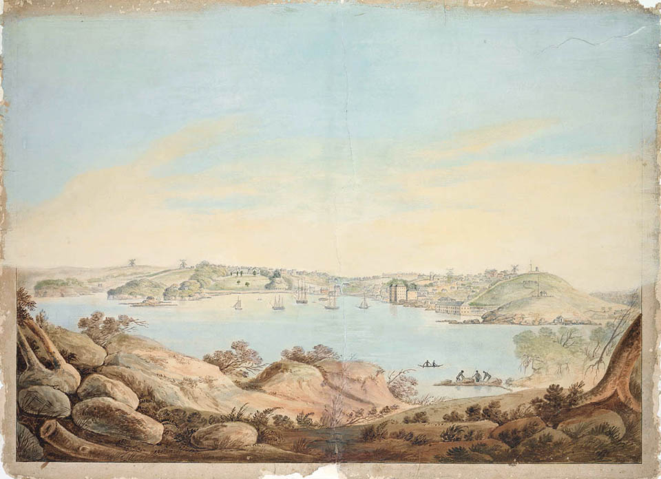
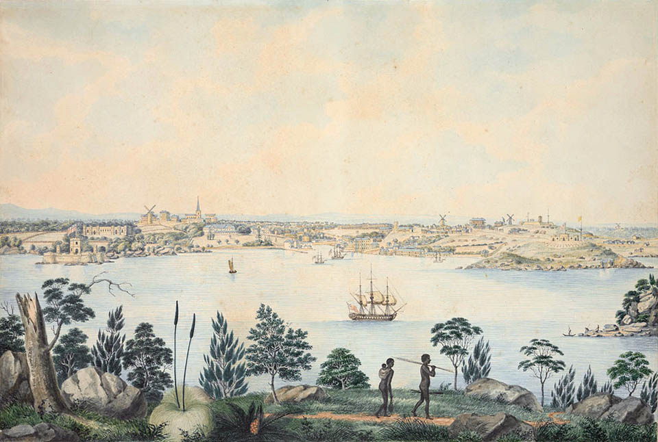
So wrote Governor Phillip, in his first despatch from the colony to the Home Secretary, Lord Sydney. But while the harbour certainly was and still is a thing of beauty to behold, it became an obstacle to be overcome in the development of a transport system to serve the settlement spreading out from that little cove on the southern shore of Port Jackson. [media]The harbour initially provided an easy means of access around the new settlement as it expanded up the Parramatta River and to the many inlets of Port Jackson, but its waters eventually became a barrier to the movement of goods and people back and forth.
The compromises that created Sydney's transport network had to take into account the restrictions of physical geography, the changing economic and social needs of the population, the limitations of technology, ideas about funding and ownership, and political feasibility or expediency.
Sydney's geography
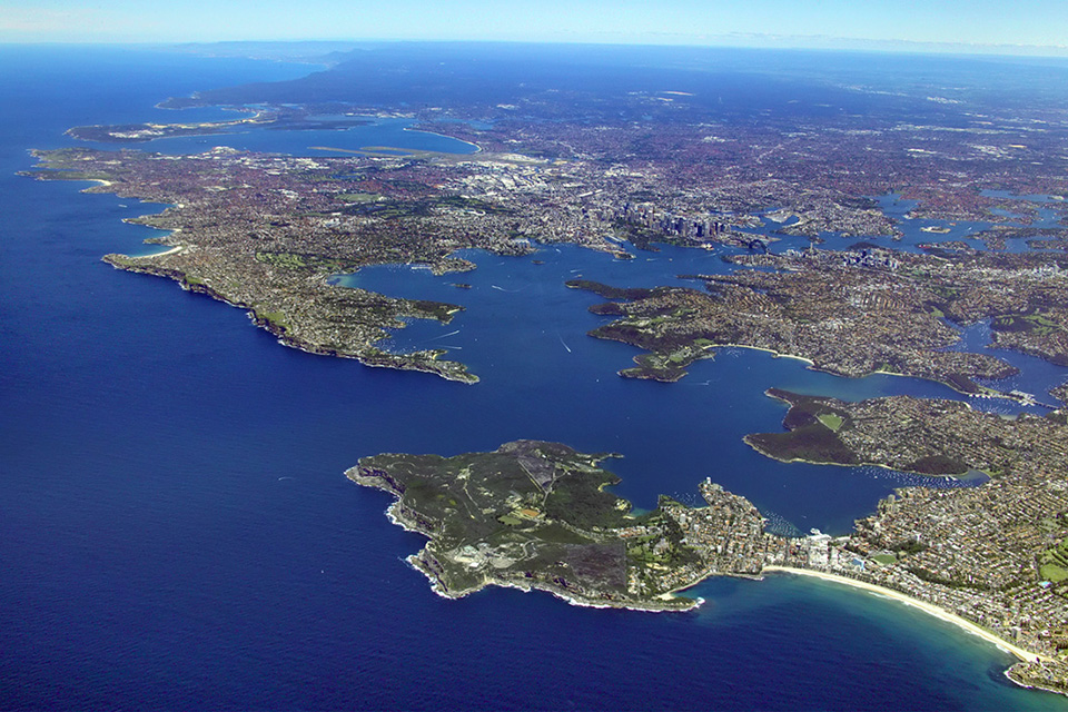
Sydney's physical geography – its topography, waterways, vegetation and areas of agricultural productivity – had to be negotiated as the settlement expanded. [media]Much of Sydney lies on the Cumberland Plain, a flat or gently undulating region through which two major rivers flow: the Parramatta, emptying into Port Jackson, and the Georges, emptying into Botany Bay. A number of smaller rivers and creeks flow west and north into the Nepean-Hawkesbury river system, which sweeps from the south near Bulli Point in a broad semicircle to Broken Bay in the north. In the centre was the original settlement at Sydney Cove.
The plain is surrounded by higher land. To the north is the Hornsby Plateau, a series of gorges and ridges rising in parts to almost 300 metres. To the south is the Woronora Plateau, a similar landscape of gorges and ridges rising as high as 440 metres. To the west lies the Blue Mountains, the Great Divide which for a quarter of a century prevented the first settlers from reaching the broad slopes beyond. Today the city of Sydney has spread from the plain into the higher ground beyond, in the north, south and west.
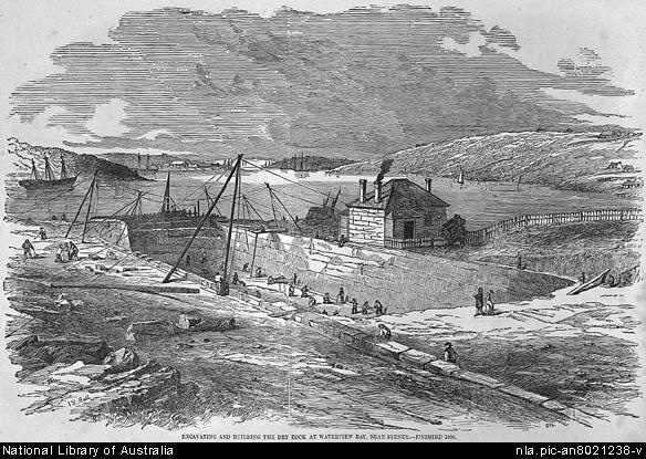
Port Jackson, Sydney's harbour, has rugged and hilly foreshores, particularly on the northern side. [media]The first white settlers chose the flatter areas to the south, at Sydney Cove and Farm Cove, as the site for their township. For many years the population of this minor convict outpost was small and concentrated, and there was little need for a passenger transport system. Since it was also a gaol, there was little encouragement for the population to spread out over a wide geographical area. Sydney was a walking city, as were most towns and small cities of the period. Its situation on the shores of Port Jackson, however, made water transport of some significance.
Human-powered transport
The transport of goods was an early problem. Little thought had been given to the logistics of establishing the colony's economy and infrastructure, and there was a shortage of draught animals for land haulage. In 1791, the local livestock – two stallions, six mares and two colts, and a small number of cattle – was far too precious to risk as beasts of burden. The obvious solution in a convict colony was human labour. Our earliest land transport system consisted of convicts dragging loads of stores and provisions, hauling stone, and loading and unloading ships. Since convicts were occasionally denied access to government stores, they hired themselves out as carriers or hauliers to earn money for food. One of the earliest kinds of paid labour to emerge in the colony was the transport of goods.
Water transport
Water transport remained of paramount importance. The harbour and its nearby river systems became an early scene of' activity, with private enterprise taking the initiative, often in the face of constraints imposed by government and scarce resources. Government control of transport is a recurring factor through to the present day. But competition between publicly and privately owned transport also began to emerge.
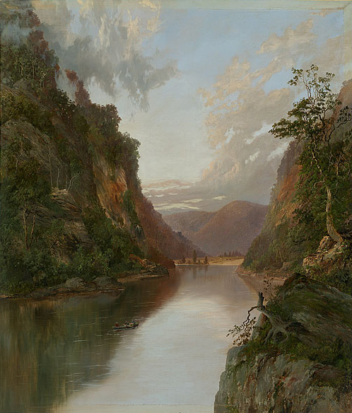
The land on the harbour shores was not particularly arable, and so attempts were made to grow food supplies further afield. Small pockets of settlement developed at Parramatta and Windsor, and further out along the reaches of the Nepean-Hawkesbury river system. [media]Water transport was the best way to move produce from these areas to the growing township of Sydney, using the harbour and the Parramatta, Hawkesbury, Lane Cove and Nepean rivers. Soon a flourishing trade was established. Even in those days Sydneysiders complained about the inadequacy of their transport system. The boat trip from Sydney to Parramatta often took up to 12 hours, instead of the scheduled four or five, and, in at least one recorded instance, took just under 14 hours.
The deepwater harbour of Port Jackson meant that Sydney soon became the major seaport of the south-west Pacific region. As the colony grew and population spread north, west and south, coastal shipping developed, supplying the city with food and raw materials for its various industries and enabling transshipment to the outside world. [media]The early shipping industry was a foundation for Sydney's future maritime activities, with important linkage effects to wharfage, chandlery, and associated industries.
Land transport
While water transport developed rapidly in the early days, land transport lagged, due to lack of mass demand and the undeveloped state of land transport technology. Industrialisation brought a switch from animate to inanimate sources of power, and from organic to inorganic (fossil) fuels, but the effect of this on land transport was slow. [media]Over most of recorded history, the heavy hauling work had been done by animals – horses, donkeys, mules, oxen, bullocks. Sydney's land transport did not really change until the coming of railways.
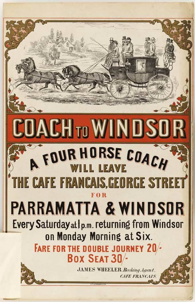
The barriers of terrain and distance had been progressively, if slowly, overcome, before the railway arrived. In 1814, a 'common stage cart' service was introduced between Sydney and Richmond, carrying both goods and passengers. [media]An English stagecoach was imported in 1819 and introduced to the Sydney-to-Parramatta run in 1821. This service also carried the Royal mail. The combination of English-style coaches and Sydney's road surfaces, however, proved disastrous, and it was not uncommon for these coaches to break down or come apart, with unfortunate consequences for the passengers. Locally built wagons and carriages were far more common than imported vehicles.
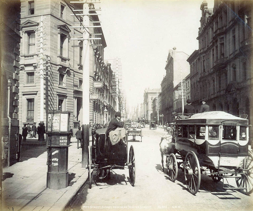
[media]Vehicles for hire seem to have appeared fairly early in the colony. As in England, some of the earliest 'for hire' vehicles were the cast-off carriages of the wealthy. They were commonly known as 'growlers' because of the noise made by their ungreased axles as they travelled over the city streets. As these growlers gradually fell apart from overuse, misuse or neglect, they were replaced by vehicles specifically designed for the hire trade.
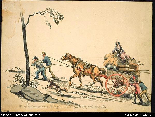
Road transport, despite the use of many second-hand vehicles, was not cheap, and it was very slow. In 1841 the mail cart took six days to make the round trip from Sydney to Bathurst and back. The fare each way was £4/10/- per passenger, at a time when a skilled labourer's wage was around five shillings a week. Even by 1857, road transport was still slow and expensive. Heavy goods took, on average, 23 days to get from Sydney to Bathurst, and cost £15/10/- per ton. [media]Bad roads meant that horses were not the best draught animals. Bullocks were far better for haulage, particularly outside the city, but the cost of drays was high – anything from £12 to £30 during the 1840s.
On the eve of the gold rushes, in 1850, Sydney's transport was still very basic. The gold rushes created huge influx of population, starting the transformation of Sydney from a walking city to a public transport city. Metropolitan Sydney's population rose from almost 54,000 in 1851 to 96,000 in 1861, and to 383,000 by 1891. Its proportion of total New South Wales's population also rose, from 28 per cent in 1851 to 34 per cent in 1891. It is not surprising that such growth in urban population was accompanied by transport innovations.
The arrival of rail
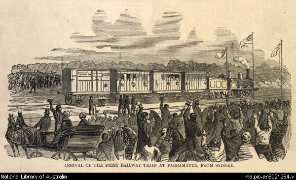
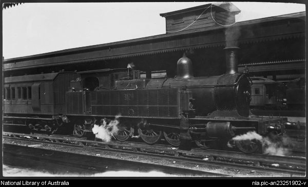
The first innovation was the railway. Plans were advanced in 1848 to link Sydney (particularly its port facilities) with Parramatta in the west, and with Liverpool, and ultimately Goulburn, in the south. This private project collapsed and the government took over, establishing in Australia a tradition of government ownership and control of the railways. [media]Though railways were aimed initially at moving goods from the productive hinterland to the port, they affected the geographical pattern of Sydney's development, particularly its suburban spread, and served as an instrument for redistributing the city's population.
At first, ribbons of suburbs grew along the railway, speeded up by the wholesale opening of large estates along the lines. Population movements and rail expansion correlate closely in this period. [media]The first Sydney-to-Parramatta line was opened in 1855, followed by extensions from Granville to Liverpool in 1856 and to Campbelltown in 1858; extensions from Parramatta to Blacktown in 1860, to Rooty Hill in 1861 and to Penrith in 1862; and from Blacktown to Richmond in 1864. Sydney's suburbs grew around this rail skeleton.
Horse-drawn transport
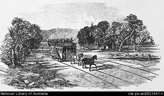
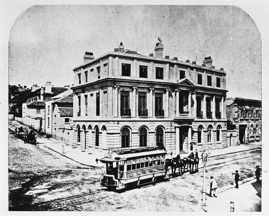
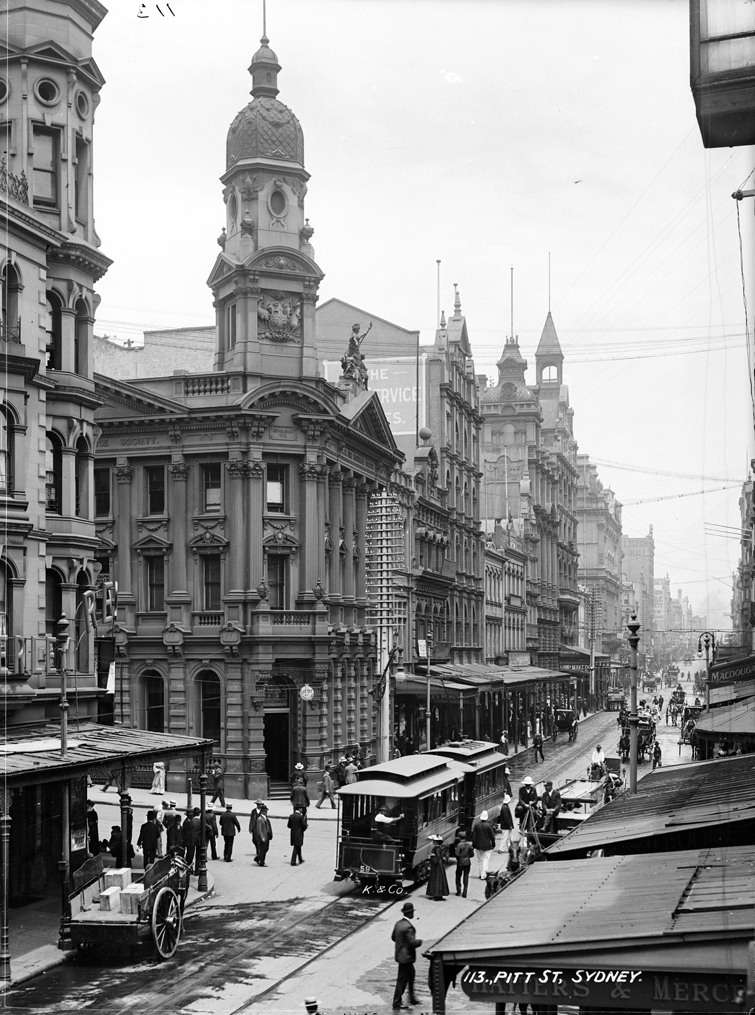
[media]Sydney's first successful attempt at an urban transport system was undertaken at the same time, with the opening of the Pitt Street horse-car tramway in December 1861. It ran from Circular Quay along Pitt Street to the old Redfern railway station (where the Devonshire Street tunnel now stands), passing through the main business district of Sydney. The line consisted of a single track, one mile 63 chains (2.87 kilometres) long, and, as so often with Sydney's transport, a grave mistake was made. The line was also intended to move goods traffic in railway trucks, but the rails imported from England were unsuitable. The solution was to reverse the rails and leave part of them protruding above the road surface, so that the longer flanges on the rail car wheels could travel easily over them. Naturally these protruding tracks created problems for any wheeled vehicles moving along Pitt Street and eventually, after continuous complaints, a parliamentary committee recommended the closure of the line, which took place on 31 December 1866.
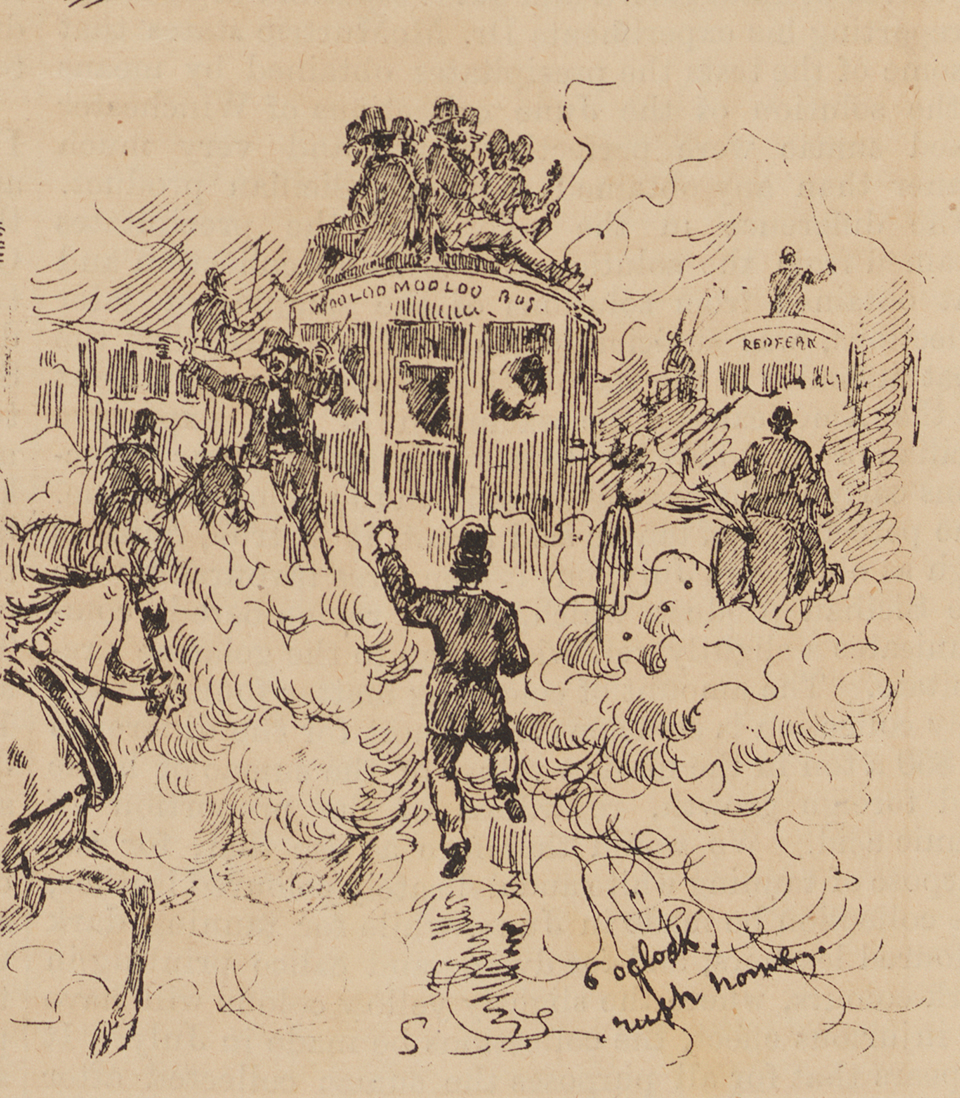
[media]The horse-car tramway service was immediately replaced by a privately owned horse-drawn omnibus service, which remained Sydney's major form of urban transport until the early 1890s.This system reached its peak in 1889, providing Sydney with an extensive, if somewhat slow, land transport network. No figures are available on passenger numbers.
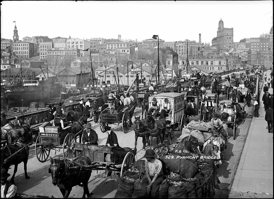
[media]Horses also continued to provide the main motive power for transport of goods within the city. Wagons and carts were the major carriers of books, food, clothing, newspapers, building materials, haberdashery, furniture and other items. This period also saw a great increase in both the numbers of private passenger vehicles and of cabs. New American technology in coach-building led to rapid growth in production of hansom cabs, buckboard buggies, landaus, broughams, phaetons and Victorias. The middle class of Sydney invested heavily in their own vehicles, and driving in Sydney streets could be as hazardous then as it is today.
Sydney's ferries
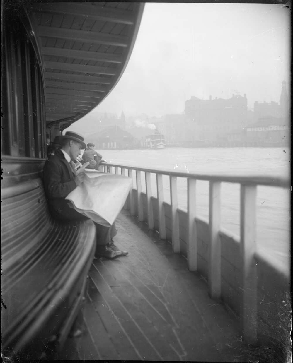
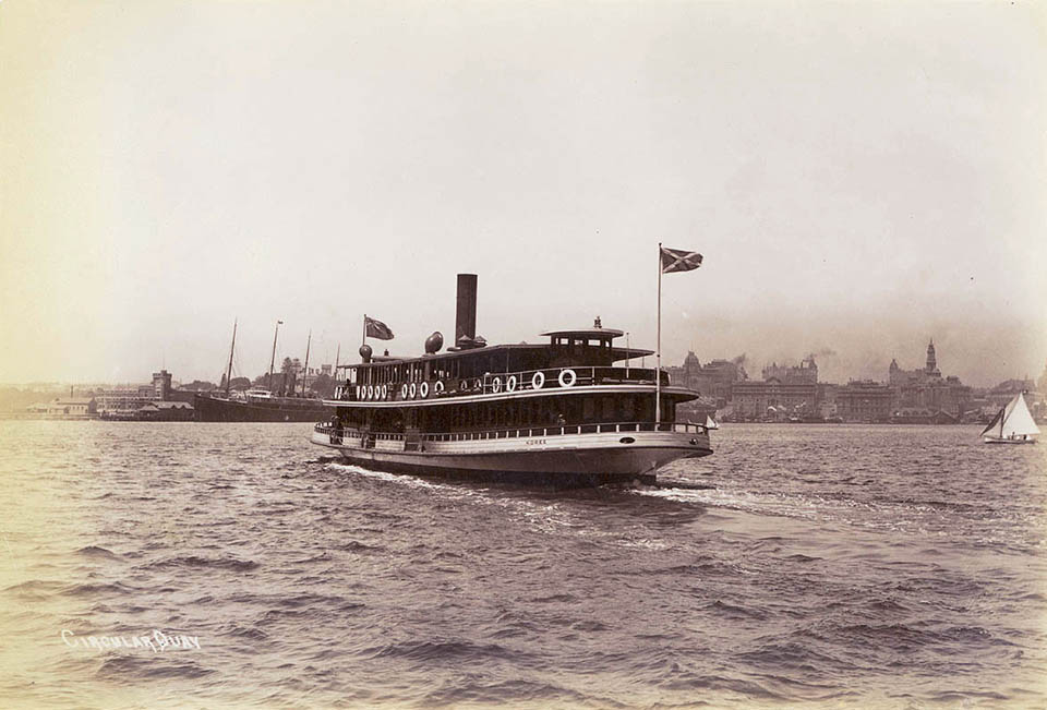
Until the [media]late 1880s, Sydney's population remained well served by water transport. There was a large network of ferry services covering inner suburbs, such as Balmain, Glebe and North Sydney, and the more distant outer areas, such as Manly and Watsons Bay.
[media]The Manly ferry, probably Sydney's most famous ferry service, experienced a continuous rise in patronage from the early days of the suburb's development until the opening of the Harbour Bridge in 1932 when competition from government bus services led to a decline. Initially private enterprise took the lead, and by the later decades of the nineteenth century the ferry system was run by large-scale private companies, operating services to all corners of the harbour. It was a well-patronised service before the advent of the trams. By 1896 it is estimated that ferry services provided some 25 million passenger journeys and trams provided almost 65 million passenger journeys each year.
Sydney's trams
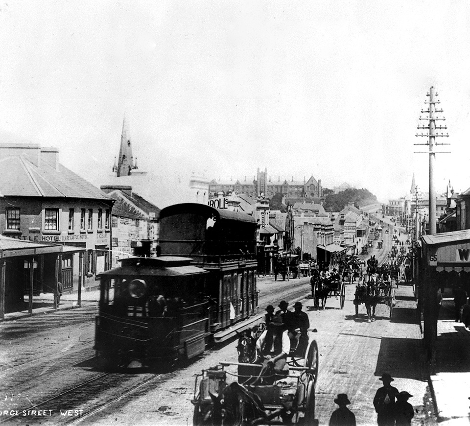
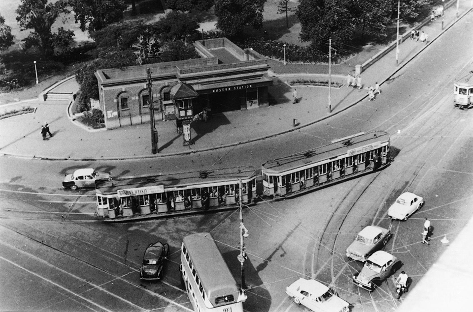
The trams were seen as the great answer to the problem of moving passengers cheaply and rapidly within the city. Here we see another of the important themes in Sydney's transport history – the impact of new technologies. In the quarter century before World War I, tramway systems mushroomed in virtually every major city in the world. [media]Although the first trams were powered by horse, steam or cable, massive growth followed the introduction of electrification, which provided a constant and relatively cheap and clean source of power. Sydney's first mass public transport network was established at this time.
Tramways played a critical role in opening up Sydney's suburbs. Sydney's population was expanding and filling in the areas between the ribbon developments that had taken place along the existing rail network
[media]Despite these developments, at the turn of the nineteenth century Sydney remained essentially a 'walking city'. The following table indicates how Sydneysiders got to work in 1901.
The journey to work in Sydney – 1901
| Main mode of travel | % of journeys | Average distance in km | Average speed in km/h | Average duration in minutes |
| Train | 11 | 9 | 13 | 42 |
| Ferry | 5 | 5 | 8 | 38 |
| Tram/bus | 19 | 4 | 7 | 35 |
| Carriage/cycle | 9 | 5 | 10 | 30 |
| Walk | 56 | 1 | 3 | 25 |
| Total | 100 |
Source: Ian Manning, 'The journey to work in Sydney', in G. Wotherspoon (ed), Sydney's Transport: Studies in Urban History, Hale & Iremonger, Sydney, 1983, p 191
Over the following decade, more than half the population switched to the developing public transport network – trains, trams, omnibuses and ferries. By the start of World War I, Sydney had been transformed from a 'walking city' into a public transport city.
Electrification
[media]The transport network kept up with the expansion of Sydney's population and area mainly through the modernisation, via electrification, of the tram network. It was not an easy transition. Apart from the cost of track-laying and new rolling stock, and the time required to train staff, the major problem was power supply for the expanding network. In 1909 additional power-supply facilities were constructed, permitting the use of more and bigger cars and the laying of new lines. Although new lines continued to be laid for the next 20 years, those built after World War I were relatively minor extensions and branches of existing lines. Sydney's tramway network reached its greatest extent in 1922.
Technological developments were uneven, however. Horses still dominated goods transport in and around the city, though the trams were electrified. Electrification was also planned for the railways.
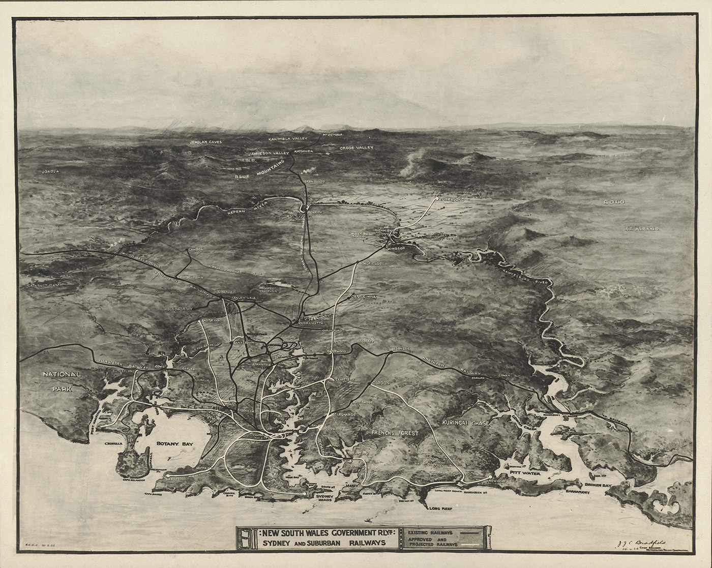
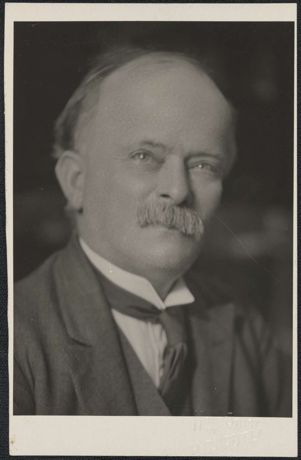
[media]The main proponent of electrifying the city and suburban railway was Dr JJC Bradfield, an important name in the history of Sydney's transport. From before World War I, Bradfield submitted various plans for improving Sydney's railway network. He identified some of Sydney's major transport problems: the need to extend the railway into the city; the need to connect Sydney with North Sydney by either bridging or tunnelling under the harbour, and the 'need' for an eastern suburbs railway. These issues were to be taken up time and again.
Modernisation and extension
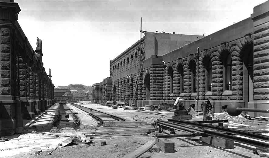
There had often been talk of extending the railway network further into the city beyond its old terminus at Redfern. The first plans appear to be those of railway engineer-in-chief John Whitton in 1857. Goods and passenger traffic was greatly inconvenienced by the railway terminating at the southern end of the city, some two miles (3.2 kilometres) distant from Circular Quay. Goods going to overseas markets had to be unloaded at the rail terminus and loaded onto some other form of transport, repeating the whole process at the wharves. A branch line for goods had been built in 1855, connecting the main rail network with Darling Harbour, but Darling Harbour was subject to silting and was also away from the main business district, so it was of little use for goods bound for the city. The growing commuter traffic had similar [media]problems. Even after the opening of the new terminus at Central Station in 1906, workers still had to switch to another form of transport – horse-drawn buses or cabs, or electric trams – to get to work in the business district.
An unusual combination of interests – Sydney merchants, city real estate developers and blue-collar residents of the expanding western suburbs – united to press for an extension of the rail network into the city and down to the Quay. This agitation had arisen as far back as 1868 and had grown steadily during the 1870s and 1880s, as population continued to expand in the west and exports of rural products continued to grow. [media]For many years the issue was successfully stalled by a similarly strange alliance of interests – the expanding population of the eastern suburbs who wanted a railway into their area, and country interests (operating as a pressure group through their members of parliament) who were against any city railway extensions. Colonial government railway funds went towards expansion of country lines rather than the much-called-for city railway extensions. And there were further complications: over the years there had been commercial wharf development of other bays on the south side of the harbour (Walsh Bay, for example) and the Quay was no longer seen to be the obvious destination of any further goods lines.
Building bridges
Plans for bridge-building in and around the city were also given low priority. In the nineteenth century, various isolated residential developments occurred along the shores of the harbour – for example on Glebe Island, Hunters Hill, and around North Sydney.[media] Industrial developments were built around the harbour, at Mort's Dock in Balmain, and on Glebe Island. All these developments created a need for bridges.
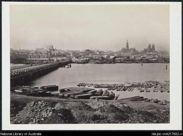
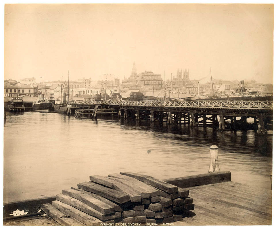
Various plans for bridging the harbour had been suggested, beginning in Governor Macquarie's time. Francis Greenway had drawn up a plan as early as 1815, but little action had been taken. [media]In 1857, a private company, the Pyrmont Bridge Company, bridged Darling Harbour and Blackwattle Bay, and charged a very unpopular toll. The necessity for access to the newly opened Glebe Island abattoirs led the colonial government to construct a bridge from Pyrmont to Glebe Island in 1862. Further population growth in the west, and the need to bring market produce from the Ryde area to the population of the south side, led to demands for additional bridges over the Parramatta and Lane Cove rivers. [media]The construction of the Iron Cove, Fig Tree and Lane Cove bridges was authorised in the late 1870s.
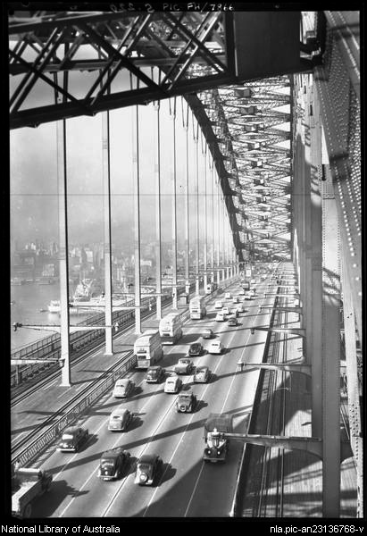
Serious demands for a bridge across the harbour also arose in the late 1870s, and by the first decade of the twentieth century there was a welter of conflicting plans. In 1911 three schemes were under consideration: the plans of the Sydney Harbour Bridge Advisory Board; the plans of the Royal Commission on Communication between Sydney and North Sydney, and the plans of the Royal Commission into the Improvement of Sydney and its Suburbs. [media]Further confusion was added when a public works committee reported unfavourably on safety aspects of both the proposed under-harbour tunnels and the pier-supported bridge. Instead, it recommended a 'steel cantilever bridge' as proposed by JJC Bradfield, then an engineer with the New South Wales Public Works Department.
Modern railways and the Harbour Bridge
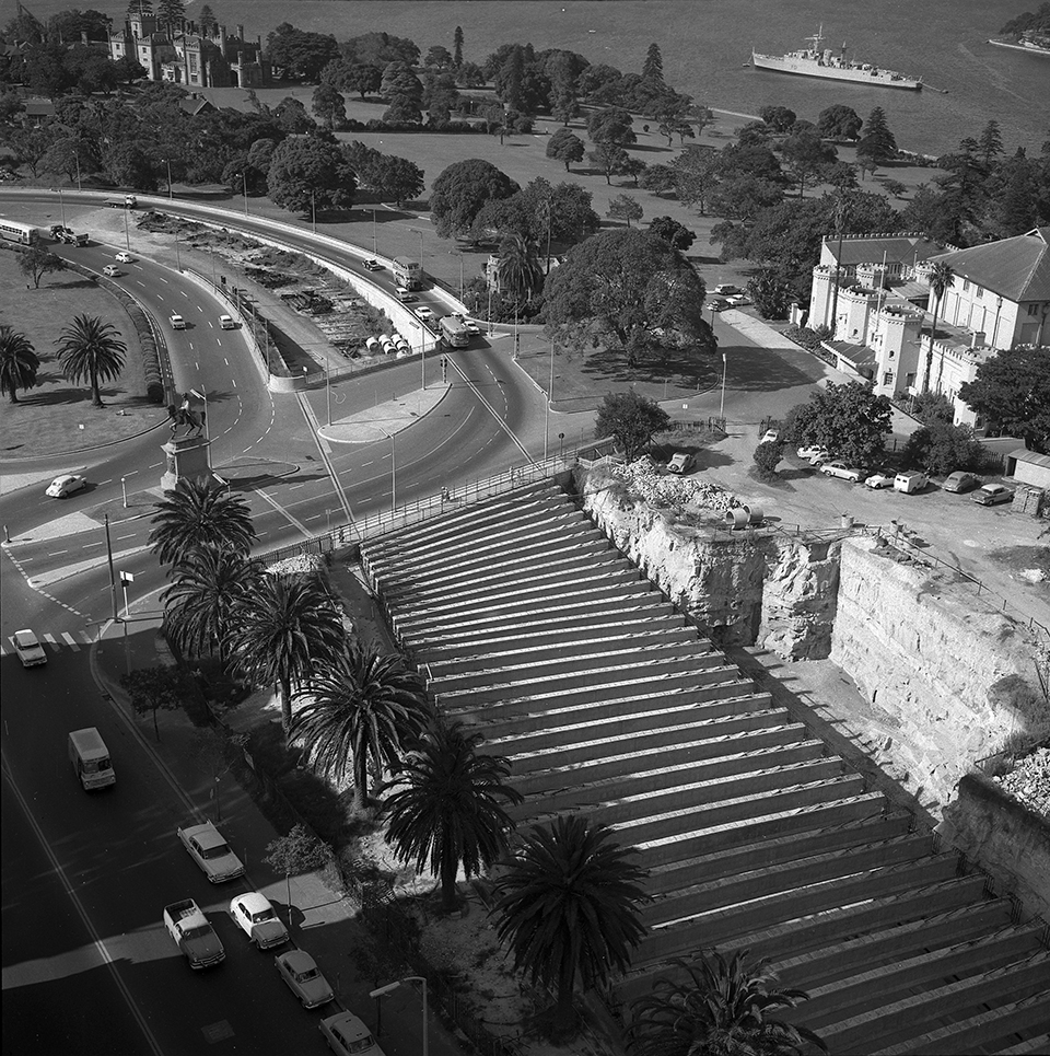
The government, however, chose to take no action. In a time-honoured tradition, it called in an outside expert to give his views. [media]David Hay, a London transport expert, proposed a two-track rail loop around the city, above ground from Central to Goulburn Street, then underground to George Street and the Town Hall, and to Wynyard Park. Here the line would divide into two, one branch to go on to North Sydney (by bridge or tunnel), the other to continue underground to Circular Quay, back through the Botanic Gardens and Pitt Street to Central. And still the plans arrived. In 1915 JJC Bradfield, now engineer in charge of a newly created section of the Public Works Department, submitted a report which recommended an underground city railway with possible extensions to the northern and eastern suburbs, a harbour bridge, and electrification of all city and suburban rail lines. [media]Bradfield's plan was accepted, and in 1917 work was begun on the city railway section of the plan.
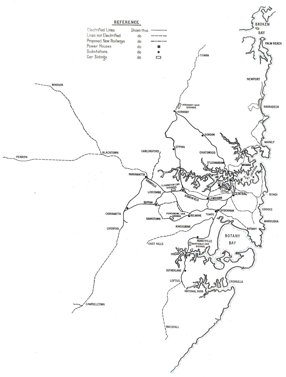
The electrification of the city and suburban rail network also got underway. Given the state's reserves of coal, it seemed eminently sensible. Electricity seemed then a clean form of energy, far cleaner than either coal-burning steam trains or diesel-fuelled motor trains. It allowed faster trips (because of more rapid acceleration), and it was also claimed to aid rapid braking, thus improving safety. [media]The electrification of the Illawarra line was completed in March 1926, and that of the Canterbury lines six months later. Further electrification was completed in subsequent years: the North Shore line in 1928, and the Sydney to Parramatta, Granville to Liverpool, Lidcombe to Cabramatta, and Strathfield to Hornsby sections in the following year.
The underground city loop and Eastern Suburbs line
The construction of the city underground and its network of stations had a major impact on retailing in the city. Before 1920, Central Station had fostered a thriving commercial and retailing area at the southern end of the city. The construction of the city loop stations from the late 1920s was detrimental to many businesses in this area – some stores were forced to close, and others entered a period of decline. On the other hand, stores like David Jones, at St James Station, enjoyed increasing business. Meanwhile the city rail loop remained uncompleted, and there was continued agitation throughout the 1930s to complete it, construct Circular Quay Station, and extend the rail network to the eastern suburbs. These projects, however, had to wait until after World War II.
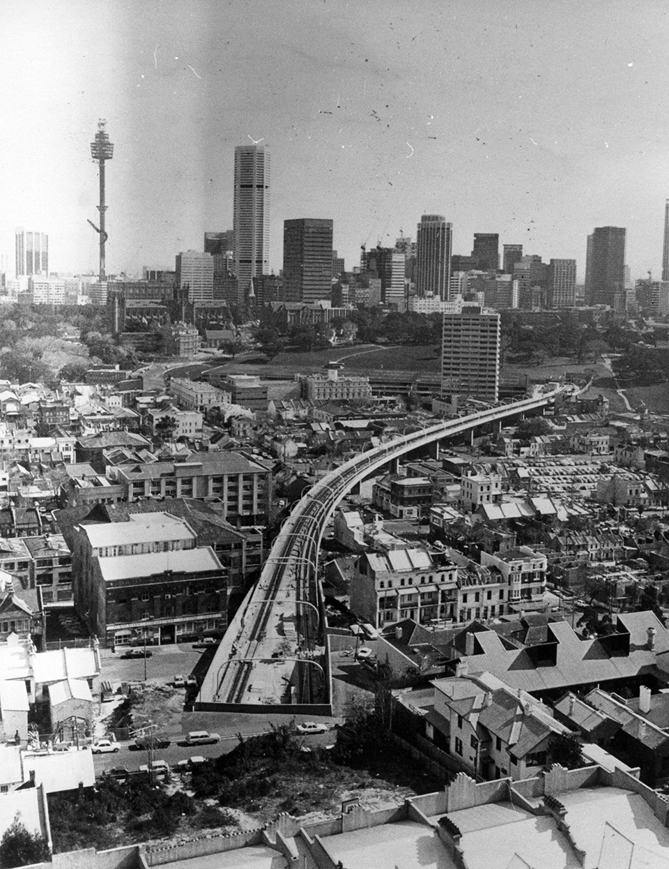
The proposed eastern suburbs railway, either connected somehow with a city railway or branching direct from Central, also had a long history of plans and proposals predating any action. The first plans to receive parliamentary approval were lost in a financial appropriations vote in 1879, but new schemes appeared continually. [media]Despite pressure from local residents and real-estate developers, the eastern suburbs railway was a low priority, particularly after the expansion of the tramway network into the area. But the 'country interest', a group of politicians representing rural landholders and their commercial allies, forced the rejection of bills allocating funds for city and suburban railways until well into the twentieth century: this helps explain why the eastern suburbs railway project took so long to come to fruition, and remained such an ongoing political issue, until it was finally opened, in June 1979.
The arrival of the motor vehicle
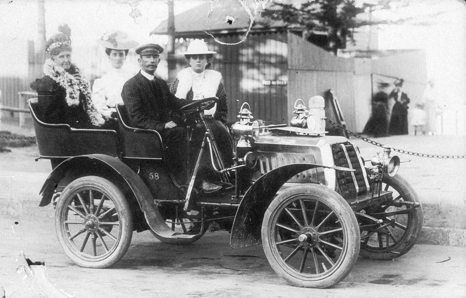
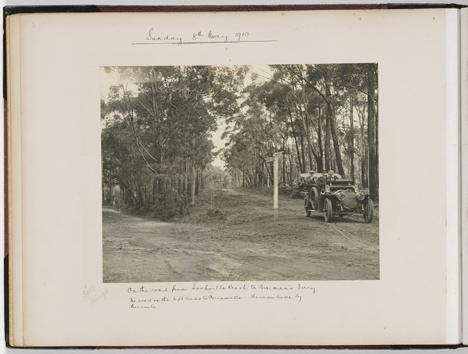
In the interwar period, a dramatic change stemmed from a new technology – the petrol-driven internal combustion engine. With the development in the late nineteenth century of motorised vehicles powered by the new engine, a new phase of land transport began – one that was to have repercussions not only on goods and passenger transport but also on the economic structure of society. [media]Motor transport became important in the 1920s, and has been the dominant factor in creating the transport system as it exists in Sydney.
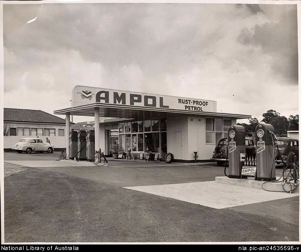
In the late nineteenth century, when a motorised horseless buggy at last seemed a possibility, alternative forms of motive power might have been developed – for example, steam or electricity. In the event, partly because oil was cheap and readily available in the United States, industrial societies opted for the petrol-driven motor, which brought with it unforeseen results. These include the dependence of many societies on oil; the growth of the massive petrochemical industry; and the growth in the economic system of an enormous infrastructure for the motor car. [media]Apart from the car manufacturers, there are petrol companies, car parts producers, tyre manufacturers, government instrumentalities (such as the RTA and Sydney Buses), and powerful lobbies such as the NRMA. None of this was foreshadowed when the motor vehicle first appeared in Sydney.
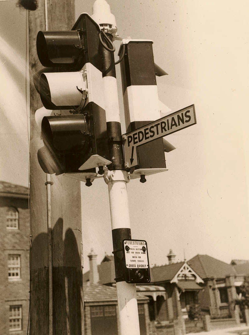
The average Sydneysider took enthusiastically to the new form of transport, despite the Cassandra-like prophesies of doom and damage to the social fabric proclaimed by society's moralisers. The authorities came to terms with it far more reluctantly. [media]Gradually, laws and regulations were altered, traffic controls implemented and new supervisory bodies created.
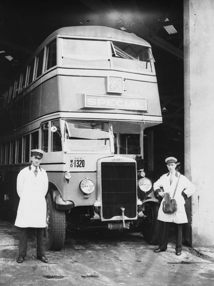
For public passenger transport, motor buses were soon seen as a far more flexible form of transport than fixed-track trams, and made a significant impact. By 1929, 612 private buses were carrying 90 million passengers annually. Sydney's trams, once part of one of the largest and most efficient tram networks in the world, were gradually superseded by the revitalised railway network, and then replaced completely by buses.
The motor vehicle had an impact in other forms of transport as well. [media]Goods delivery in the city rapidly switched over to the new technology, as the following figures indicate:
Commercial vans in Sydney
| Year | Horse Drawn | Motorised |
| 1911 | 1303 | 3 |
| 1921 | 1623 | 376 |
| 1927 | 379 | 2016 |
Source: NSW Year Book, 1927/28, p 116
Motor vans had advantages over horse-drawn vehicles, particularly in speed and certainty of delivery of goods, and businesses moved to them quickly. But there were costs. Better quality roads were required for the new vehicles. With the establishment of the Department of Main Roads in 1925, an intensive and expensive programme of road upgrading was undertaken. Traffic congestion in the city increased immediately, and traffic control and road safety were two additional areas where the new vehicles were seen as less than beneficial.
Public transport in decline
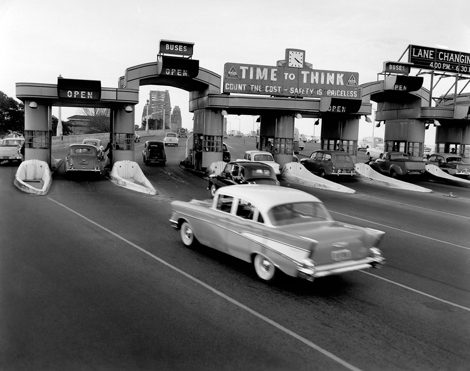
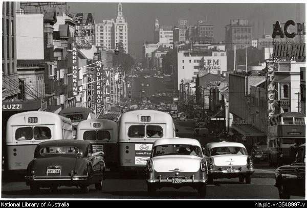
[media]In the immediate postwar years Sydney's transport system experienced a series of rapid, dramatic and far-reaching changes, with most impact on public passenger transport, especially ferries and trams. The tramway system was in its last years and forces were already in operation that would lead to its closure in just over a decade. Ferry travel (which had revived somewhat during the war years, from 28 million passengers in 1939 to 37 million in 1945) entered a period of decline which saw its patronage fall to a low of 11 million in 1963 (although it has since risen slightly). Part of the cause was the growing acceptance of the motor car. [media]The future was seen as belonging to the motor vehicle: motor buses would soon be the major form of public transport serving the city and suburbs. At the same time, private motor cars were owned by more and more people.
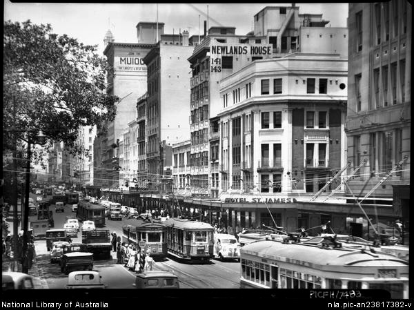
The [media]motor car, more than any other single factor, has determined the pattern of Sydney's urban development since World War II. The introduction of the motor lorry in the 1920s had changed the location of industry, which had once needed to be near the railway or waterways. Buses too, with their greater flexibility, had further hastened the process of suburbanisation. Decentralisation of industry in the postwar years led to a shift in the location of employment, and further population expansion in the development of Sydney's 'fringe suburbs', posed problems for Sydney's CBD-centred transport system.
In the [media]early 1960s trips undertaken daily by private motor cars surpassed trips taken on public transport. In 1946-7, only 13 per cent of all trips in Sydney were by private car; by 1960 the figure had risen to 50 per cent, and by 1971 the proportion exceeded 70 per cent. This rapid increase was disastrous for the public transport system as commuters deserted in droves for the advantages of their own personal transport. This trend was facilitated by the expansion of hire-purchase facilities – while 'mass production cheapened the relative price of cars and brought them in range of rising working-class incomes, the growth of hire purchase solemnized the marriage'. [2]
City of cars
[media]A car became a necessity for those wishing to live in one suburb and work in another not easily accessible by public transport. Widespread car ownership furthered the spread of suburbia, as people were freed from the limitations of the public transport system. Patterns of residence, leisure and employment were all affected. [media]The car has now become the major mode for travelling to and from work in Sydney. The use of buses and the massive growth in the road-freight haulage industry also form part of the motor vehicle's impact on the pattern of Sydney's transport.
In the twenty-first century, where do Sydneysiders stand (as they usually have to, if they travel on overcrowded buses or trains in peak hours) in relation to their transport? The following table indicates the changes that have occurred in the journey to work for Sydneysiders over the past century:
The journey to work in Sydney – 2001
| Main mode of travel | % of total journeys | Average distance in km | Average speed in km/h | Average duration in minutes |
| Car | 58.7 | 10 | 32 | 19 |
| Train | 13.5 | 18 | 37 | 29 |
| Ferry | 0.3 | |||
| Bus | 8.2 | 7 | 19 | 22 |
| Walk/cycle | 4.4 | 2 | 4 | 11 |
| Other (working from home, etc) | 14.8 | not known | not known | not known |
| TOTAL | 100.0 |
Source: Prepared for the Dictionary of Sydney, by Phil Raskall, Research Manager, City of Sydney Council, 2007
But there are positives. An orbital road system now circles the city, removing the necessity for road traffic to travel through the city to get across it. But at peak hours, roads within the CBD are gridlocked. As New South Wales's one-time Sustainability Commissioner, Peter Newman, noted, $10 billion has been spent over the past decade on tollways and tunnels. [media]A road lane can carry only about 2,500 people per hour, light rail can carry between 7,000 and 10,000 per hour, and trains can carry 50,000 people per hour – 20 times the capacity of a roadway. There is an urgent need for something like a light rail system, connecting the CBD and the inner suburbs, to relieve pressure on the roads. Newman went on to note that, since some 200,000 people come into the city by train every day, Sydney now needs a decade of rail building, to make a liveable and sustainable city. [3]
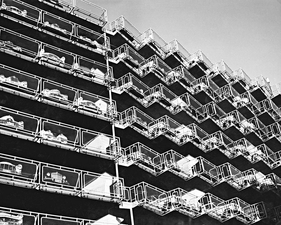
[media]A TV news program in 2005 highlighted that 'almost a third of Sydney's landscape is [now] dedicated to roads and car-parks - and more are being built.' There are 2.1 million cars on the road in Sydney in 2007, a growth of just under 10 per cent in five years. And as all transport experts agree, putting in more roads and freeways only adds to congestion and pollution. In 2007, on any day at peak hour, there are 350,000 cars on the roads of greater Sydney.
Currently, as in the early 1970s, rapidly escalating oil prices have highlighted the problems of a city basing its transport network heavily on the motor vehicle, whether car, bus or lorry. This situation has been exacerbated since 1990 by the propensity of the New South Wales state government to step away from its traditional role of building and managing public transport. Instead, it has refused to invest in public transport on the same scale as road spending, transferring its responsibilities in this area to so-called 'Public-Private Partnerships', by which private consortiums have built and operated toll roads around the city. This has proved to be highly unpopular with commuters and voters, as well as costly to the taxpayers, as transport bureaucrats have been outmanoeuvred by wily investment bankers. Extraneous influences, such as the desire to woo certain electors, the need to appear able to manage the state's infrastructure effectively, or the emergence of new ideas about financing public services in general, have usually impeded rational decision-making.
The future of Sydney's transport
Past experience does not foster optimism about Sydney's transport future. While many cities have decided that the advantages of the so-called 'motorised democracy' are illusory for the great mass of the population, Sydney is once again at a crossroads where the city's direction must be reassessed.
A society's transport requirements change constantly, due to population movements, changes in work and leisure patterns, alterations in demand for goods and services, and so on. No transport system is perfect and Sydney's transport network is no exception. New technologies provide innovative solutions to problems, but may have long-term economic and social implications that are unclear when the initial choices are made. Finally, governments are intimately involved in transport decision-making, but they are subject to changing ideologies and fiscal fashions.
What of the future? New concerns about global warming, carbon dioxide emissions, respiratory diseases and our dependence on imported oil, supplies of which may have peaked, will all have effects on transport policy and provision in the decades to come.
References
Garry Wotherspoon, (ed), Sydney's Transport: Studies in Urban History, Hale and Iremonger, Sydney, 1983
Garry Wotherspoon, 'The CARR that ate Sydney', available at http://www.onlineopinion.com.au/view.asp?article=35, accessed 31 January 2008
Notes
.


