The Dictionary of Sydney was archived in 2021.
Urban growth in the Cooks River valley
Citation
Persistent URL for this entry
To cite this entry in text
To cite this entry in a Wikipedia footnote citation
To cite this entry as a Wikipedia External link
From hunting grounds to sprawling suburbs
Having a home and hearth is a fundamental human need and the Aboriginal people of the Cooks River had used the valley for centuries. The new arrivals also had this need and over time the valley became home to a growing number of Sydney’s population. This pattern of development tells us much about the process of urban growth: from a small nucleus around a significant site to the ongoing infill of suburban density that has become a feature of Sydney’s inner city.
St Peter's Church
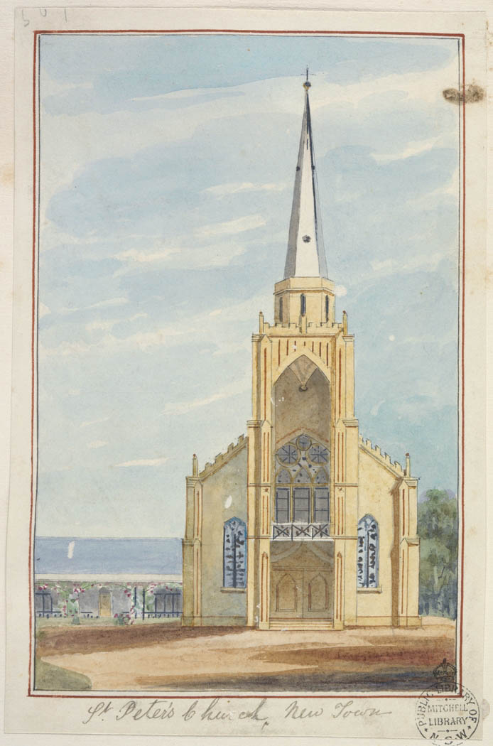
[media]One of the earliest townships in the Cooks River valley developed around St Peter's Church of England on the Cooks River Road (now Prince's Highway). The gentry of the district formed a committee of the richest residents in 1836, as it was hoped that these people would make donations to finance the building of a church. Robert Campbell donated the ground for the new church and successfully subdivided and sold the surrounding allotments as well. The area became known as St Peters, after the new church.
When the foundation stone of St Peter's Church was laid, the ceremony was celebrated with 'refreshments provided in an adjoining field...a long table ornamented with delicacies, flowers and fruits'. A B Spark recorded that, after the 'distinguished guests' had withdrawn, 'the table was a second time furnished with guests, and finally the workmen had their turn'. [1] There were 85 carriages counted at the consecration of the church, on 20 November 1839. It is thought Thomas Bird designed the church, which originally had a central spire. The Register of the National Estate description is:
Built in 1838–9 from stuccoed brick, the church has aisle arcading and plaster vaulting in the nave. At the eastern end is a tower originally capped by a needle spire (removed 1963). Alterations were carried out in 1875 by Edmund Blacket. The graveyard contains a number of fine Neo-Classical monuments. A virtually intact Gothic Revival church which is a fine example of Bird's work.
St Anne's parish church and village
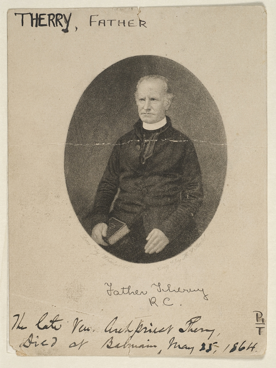
[media]At the other end of the river valley, the parish church and village of St Anne's was a dream of Father Therry, one of the first Catholic priests to arrive in the colony with the approval of both Rome and England. In the 1820s he was promised land from which to obtain timber for the building of St Mary's Cathedral in Sydney. In 1837 Governor Bourke granted him 47 acres (19 hectares) of land at Bark Huts (Enfield). In 1841, as a way to raise money for church and school buildings, he planned two townships on the circumference of Irishtown (north Bankstown): St Anne's at Bark Huts and St Joseph's at Liberty Plains (Lidcombe).
St Anne's church stands in a square from which radiate streets planned by Father Therry, still bearing the names that he gave to them: John and Bede were the names of Archbishop Polding, Australia's first Catholic bishop; his friend Archdeacon John McEncroe, who arrived in 1832, became a leader particularly among Irish Catholics and later founded the Freeman's Journal ; Gregory and Anselm were both saints associated with the history of the Benedictine order, which dominated early Catholic administration in Australia.
Therry sold four acre (1.6 hectare) blocks of land for £25, but the 33 acre (13.4 hectare) township of St Anne's saw little development until 29 July 1854 when Father Therry celebrated Mass there in a tent, following the laying of the foundation stone of the 'church of St Anne's at the Bark Huts'. Archbishop Polding laid yet another foundation stone there on 2 July 1859. The church was built between 1859 and 1864, but, because the township was very slow to be settled, the parish did not become a separate parish until 1953.
Canterbury Sugarworks
The third township in the Cooks River valley was formed, not as a result of church activity, but as an industrial settlement, serving the construction and operation of the Canterbury Sugarworks.
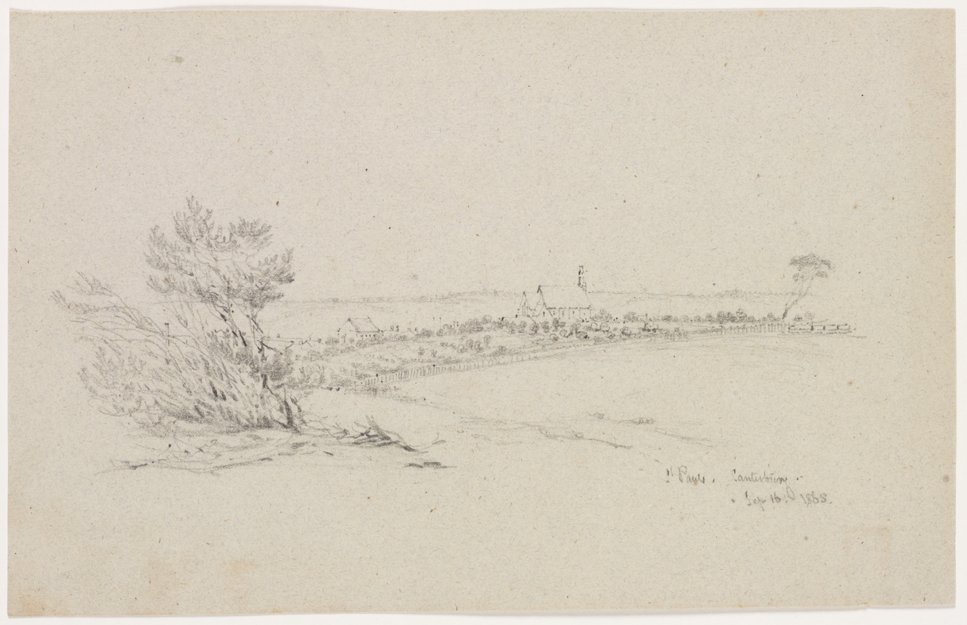
On 12 July 1840, the Ann Gales sailed into Sydney Harbour, bringing the nucleus of a company town: 'one sugar plant (complete)', 30 bounty immigrants and two families, in first class, who were to set up the new enterprise. An agreement was promptly made with Robert Campbell to exchange 60 acres (24.3 hectares) of land on the Canterbury estate for 24 shares in the company. Managers William Knox Child and later, Francis Kemble, moved into Joshua Thorp's Juhan Munna (Undercliffe) and the immigrants built themselves slab huts around the Sugarworks construction site. In 1841, most of the 60 acres (24.3 hectares) was subdivided into 'plots of half, and quarter of an acre, most eligible for building on and for gardens' [2] and was auctioned to raise finance for the new company. Streets were named after the largest investors in the company, Frederick Wright Unwin, George Minter and John Tingcombe. Scottish stonemasons who quarried the stone and constructed the factory were paid in allotments of land. Three months later, Robert Campbell subdivided the land adjoining to the west into the allotments of the 'Village of Canterbury', with streets named after his family. [3]
At the height of its success, just before the goldrush, the Sugarworks village at Canterbury had a Methodist church, a school, four pubs, a brickworks, a butcher, at least one general store, as well as blacksmiths, carpenters and other tradesmen. The village went into a severe decline after the factory closed in 1854 and only revived after permanent industry and a railway came to the district in the 1890s.
Suburban settlement
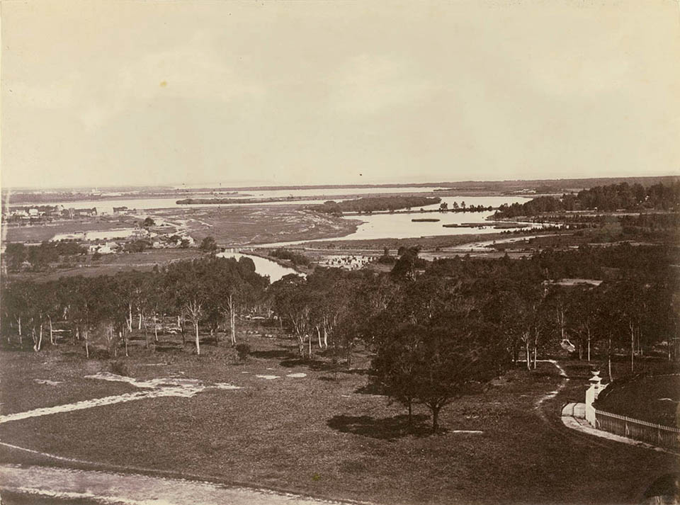
The [media]first stage of suburban settlement came with the subdivision of large estates into small farms, a change to the land ownership pattern which took place on the north bank of the Cooks River valley from as early as 1836, with the subdivision of Brighton Farm, and continued right through the mid nineteenth century. William Whaley Billyard, the trustee of Samuel Terry's estate, divided Redmire estate, between Brighton Farm and the village of St Annes's, into farm allotments in 1866. Sophia Campbell subdivided her Canterbury estate inheritance in 1865 and Robert Wardell's heirs turned Petersham into garden and dairy farm allotments in the late 1840s.
[media]On the south side of the river, there were some early subdivisions along the main roads but none were particularly successful. The village of Arncliffe, Wanstead and Bridgewater, speculative subdivisions of the early 1840s, only brought bankruptcy to their respective owners. On the Brighton estate to the west, Thomas Hyndes financed the building of St Thomas's Church of England, designed by John Frederick Hilly and the Adelaide Park Free School, which opened in 1847, forming the social centre of a new village called Enfield.
[media]After the construction of the railway from Sydney to Parramatta, suburbs spread slowly west along the line. Early subdivisions at Petersham, capitalising on street names associated with London's Crystal Palace, took a long time to be settled. Through the 1870s, new railway stations were approved along the line – Henry Parkes was an early speculator, creating the estate of Croydon Park in 1876 to capitalise on the new station approved by his government in 1874. The large blocks of Redmire (Strathfield) and Ashfield, formerly market gardens, orchards and dairies, allowed the wealthy to build mansions in large expansive gardens.
Land speculation
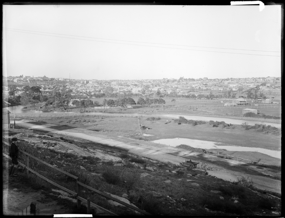
[media]Surveys of a railway to Illawarra between 1874 and 1879 fuelled land speculation south of Cooks River along all the likely and unlikely routes. Thomas Holt and his friend George Alfred Lloyd bought up most of the land in a line along the swamps from Muddy Creek to Rocky Point early in the 1870s, in the hope that Sydney's industrial expansion would take place there. [media]Later, politicians and their friends scrambled for estates on all the heights along Forest Road from Arncliffe to Oatley, believing that their guess about the route would be profitable. [4] Following approval of the Illawarra line in 1880, an enormous real estate boom both north and south of the river cleared the forest from part of the catchment area and covered the land with houses and paved roads; the consequent increase in run-off made the siltation of Cooks River worse.
Subdivision
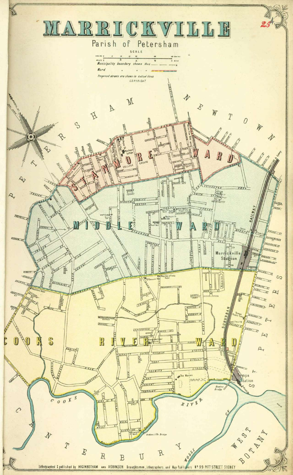
[media]During the 1880s, dramatic improvements in public transport around Sydney encouraged further land subdivision. When the tramway reached Marrickville in 1882, land surrounding The Warren was subdivided and sold to the Excelsior Land Investment and Building Company and houses, mostly designed by architects Thornley and Smedley, were built. At the same time, the Croydon Park and Rosedale subdivisions on the former Brighton Farm anticipated a promised tramline from Ashfield to Druitt Town.
Uncertainty about the final route of the Bankstown railway line did not hinder subdivision – by the time the line was completed along the Cooks River valley in 1895, a great deal of the area from Erskineville to Campsie had been cut up into allotments. Even before the railway opened, the Campsie Park estate and Silver Park both had influential backers among the investors. Harcourt Model Suburb, with its landscaped public gardens and white fencing, was closely linked with politicians as well. Creditors of a confidence trickster who had started his own bank and absconded with the money created Mildura, known locally now as Poet's Corner. It was sold with the slogan 'Land is a bank which never fails'. The opening of the Bankstown line as far as Burwood Road Belmore in 1895 opened the main catchment area for settlement, and the suburbs of Marrickville, Dulwich Hill, Fernhill (Hurlstone Park), and parts of Wattle Hill (Ashbury), Canterbury and Campsie were soon covered with Federation era houses.
War service homes
The [media]years from 1900 to 1929 marked a major period of suburban building in the Cooks River valley. Soldiers returning from World War I were promised a 'land fit for heroes', and schemes such as the Commonwealth War Service Homes Scheme were set up to help them rebuild their lives and establish their families. The Warren was demolished to build one such estate of soldiers' homes, designed by Sir John Sulman. The first war service home in Australia was built in Kennedy Avenue, Belmore. [5] At Belfield, near the new marshalling yard, large estates of war service homes were built, designed by architect John Kirkpatrick, who also designed many of the early buildings of Canberra. Earlwood, too, had a large war service homes estate on the heights above the river, with street names commemorating World War I battlefields in France and Belgium. This estate was served by an extension of the tramline from Undercliffe to Earlwood terminus in 1924. At the same time, speculative builders were also very active; the last section of the Canterbury estate, known locally as Goodlet's Bush (Ashbury), was subdivided and settled in the 1920s, as was the last of Redman's estate in Belmore. Altogether, between 1919 and 1929, 10,000 houses were built in the Canterbury municipality alone – thousands more than any other municipality in the Sydney region.
Pollution in the Cooks River
[media]Clearing and paving the valley had disastrous consequences for the Cooks River. It became a muddy and smelly eyesore that flooded regularly in heavy rain. The building of the Tempe-East Hills railway in 1931 opened the Wolli and Bardwell Creek valleys for settlement and this made the problems of urban run-off and siltation worse. The formation of the Cooks River Improvement League in 1925 was a direct result of suburban settlement – the Cooks River was perceived as a liability by the new householders who were alarmed at the pollution and fearful for the health of their families. Land along the river and its tributaries was believed to be unhealthy and flood-prone and, for many families during the 1930s, the aim was to move to higher land as soon as possible, where the risk to life and property was not as great. [6]
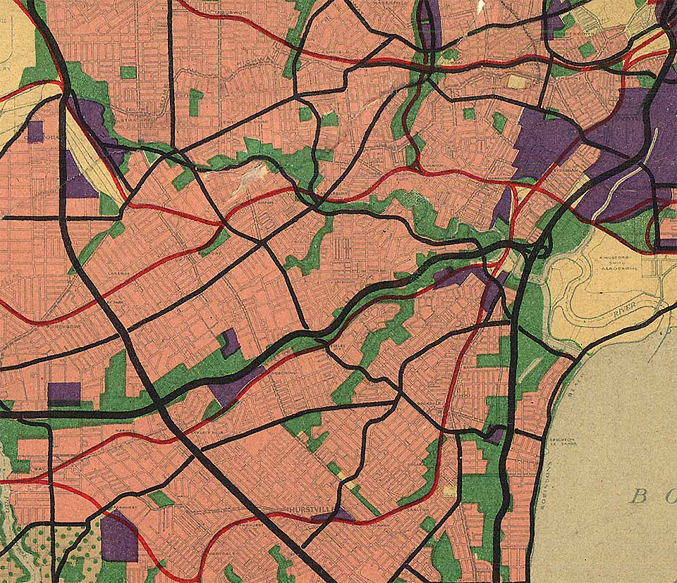
[media]It was not until after World War II, when drainage work had been completed and some dredging had been done, that the image of the Cooks River began to change. To the planners who drew up the Cumberland Plan in 1948, Cooks River became part of a 'green web', a network of existing open spaces linked together 'following the lines of watercourses and land generally unsuitable for building to make an almost continuous network through the urban areas bringing everyone within reasonable reach of green grass and shady trees'. The network was to stretch from Marrickville and Petersham westward to Enfield, southwest to Riverwood and the foreshores of Salt Pan Creek, and southward to Sans Souci and the mouth of the Georges River, thus creating 'a series of lungs or breathing spaces between some of the most densely developed areas in the County'. [7]
Urban growth
By 1971, the population of the Cooks River catchment area had grown to over 670,000 people. [8] The Cooks River Report noted that:
There is a high mobility in the valley population. This is particularly so in Marrickville, Burwood and South Sydney, where 50% to 60% of residents moved between 1966 and 1971. In Rockdale, Canterbury, Botany and Strathfield 40% to 50% of residents moved in the same period. A large percentage of these people would be migrants who have chosen the Cooks River valley as their first Australian homeplace. Where possible, they move elsewhere to find more pleasant surroundings and a better standard of living.
It is no accident that the same period was the peak time for demolition of houses and construction of thousands of blocks of redbrick, walk-up flats in the older areas of the Cooks River catchment. Large parts of the valley became notorious for cheap and crowded housing, a transient population and a drastic reduction in private green space. The process of redevelopment and the building of medium- and high-rise blocks of flats continue along the river to this day. The opportunity to re-create the historically significant garden setting of Tempe, near Wolli Creek, for instance, has been lost to political pressure for high-density 'urban consolidation' on every metre of available land near the Airport railway line. In the mid-1970s, a trend for 'gentrification' of the inner city gained momentum and this trend gradually spread through the 1980s and 1990s into Marrickville, Dulwich Hill, Hurlstone Park, Earlwood, Ashbury, Croydon Park, parts of Canterbury, Belfield,and Belmore where the Victorian, Federation, and inter-war bungalow housing stock and large gardens were valued by a new generation of home buyers. The Cooks River became a desirable place to live once more.
The Cooks River as a recreation area
[media]From earliest times, the people of Sydney appreciated the Cooks River as a retreat from the noise, dirt and disease of Sydney. Residents like A B Spark walked along the banks, swam regularly in summer and cultivated gardens for pleasure as well as for household fruit and vegetables. Throughout the nineteenth century, the river was a destination in itself; a green space with fine scenery. The Rev Stanley Howard, of St Peters, Cooks River, described one of his rides over Undercliffe Bridge to his family in England:
Down we came to the river, which was approached by a road passing through a rather pretty low shrub. Then over the rustic wooden bridge and up the other side, under the shade of overhanging acacia trees, with grey rocks jutting out from the steep hill in front, two or three pretty little houses giving life to the scene…The hill sloped steeply down to Arncliffe, which looked very pretty, and then the land stretched away in half wooded plain, until in the distance you had a perfect view of Botany Bay, which was as blue as it could be…The view, as I came back was also very delightful, with the river winding in and out among the hilly country covered with a thick growth of young sapling trees with their rich colour from the fresh young summer leaves. [9]
[media]Beyond the industrial sites around the Sugarworks, it was a pleasant place for a picnic. At Hilly's Orchard and river ford, a boating party of journalists paused for refreshments:
The land opposite to that of Mr Hilly belongs, we are told, to Mr Redman [i.e. Harcourt] Here we made a fire and refreshed ourselves with a capital 'pot o'tea', in true bush fashion. Our tea was made, of course, with water from the river, and very excellent it was. There was no lack of creature comforts, either in the shape of eatables or drinkables…In England such a stream – lying within a convenient distance from a great commercial city – would have its banks studded with villas, each with its boat and boathouse, and would also, in all probability, have a steamer or two plying upon it. With a comparatively trifling outlay, Cook's River could be made navigable for a small steamer to the point where we took our boat…I dare say all this will be done by-and-bye…and that people will be found enterprising enough to establish tea-gardens, or something of the kind, high up the river, to which pleasant little trips may be taken at holiday times. [10]
Joseph Hilton and his wife Elizabeth kept boats for hire at the Cooks River dam in the mid nineteenth century, as did the owner of Bramshot Farm but, by the end of the century, they were gone:
In the vicinity of the old sugar works, and looking down the river towards Undercliff, the visitant of to-day would scarcely believe that here only a few years ago there flourished ferns in great variety, waterlilies, the gay epacris, grandifloras, waratahs, native roses, and last, but not least, the golden-blossomed wattles, rendering the air redolent with their powerful perfume. Alas, tempora mutantur! With the advent of the iron horse the romantic has vanished before the utilitarian. One may look in vain for the pleasant boating parties that oft frequented this locality, and lifting their rowing boats over the dam, where the tannery now stands, passed up between the gardens in the direction of picturesque Croydon Park, to cast in their rods for mullet, or to gather the much-coveted ferns, or to picnic to their heart's content amid surrounding ferns and foliage. [11]
Reservations
Croydon Park and Rosedale Park[media] were early reservations of open space within subdivided estates, each being a good example of the flood-prone and unsaleable land being dedicated as 'parkland' by the developer. Much of the open space along the river was preserved in this way. In the late 1870s, politicians also took up the idea of reserving land for public parks, to give the people a place for recreation. In 1883, an area of 20 acres (8.1 hectares) bounded by the original Canterbury Farm on the north was purchased by the government for a park at £250 an acre. Canterbury Park, one of the early parks of suburban Sydney, was dedicated in the same year and proclaimed on 8 December 1885.
Life on the river
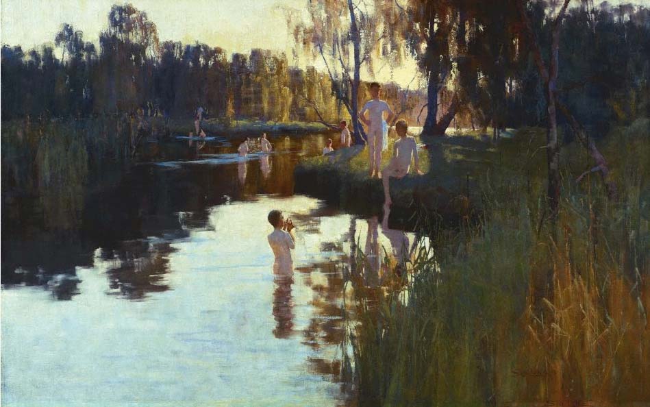
[media]Throughout the nineteenth century, the Cooks River was popular with swimmers; Sydney Long's painting, By Tranquil Waters, 1894, records the scene at its junction with Wolli Creek. Indeed, newspaper correspondents frequently complained about the impossibility of taking ladies down to the river because 'from Starkey's Corner (Hurlstone Park) to Tempe there could be counted 30 to 40 men and boys openly bathing in a perfectly nude state, some standing on projecting rocks without the slightest show of concealment'. [12]
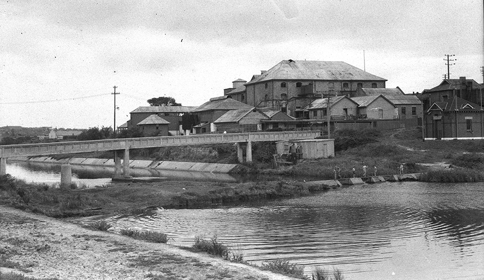
[media]At the end of the nineteenth century, swimming baths were built near Undercliffe Bridge (now Steel Park and Mahony Reserve). Public bathing facilities were also provided at Riverside Park in 1918. [13] The boat hire trade revived and there are many photographs from this era of young men and women spending pleasant afternoons rowing on the river. The Steel Park River Patrol Life Saving Club was active in the late 1920s and early 1930s to rescue people after the inevitable accidents.
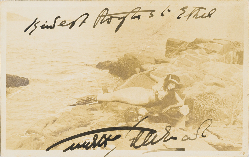
[media]It is said that the 'Million Dollar Mermaid', Annette Kellerman, used to swim at Undercliffe. Living in Marrickville, Annette Kellerman (1886–1975) took up swimming at the age of six to strengthen her legs, after being semi-crippled by rickets. She began swimming competitively to improve her family's finances and, in 1902, set the New South Wales records for the women's 100 yards (914 metres) and the mile (1.6 kilometres). She later travelled to England where she began giving demonstrations and made headlines by swimming 21km of the river Thames. At a time when female swimmers wore restrictive, cumbersome bathing costumes, Kellerman came up with the idea of a more practical one-piece swimsuit. When invited to give an exhibition of swimming and diving before members of the Royal family at London's Bath Club, she was forbidden to show any bare leg. Her solution was to buy a long pair of black stockings and sew them onto a boy's short racing swimsuit. In 1906 Kellerman, once dubbed 'the perfect woman', appeared on a Boston beach in her revealing one-piece bathing suit where she was quickly arrested for indecent exposure. [14]
Horseracing
[media]The Cooks River's alluvial flats were convenient places for organised sport. Horseracing had been popular in Canterbury from the early days of the Sugarworks village and by 1871 meetings were held on a level paddock behind the houses. A crowd of 3,000 attended a meeting there to celebrate Queen Victoria's birthday in 1878 and by 1884, meetings were formalised on a seven-furlong course under the banner of the Canterbury Park Race Club. The directors were Frederick Clissold and William Lovel Davis. In 1886, Davis consulted Arthur Frederick Jeffreys, whose mother had inherited the land from Robert Campbell, and purchased almost 53 acres (21.5 hectares) at £200 per acre for the use of the club. Many horse and pony trainers moved in to large blocks of land surrounding Canterbury and by the 1890s there was quite a flourishing network, especially in Minter, Church, King and Broughton streets and over the river in Northcote Street. Remnants of some of these stables can still be seen.
Kyeemagh polo ground was [media]located on the eastern side of Muddy Creek and Ascot racecourse operated on a site at the mouth of the river near the Botany dams, but both were closed when Kingsford Smith Airport was expanded between 1947 and 1955.
Parks and sporting fields
William (Bill) Picken purchased the land that subsequently became Picken Oval in 1954. As president of the Canterbury Trotters, Owners & Trainers Association, he applied to Canterbury Council on 17 September 1954 to construct a training track on an area of 6.5 acres (2.6 hectares), and offered to dedicate sufficient land for Croydon Park Bowling Club to construct three greens and a clubhouse. Because the land was part of the County Road reservation, council agreed to support the application to the Cumberland County Council, initially for ten years. The track was in use from 1955 until the 1990s.
[media]In the early part of the twentieth century, golf clubs occupied land along the Cooks River that was mostly flood-prone and further land became available when the river's course was changed in the 1930s and 1940s. North Brighton Golf Links was on the site of the sewage farm, and Bonnie Doon Golf Links, on the western side of Muddy Creek, occupied the nearby site of a nineteenth century mansion, Bonnie Doon. When the Upper Nepean water scheme was finally completed, Sydney's earlier water supply lakes of the Botany swamps became the site of the Lakes Golf Club.
Strathfield Golf Club, which extends along both banks of Cooks River, was formed in 1931 as a nine-hole club, occupying land at Freshwater Park leased from Strathfield Council and from the NSW State Rail Authority. It was later extended to 18 holes.
Marrickville golf course[media] occupies an area of infill, created in 1938 when the course of the river was straightened and moved south a few hundred metres. When Sydney has heavy rain, the depression that was once the riverbed fills with water and it is easy to see the river's former course. Local devotees formed the golf club in 1941.
Several other parks and sporting fields are the result of the 1930s reclamation works. Tasker Park was enlarged when a bend in the river at Canterbury was straightened. This work removed the site of the original Canterbury Velodrome, built in 1928 near Canterbury railway station. Both Ewen Park and Beaman Park, the home of the Canterbury and Western Suburbs Cricket Association, were widened at the same time.
[media]A 'boat harbour' with 'moorings for forty boats' [15] was constructed in 1964–65 below the Sugarworks building for the local sea cadets. The name 'TS Shropshire' was associated with the group. Meetings of the Cooks River Valley Association were held in the sea cadets hall in the 1970s.
In 1976, the Cooks River Environment Survey and Landscape Design report noted that 'the lack of passive open space is the most serious recreational problem in the Cooks River area' [16], and that existing provisions were seriously inadequate. It recommended that the river itself be transformed into a usable recreational resource, with boat, canoe and bicycle hire centres, cycling and walking trails with underpasses and river crossings, natural bush areas and quiet areas for relaxing, and riverside cafes and barbecue areas for socialising. Playing field space was also considered to be inadequate but the report believed that rather than taking over any of the passive recreation space, problems could be solved by creating 'a more rational pattern of use and allocation of existing playing fields'.
Urban consolidation has increased pressure on the valley to provide a green space for the crowded suburbs. Bike and walking tracks through the valleys of Wolli Creek and Cup and Saucer Creek, and a greenway following the route of the proposed nineteenth century canal from Parramatta River to Cooks River, have increased community awareness of the catchment area.
Notes
[1] AB Spark, 20 November1839, Alexander Brodie Spark diaries, 1 January 1836–22 September 1856, Mitchell Library manuscript collection, A4869
[2] The Sydney Morning Herald, 30 July 1841
[3] Plan of the Village of Canterbury: Part of the Canterbury Estate on Cook's River Immediately Adjoining the Australian Sugar Company's Establishment to be Sold by Auction by Mr. Stubbs, on Wednesday next, the 31st. May 1843 / J. Armstrong, surveyor, Mitchell Library manuscript collection, State Library of New South Wales, M2 811.1829/1843/1
[4] Lesley Muir, Shady Acres: Politicians, Developers and the Design of Sydney's Public Transport System, 1873–1895, Phd thesis, University of Sydney, 1995
[5] It was mutilated beyond recognition by an unsympathetic owner in 1994
[6] Interview with Mrs Reid, Canterbury and District Historical Society, ca 1979; Muir's parents moved in 1939 from the low end of the street, near Redman's Creek, to the higher end of the same street because the creek flooded after rain before the drainage canals were built
[7] Denis Winston, Sydney's Great Experiment: The Progress of the Cumberland County Plan, Angus and Robertson, Sydney, 1957
[8] Cooks River Project, Cooks River Environment Survey and Landscape Design, Chippendale, 1976, p 85
[9] Diary of Stanley Howard, 3 December 1874 in Laurel Horton (ed), Stanley: A Young Man's Colonial Experience: Rev. Stanley Howard Writing to His Family in England, 1872–1878, St Peters Publications, Sydney, 2005; the road is probably Illawarra Road and Homer Street
[10] 'A Day on Cook's River', The Sydney Morning Herald, 21 August 1868
[11] RB Parry, 'Canterbury: An Old Sydney Suburb, Interesting Reminiscences', Evening News, 14 November 1908, p 13
[12] The Sydney Morning Herald, 6 January 1891
[13] Chrys Meader, Richard Cashman and Anne Carolan, Marrickville: People and Places, Hale & Iremonger, Sydney, 1994, p 167
[14] GP Walsh, 'Kellermann, Annette Marie Sarah (1886–1975)', Australian Dictionary of Biography, National Centre of Biography, Australian National University, http://adb.anu.edu.au/biography/kellermann-annette-marie-sarah-6911
[15] The Torch, 14 October 1964
[16] Cooks River Project, Cooks River Environment Survey and Landscape Design, Chippendale, 1976
.


