The Dictionary of Sydney was archived in 2021.
Botany
Citation
Persistent URL for this entry
To cite this entry in text
To cite this entry in a Wikipedia footnote citation
To cite this entry as a Wikipedia External link
Botany
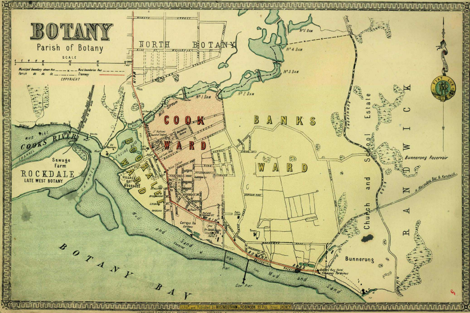
Botany is [media]situated on the northern shores of Botany Bay in the south-eastern suburbs of Sydney, 10 kilometres south of Sydney's central business district. The presence of water, whether fresh or salt, is so inextricably bound to the history of Botany that the two are almost synonymous.
In modern terms, the area is also strongly associated with various industries, aeroplanes, major arterial roads and seaports. For these reasons it is often regarded as the 'gateway' to Sydney, yet it is also much maligned and often overlooked, as people quickly pass through on their way to other destinations around the country or across the world. Still it is steeped in history of national significance with a large record of 'firsts' to its credit.
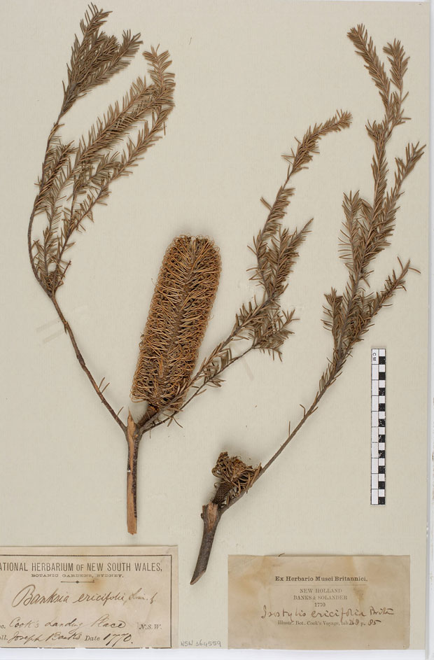
The [media]heritage of the Botany area is closely linked to the discovery of the eastern seaboard of Australia and the beginnings of the nation. Captain James Cook 'discovered' this continent when he first made landfall at Botany Bay on 29 April 1770. Together with Endeavour's botanist, Joseph Banks, and his assistant, Daniel Solander, they spent several days ashore collecting and cataloguing vast numbers of previously unknown plants.
Originally Captain Cook had wanted to name the bay 'Stingray's Harbour', but later, probably due to Banks's findings, he settled on Botany Bay. As a result Botany can well claim to have the oldest English place name in Australia. These two significant elements, botany and water, are symbolised in the City of Botany Bay's emblem, with both Banksia serrata and waves of water represented. This signifies their vital importance to the area.
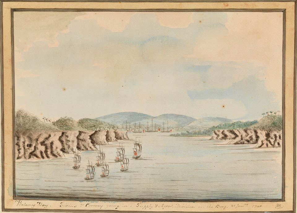
[media]However, when Governor Phillip arrived in 1788 he found the bay too shallow in many places and deemed it unsuitable as a harbour. As a result, the First Fleet sailed on to Port Jackson, finding a more suitable site for settlement at Sydney Cove.
In 1809, Edward Redmond became the first recorded white settler in the Botany area, and the land was so swampy that he called his property Mudbank. [1]
The history of the City of Botany Bay has been shaped by its location, within easy reach of the city of Sydney and near an abundant supply of water. Its initially remote location has seen it evolve from a tight-knit village with strong ties to all of its past and present industries, each with its own dominant effect.
The Aboriginal people
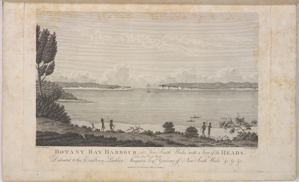
Botany's earliest residents were the [media]Aboriginal people who have lived in the Botany area for over 9,000 years. It has been estimated that 1,000 to 1,200 Aboriginal people lived around the shores of Botany Bay. They called the Botany area 'Gwea'. Later though, when European settlement took hold and the name 'Botany' was adopted, the Aboriginal translation of 'Booralee' was often used. The village was often officially referred to as 'Booralee' and subsequent maps saw Botany bearing this name. Nearby Booralee Park celebrates this long-term connection.
The Kameygal set up camps along the banks of the Cooks River and on the northern shores of Botany Bay with the Gweagal mainly on the southern side around Kurnell, although the Aboriginal boundaries are somewhat blurred. The Cadigal were also present but more to the western shores of the bay in areas immediately west of the Cooks River.
In the mild Sydney climate, the Aboriginal people had thrived, and their way of life was undisturbed until the English arrived and exposed them to diseases such as smallpox which decimated their numbers. While the Cadigal retreated further west, the local Botany tribes remained along the northern shoreline of Botany Bay, much to their peril.
Early industries
Water was a precious commodity in early Sydney, and it was an abundant but essential resource in the evolution of three earliest Botany industries; fishing, shell lime and salt.
Water reserves below Botany are still strategic in irrigating the parks and reserves in the area. Under Botany, a layer of sandy soil and peat that comprises the Botany Aquifer acts like a sponge, retaining water for months after heavy rain. This runs from higher ground at Centennial Parklands out to the north shore of Botany Bay itself. A main part of this system is the Botany Wetlands – the largest freshwater wetland in the Sydney region. [2]
European settlers and convicts collected shells cast aside by Aboriginal people and these were burned to create lime for the manufacture of much-needed mortar for building across Sydney. It was transported to Sydney town by small boats. Saltpans, called the Bennelong Salt Pans, were located around the north shore of Botany Bay and each produced one ton of salt per week. [3]
Fishing became another strong early industry with plentiful supply, and fishing villages sprang up all around Botany Bay. These became an important part of Booralee village and the close-knit community of established families reaped the rewards of the sea throughout the lucrative 1860s and 1870s. [4] Many related members of these families still live in the area. Names such as Puckeridge, Duncan, Bagnall and Johnson are carried by direct descendants of servants of the Lord family.
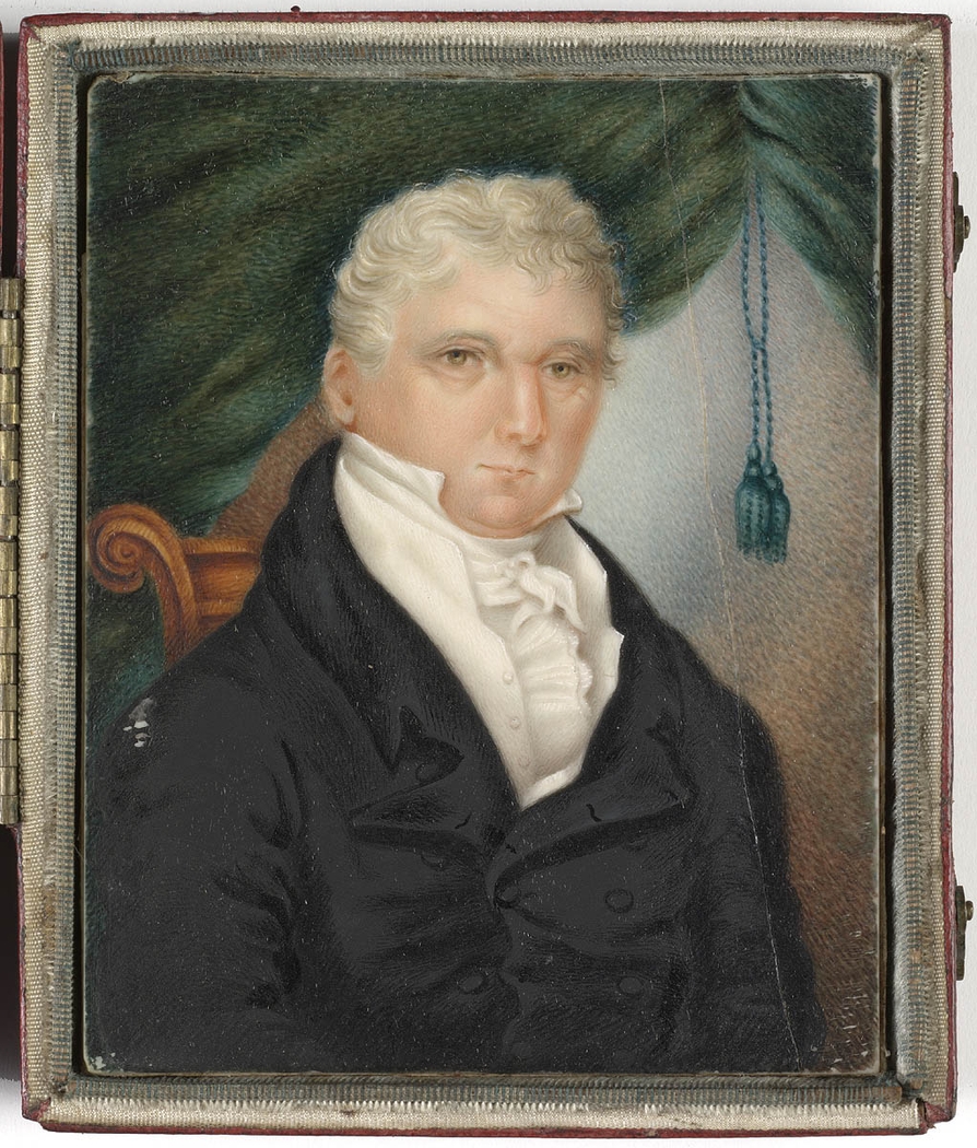
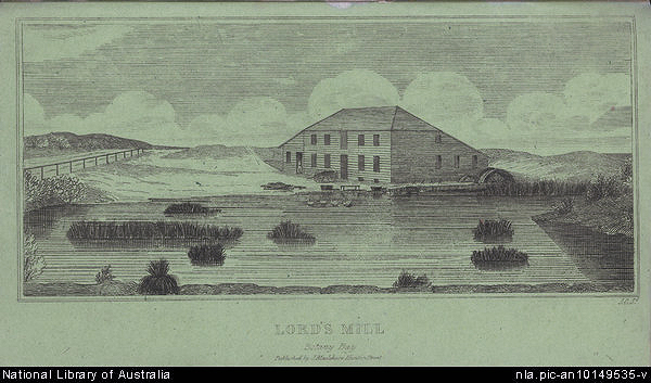
[media]In 1815, the ex-convict Simeon Lord took advantage of the natural landscape, when he dammed a stream close to Botany Bay and established the first privately run woollen mill on its banks and a flour mill on a nearby body of water. The two ponds he created are now local landmarks, known as the Mill Pond and the Engine Pond. Lord was not the only one to recognise the value of Botany's water but he certainly became very rich from controlling it. Lord became one of the colony's earliest manufacturers and held a diverse portfolio of business interests ranging from sealing to cloth manufacture. He is listed as having been the first person to export Australian wool.
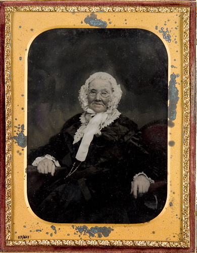
[media]In 1823 he was granted an additional 600 acres (243 hectares) at Botany, which embraced the original water reserve with Lord's mills on the Mascot side of the Millstream. Here he built a new home and factory and relocated his entire [media]family of 13, plus servants, from their grand city residence to his new centralised base of operations.
Following Lord, other associated wool industries were linked with the development of Botany. Again water was instrumental in attracting various industries especially noxious trades such as slaughtering and wool scouring. The pollution from these growing industries began to affect the quality of the water and air, generating pernicious odours, fumes and toxins. These same businesses offered employment to local residents who often withheld complaints for fear of losing their jobs.
In the 1830s, market gardeners arrived in the area and the soil in the Botany area was indeed fertile. After the gold rushes of the 1850s, Chinese farmers took over the leases on these gardens. They cut trenches in the soft soil to irrigate their crops, and sold fruit and vegetables to the nearby city and suburbs. The industry had begun in 1830 when the colonial government drained large swamps in the area and granted portions of land to members of the New South Wales Veterans Corps. [5] The suburb became known as Sydney's 'backyard vegetable garden'. [6] Some Botany market gardens survived into the 1960s but were confined to pieces of land along the freight rail lines; squeezed out by industry they had completely disappeared by the 1970s.
Leather and tanning also became major industries, employing a large number of local residents. In 1880 there were at least four tanners in Botany and some of the most longstanding companies were established at that time. Tanners such as J Geddes and F Lupton were joined a decade later by JF Page, F Luland, C Etherden, W Hale and W Herford, most of whom later became mayors of Botany. One of the most famous of the tanneries, Bunce's, was established in 1887 and by 1938 there were 21 tanneries in the Botany area. But it was J Bayley and Sons that became the largest in the area employing 600 workers at its peak. Its operations covered seven acres (2.8 hectares) of land.
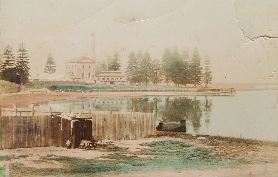
[media]From the 1850s, as the colony's streams closer to the city had become clogged and polluted, the government turned to Botany to supply Sydney with fresh water. From 1859 to 1886 pumps carried water from the Botany Swamps to the city and surrounding suburbs. At the same time, more and more industries set up factories in and around the Botany Water Reserve. By 1869, the area was no longer considered to be a reliable source of water. The Botany Pumping Station remained in service till 1886 when the Nepean scheme took over the job of supplying Sydney's water. In 1896, the machinery and boilers of the dismantled pumping station were sold at auction. All that remains today is part of a chimneystack on the south-east perimeter of Sydney (Kingsford Smith) Airport.
After the Nepean scheme came online, the wool scourers returned to the Botany area and major companies like Swinbourne & Stephen started up large factories on the shores of the same waterways that had supplied Sydney only a few years earlier. Eventually the need for a cleaner residential environment spelled their demise.
Today, primary industries such as agriculture, forestry and fishing make up less than 0.5 per cent of the local industry, a far cry from yesteryear.
A growing community
Originally seen as a country retreat and later as a holiday destination, Botany shifted gear as the colony grew. As the local population rose, so too did the demand for the establishment of local government services. Botany remained a village even after other Sydney councils had formed in the 1850s. The three Botany municipalities of Botany, North Botany and West Botany did not come into existence until the Municipalities Act of 1867. [7] In 1888, the municipalities of Botany and North Botany were incorporated. Later North Botany became Mascot and West Botany became Rockdale.
Botany Council placed considerable priority on residential development and beautification of the local area, and undertook schemes to make this a reality. The councils set to work to provide better facilities, as evidenced by the large number of planned open sports fields, golf courses, parks and recreational facilities catering for athletics, swimming, cricket, soccer, rugby and tennis and other outdoor activities.
Botany Council opened its first library in July 1896 and the Town Hall in 1899. The Town Hall, built by the first mayor, James MacFadyen in Italian Renaissance style, was opened by the Governor of New South Wales, Lord Beauchamp, to much fanfare and celebration.
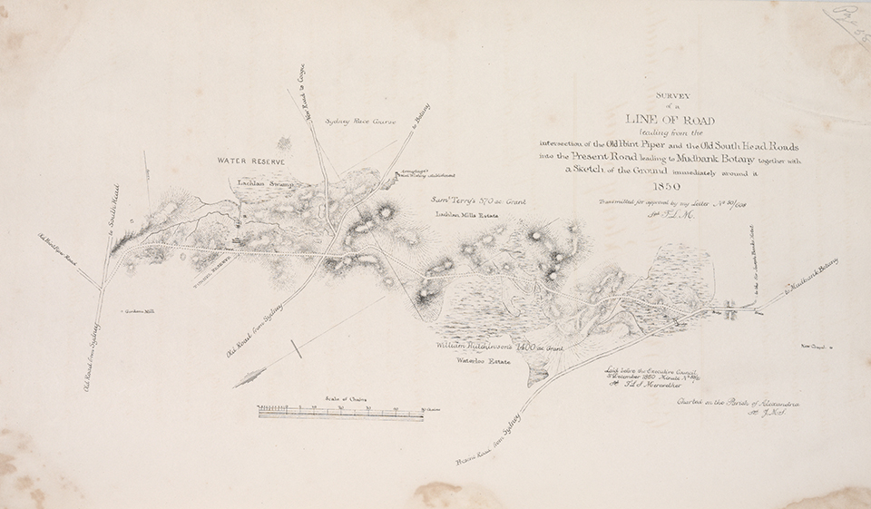
[media]There was a trafficable 'track' in 1809 that also bore the name 'Mudbank', but as early as 1813 it was described as 'dangerous.' [8] At that time it was funded by local business people. However, Governor Lachlan Macquarie contributed to and prioritised its upgrading to provide access to recreational facilities on Botany Bay. It was replaced later in 1833 by what is now known as Bunnerong Road. Horses were plentiful in the early days of Botany and the low level sandhills of an undeveloped landscape fostered horse-riding as well as sports such as horse racing and steeple chasing.
[media]The present day Botany Road was surveyed as early as 1863 and ran from Mascot to Botany. It was also known as 'Corduroy Road' and was a toll road charging threepence until 1882. In the 1870s horse-buses ran from the city to the Sir Joseph Banks Hotel. A decade later, in the early 1880s, horses powered the first tramline running from Botany to the city, and it took 54 minutes to reach Botany from Sydney's central business district. The tramline, later electrified, ceased operation on 24 September 1960. [9]
From 1861 until its final completion in 1925, the Sydenham to Botany railway line had been planned and was passed by parliament as early as 1863. It was designed to follow Botany Road as far as the Sir Joseph Banks Hotel. It wasn't until construction finished in 1913 that a line from Marrickville to Botany was begun. It was finally opened in 1925 but was designed only as a goods line to carry goods to and from local industrial sites and on to Port Botany. It still operates as such in 2010.
Botany also benefited from the Sydney City Council's undertaking for electricity and gas, as it was were included in the same scheme, and had reticulated gas and electricity from 1935 onwards.
Over the years industry and housing grew alongside one another. With the coming of World War II and the expansion of the airport, which had been operating since the early 1920s, a three-storey height limit was imposed across the Botany area. This had a strong influence on the way the district grew both vertically and horizontally. Medium density housing has always been a strong feature of the Botany Council area. Even today residential and industry abut one another in an ad hoc manner throughout the suburb in a manner unique to the area.
Industrial growth and development
As more houses and factories were built, roads were upgraded and extended to service a number of communities and to carry products to the growing population of Sydney.
Laws were lax in the early days and Botany paid a price, becoming a declared 'noxious trades area' whereas North Botany had legislated against such industries. This had a great impact on the residential development of both council areas.
Wool scouring works and tanneries often let their drains full of slops and soupy chemical mixtures overflow into the nearby Cooks River and Botany Bay. Both became severely polluted. Successive councils formed action groups and wrote letters of complaint to the authorities, demanding a clean up of the waterways. Business grew and expanded, with some of the biggest and best-known international corporations setting up factories in the area. Some, like General Motors Holden, flourished in the post-World War II era, but have since moved elsewhere. Others, like Kellogg's, ICI and Johnson & Johnson, are part of the long-term modern industrial environment.
Of all the industries established in the area, two stand out as having a lasting impact on the history of the City of Botany Bay. In 1921, Mascot was chosen as the site of what was to become Australia's largest international airport. Less than ten years later, a shipping port was established on the shores of Botany Bay. Both developments were greeted as a sign that Botany had come of age: with the development of containerised shipping and the expansion of aviation, they now dominate the landscape, bringing both economic growth, and at times, protest and controversy.
Sydney (Kingsford Smith) Airport
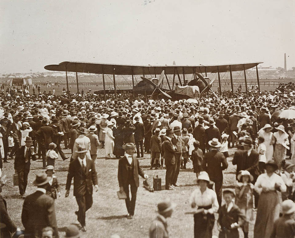
In 1911, an [media]early aviator named Joseph Hammond chose the Ascot Racecourse as his landing field. But it wasn't until 1920 that a returned service airman from World War I, Nigel Love, along with Harry Broadsmith and Jack Warneford, chanced upon the idea of leasing 400 acres (162 hectares) of cow paddocks from the Kensington Race Club and turning the land into an aerodrome. The first plane to land from England was the Vickers Vimy machine piloted by Ross Smith on 14 February 1920. In 1921 the Australian government purchased an additional 161 acres (65 hectares) of land for the express purpose of an airport as opposed to an aerodrome. Regular flights began in 1924, and by 1934 Qantas began commercial services to England. In 1938 the airport had a staff of 11 people who handled 120 flights per week. The aerodrome (as it was still known then) had just three small gravelled landing strips, the longest of which was a mere 900 metres. [10]
Sydney airport had first begun as the tiny Mascot Aerodrome. After being taken over by the Commonwealth government, it grew quickly, and following World War II the airport grew to nine times its original size, forcing the relocation of the mouth of the Cooks River. From 1947 onwards the airport grew again, swallowing the Ascot Racecourse, three cricket fields, a polo ground, two golf courses, the former Sydney Sewerage farm and, sadly, some residences. [11]
The construction of a third runway jutting out into Botany Bay has fuelled protests in the local community. Damage to the bay, erosion of the foreshore and an increase in aircraft noise have been of greatest concern to diehard local residents.
Port Botany
Botany Bay [media]was first used as a seaport as early as 1885 when the Botany pier was constructed to unload coal transported from Newcastle to Sydney: this was later used to fuel the nearby power station at Bunnerong, constructed in the late 1920s. The pier was replaced between 1929 and 1930, and was further expanded in the 1970s, with the addition of bulk liquid berths and storage and container terminals. Port Botany was implemented to take the pressure off Sydney Harbour and lessen the impact on the state's capital as a 'working port.'
Port Botany access also made it easier for petroleum to be shipped to nearby terminals and large storage tanks operated by the major oil companies of the period such as Amoco.
Today, almost all of Sydney's commercial shipping passes through Port Botany and this alone earns millions of dollars in trade for Australia. But the siting of the country's largest port near its busiest international airport means that a huge amount of road traffic converges on the area every day.
Leisure and sports
However, Botany wasn't always about work and industry. Sport and leisure became increasingly important and were highly regarded and sought after.
The earliest evidence of sports entertainment was seen in competitions between several groups of the Aboriginal people around Sydney. Canoeing and speed tree climbing were competitive sports that were both prized and assisted daily living in food gathering.
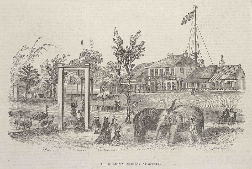
[media]The Sir Joseph Banks Hotel and Pleasure Gardens represented the introduction of 'leisure' into the Botany mindset, and occupied 75 acres (30.3 hectares) of land and seafront. Here too Aboriginal people competed in running events, categorised by the colour of the entrants' skin. For more than 50 years this was the site of Australia's first private zoo and sports fields.
In 1834 Thomas Kellett, a prominent Sydney citizen and former army sergeant, bought the site for the Banks Inn, facing the beach at Botany. It opened in 1844. This later became the core of the Sir Joseph Banks Hotel complex. By the end of 1850 he had created the biggest gardens and menagerie in Sydney. It became a famous attraction very quickly, [media]boasting Australia's only elephant, Bengal tiger, Himalayan bear, red deer, Indian goats, black Bengal sheep and a grizzly bear. It also had ponies for racing and horses for horse-riding, a grand ballroom that could cater for up to 1000 diners per evening and a bathing house with boats for hire from its own private jetty 800 metres in length. [12]
In the 1860s Kellett expanded the pleasure gardens to encompass sports arenas catering for cricket, a bowling green, an archery range and a football field. It also had a running track that hosted a famous annual event, the Botany Bay Gift, which attracted international athletes.
In 1875 Frank Smith, a licensed innkeeper, purchased the hotel complex for £2,600 in gold sovereigns and in 1884 he built a new structure facing what is now Anniversary Street, Botany. He also expanded the sports fields and built a grandstand for large scale athletic events where runners won big purses and spectators won by betting on the athletes. [13] As a result of this, the Botany Harriers running club was formed in a nearby Botany shopfront in 1907.
In 1908 the hotel and grounds were sold and in 1920 a new smaller hotel with the transferred licence was built on the corner of Waratah and Botany Roads. It bears the same name as the original. The original hotel was divided into apartments in the 1930s. Today it has been heritage-listed and refurbished to its former glory.
Locals still affectionately refer to the four-pub crawl, including the Sir Joseph Banks, Captain Cook, Pier and Botany Bay hotels. These have all been in existence for over 150 years and are heritage-listed. They stand as testaments to the industrial working class waterfront history of the area as well as its past affluence.
Sailing [media]has a long history in this area and a strong association with long established families as well. While more traditional sailing craft such as 14–18-foot class vessels were a prominent feature of the Bay, the advent of another class, 'the tin dinghy', grew out of the hard times of the Great Depression. These were simple sailing craft derived from the tin canoe. They were often constructed from soda drums and used laundry props for masts and bed sheets for sails. These became increasingly popular locally as early as 1932 with the formation of nearby clubs and individual classes to compete in. The advent of World War II marked the end of their prominence and no sailing club exists in the area any more.
Botany also had its own theatre – The Empire in Botany Road, which screened movies six days and nights a week. Built in 1920 on the site of the old open-air cinema bearing the same name, it had an ornamental façade, decorative interior and exterior detail, and stained glass windows. It stood derelict from 1965 when it ceased operations, and was finally demolished in 1972.
Numerous Botany landmarks and streets testify to the forefathers who worked hard to establish a community or had built icons of local importance, such as the John Brotchie Memorial Nursery School in Botany Road: this name commemorates the first town clerk of the amalgamated councils of Mascot and Botany in 1948. A large number of Botany streets have been named after councillors or past mayors, such as MacFadyen, Wiggins, Swinbourne and Daniels.
Education and religion
Education was slow to get a foothold in New South Wales, and this had a lot to do with dispersion of the population across wide areas, parental apathy, and religious sectarian rivalry, plus pioneers had little spare time and energy above basic requirements. [14]
The first church in Botany was the Anglican church of St Matthew, and Simeon Lord allowed the new church to use his mill for Sunday school. The original church was erected in 1841 and a new church replaced it in 1862 and is amongst the oldest in the country. It is listed on the National Trust register.
A number of temporary schools existed from 1848 onwards. In 1869 the Wesleyan Church opened a denominational school adjacent to its church in Botany, and this formed one of the four main church presences in the village area.
In 1854 Simeon Lord also favoured the Botany Wesleyan church, when he granted land for a new chapel to be built and he again assisted its establishment by allowing his factory to be used for Sunday school.
Botany Bay School, the first public school, began in 1848, the same year that the Board of Education was established in New South Wales. It was located on the eastern side of Botany Road. However, it closed the following year and pupils were accommodated in the Wesleyan Chapel until 1867 when Edward Lord, Simeon's second son, donated land across the road from the church grounds for a new school building. The new Botany Public School opened in 1869 and is still in use.
St Bernard's Catholic school was the first denominational school and began in 1885 beside the church, constructed in 1860.
Churches have flourished in this area for over 150 years and have been greatly influenced by people of varied ethnicities moving into the area in the latter part of the twentieth century. In more recent times there have been many new places of worship to accommodate the new residents of Botany.
Cultural diversity and change
Today it is not only Botany's industrial landscape that is changing. The area has one of the most ethnically diverse populations in greater Sydney. The 2006 census showed that over 33 per cent of local residents come from a non-English-speaking background. The community has benefited greatly from contact with different cultures and ideas, and the influence of the postwar generation of immigrants is evident in the daily life of the community, with many Greek and Italian people settling in the area – at double the rate of the rest of Sydney.
Today, the suburb has experienced significant residential growth as property developers move in to take advantage of the favourable location and its proximity to the city of Sydney, its airport and coastline. Its future is as assured as it has been enduring.
References
'Booralee – the lost fishing town of Botany', undated pamphlet, local history files, Botany Library
Botany Council, 'Botany: together we've been building a better Botany: a community report' undated report, local history files, Botany Library
'Botany & Local area', undated pamphlet, local history files, Botany Library
'Botany Public School: A brief history', undated pamphlet, local history files, Botany Library
M Chaffey, 'A review of Botany', undated pamphlet, local history files, Botany Library
City of Botany Bay Council, 'Botany Wetlands: a guide to the Botany Wetlands', undated brochure
'A Short History of the City of Botany Bay', City of Botany Bay website, http://www.botanybay.nsw.gov.au/city/history.html, viewed 24 May 2010
Council of the Municipality of Botany, The Heritage of Botany, Mascot, 1989
B Kennedy, Sydney and suburbs; a history and description, Reed, Frenchs Forest, 1982
Frederick Larcombe, The History of Botany 1788–1970, The Council of the Municipality of Botany, Mascot, 1970
J Sippel, Valuable swampy land; market gardens in Mascot and Botany, City of Botany Bay, Mascot, 2002
Notes
[1] M Chaffey, 'A review of Botany' undated pamphlet, local history files, Botany Library, p 1
[2] City of Botany Bay Council, 'Botany Wetlands: a guide to the Botany Wetlands', undated brochure, p 2
[3] Frederick Larcombe, The History of Botany 1788–1970, The Council of the Municipality of Botany, Mascot, 1970, p 12
[4] 'Booralee – the lost fishing town of Botany', undated pamphlet, local history files, Botany Library
[5] J Sippel, Valuable swampy land; market gardens in Mascot and Botany, City of Botany Bay, Mascot, 2002, p 1
[6] Frederick Larcombe, The History of Botany 1788–1970, The Council of the Municipality of Botany, Mascot, 1970, p 10
[7] B Kennedy, Sydney and suburbs; a history and description, Reed, Frenchs Forest, 1982
[8] 'Botany & Local area' undated pamphlet, local history files, Botany Library p 3
[9] 'Botany & Local area' undated pamphlet, local history files, Botany Library p 3
[10] 'Botany & Local area' undated pamphlet, local history files, Botany Library p 5
[11] M Chaffey, 'A review of Botany' undated pamphlet, local history files, Botany Library, p 5
[12] M Chaffey, 'A review of Botany' undated pamphlet, local history files, Botany Library, p 1
[13] Council of the Municipality of Botany, The Heritage of Botany, Mascot, 1989, p 33
[14] 'Botany Public School: A brief history' undated pamphlet, local history files, Botany Library, p 1
.


