The Dictionary of Sydney was archived in 2021.
From a fine stream to an industrial watercourse
Citation
Persistent URL for this entry
To cite this entry in text
To cite this entry in a Wikipedia footnote citation
To cite this entry as a Wikipedia External link
The transformation of the Cooks River valley
Initially, the Cooks River was an impediment to the movement of people and goods from the settlement at Sydney Town to its outposts, such as Camden, the home of the Macarthurs. This area had originally been known as the Cowpastures, where in 1795 the 'lost' cattle – those that had strayed from Farm Cove in 1788 and not been seen since – were discovered.
The early decades of the nineteenth century saw several bridges built across the river upstream, to facilitate the necessary transport movements, while punts and ferries also appeared, all of which allowed settlement and cultivation of the land to the south.
But this 'fine stream' of fresh water also had other potential, and in the third decade of the nineteenth century, the Cooks River was viewed as a potential source of fresh water for the growing Sydney Town.
Fresh water for Sydney Town
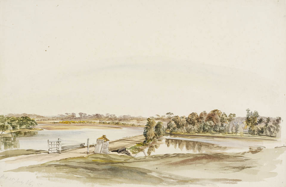
[media]The only attempt, in 1839, to dam the Cooks River as a source of water for Sydney, started with the best of intentions:
The government, with a view to securing for Sydney a sure supply of fresh water in order to remedy the serious inconvenience resulting at times from the scanty supply from the Botany Swamps, has determined to erect a dam across Cooks River a little distance above Mr A. B. Spark's house, at Tempe, in order to prevent the ingress of salt water. A canal is then to be cut through the country from the spot to within about a mile of Sydney, whence the water will be conducted into the town in pipes. A gang of 200 men will set to work immediately. [1]
The sandstone dam wall was porous, so the water remained brackish and unfit for drinking, and the only result was an obstruction that, though it formed a convenient crossing for the road to Illawarra, also contributed to the pollution of the river.
In 1867, a water commission was appointed to examine the question of Sydney's water supply. Thomas Holt of The Warren proposed dams across both the Cooks River and the Georges River, connected by a canal along Muddy Creek and the wetlands to the south, parallel with the shoreline of Botany Bay and forming an access route into Sheas Creek to the north. He believed that the canals would allow the land 'along the canal and swamps' to be 'the manufacturing part of Sydney'. [2] Holt's scheme was rejected, despite his active lobbying, because the commission believed that it would take too long for the salt to be entirely removed and it would cost too much for the masonry to be made entirely sound.
Hudson's Temporary Water Scheme
[media]Ten years later, the government made a start on building the Upper Nepean Water Scheme but in the early 1880s, a severe drought brought water shortages and typhoid epidemics to the city and suburbs while the pipes and dams were still under construction. In 1885, Hudson Brothers offered to build a temporary connection for the water supply from Pipe Head at Sherwood Heights to the dams at the Botany swamps, using corrugated iron flumes sealed with asphalt and carried on timber frames. The company guaranteed to bring three million gallons of water daily into Sydney from Pheasants Nest at a cost not exceeding £60,000. The Cooks River valley formed a convenient corridor for carrying Hudson's Temporary Water Scheme to Botany, and by Christmas Day 1885, water carts were able to tap the pipes to supply the Burwood, Ashfield and Marrickville districts.
On Saturday 30 January 1886, a fountain of muddy, tarry-tasting water exploded out of a weakness in the pipe at Botany, circumventing the carefully laid plans for the official opening ceremony where a plug was to be knocked out of the end of the pipe to stream the water into the Botany dams. After the trunk mains from Potts Hill to Petersham reservoir became operational in 1888, the Hudson's Scheme fluming and pipes were re-used elsewhere. In 1915, an additional trunk main was built from Potts Hill to the Cooks River valley to supply Bankstown, Canterbury and the Illawarra suburbs formerly supplied from Petersham reservoir. [3]
Sewerage farm
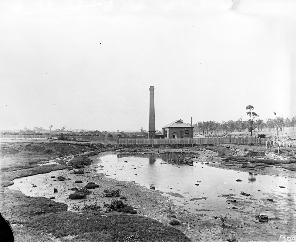
[media]In the 1880s, a great deal of Sydney's sewerage and drainage network was also constructed. In 1887 a sewage farm began operating on Webb's Grant, a sandspit at the mouth of the Cooks River, amid fears for public health. About 1.5 million gallons of sewage would arrive at the farm each day in the main outfall of the southern and western suburbs system, constructed between 1889 and 1898. This crossed the Cooks River and Wolli Creek via brick aqueducts carrying circular steel barrels. The aqueducts are now heritage listed. The sewage was transported to the irrigation beds; the effluent went into the Cooks River. By the early twentieth century, over six million gallons of sewage per day from the western suburbs reached the 620 acre (251 hectare) farm, and on the floodplains of Marrickville, Sydenham and other low-lying areas, raw sewage would back up after heavy rains and become trapped in the mangroves. The farm was closed after the Long Bay outfall was completed in 1916. [4]
The Canterbury-Enfield branch of the system, constructed between 1910 and 1928 along the north side of the valley from Canterbury Park to South Strathfield, was one of many services to use the banks of the Cooks River as a convenient corridor. Another branch, completed in 1927, provided for the reticulation of the Cooks River and Wolli Creek valleys, terminating at the railway property at Chullora. [5]
Crossing the river
The bridges built over the Cooks River allowed settlement and cultivation of the land to the south. The Punch Bowl ford at the head of the tide was the first all-weather crossing for wheeled transport; Laycock's bridge at the end of Beamish Street Campsie, built some time between 1804 and 1810, was the first bridge across the river. Moore's bridge, on the high road to Liverpool (South Strathfield) opened in 1814. Further downstream, the river was crossed by punts – at Thorp's punt (Undercliffe) in 1828, at Pickering's punt (Hurlstone Park) some time between 1814 and 1828, and at Prout's punt (Canterbury) in 1833, a substantial ferry which was 'capable of conveying a loaded wagon and a team of bullocks across the river with perfect ease and safety'. [6]
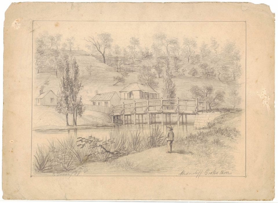
In 1840, Cornelius Prout replaced his punt with a sandstone bridge, and Frederick Wright Unwin constructed a low-level bridge to Wanstead, his country house. His road is still known as Unwin's Bridge Road. The completion of the Cooks River dam at Tempe created a solid and permanent crossing, allowing a road to Illawarra through the forest (Forest Road) to be surveyed in 1841 and opened a few years later. [media]In 1854, Undercliffe bridge opened on the site of Thorp's punt as a bypass to the tollgate near the dam; the 'new road to Illawarra' through Marrickville to Undercliffe bridge is still called Illawarra Road.
Railway and freight
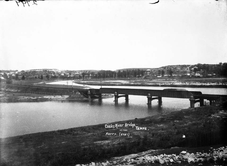
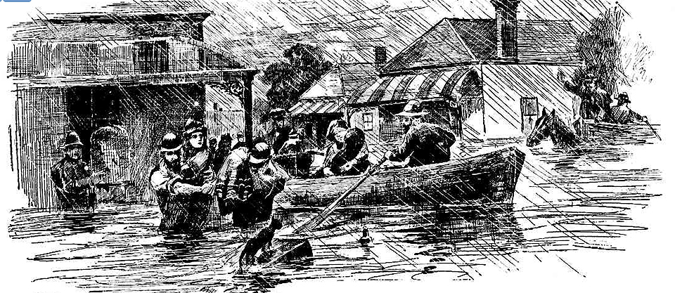
[media]Once the resources of New South Wales began to be exported, there was a push to build railways as a faster and more efficient means of freight transport. The first railway, opened in 1855, ran on timber sleepers cut from the forests of the Cooks River valley, but it was not until the great age of railway expansion, 1881–1895, that the district attracted the attention of railway speculators. At the end of the 1870s, coal gained in importance as a commodity and merchants and speculators pressured the government to build a railway line to the rich coalfields of the Illawarra escarpment. It was approved in 1880 and its construction in 1882–84 added a railway bridge to the Cooks River's obstructions, causing silting to occur at the mouth of Wolli Creek. The Illawarra line was not only a freight railway – long before it was approved, land speculators had subdivided estates along the line to as far away as Sutherland, ready for sale. It was [media]unfortunate that, close to Sydney, the route chosen was parallel to the Gumbramorra Swamp; early subdivisions like Thomas Saywell's Tramvale (Sydenham), dangerously low-lying and swampy land, were the first to flood when it rained.
[media]The Bankstown line started as a proposal to relieve congestion on the main southern and western lines. A loop railway was surveyed from St Peters to Liverpool across the Cooks River and along the valley of Cup and Saucer Creek (Bell's Line), thus bypassing the increasingly crowded rail junctions at Homebush and Granville. Alternative proposals, Sanderson's line along Wolli Creek and Kennedy's line along the north bank of the Cooks River, were drawn up by groups of land speculators in the 1880s. Eventually it was a shorter variation of Kennedy's line, a purely suburban railway that had powerful support from successive ministers for public works, which was finally built to Belmore in 1895, and extended to Bankstown in 1909.
Metropolitan rail freight
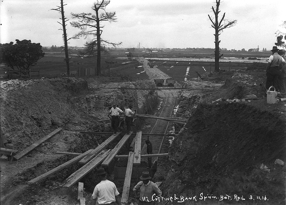
Because the St Peters to Liverpool loop line was not built, early in the twentieth century, the only route for goods trains to and from Darling Harbour was on the suburban railway lines through Redfern. By 1908, passenger and goods traffic had grown so much that the movement of goods trains in peak hours was prohibited. This made it very difficult to operate efficiently. Enfield Marshalling Yard was an important terminus in the Metropolitan Goods Line network, proposed in 1908–10. A separate line from Flemington to Glebe Island and Darling Harbour via Campsie and Dulwich Hill was approved in 1910. The first section to open was between Flemington and Campsie in April 1916 and the line through to Glebe Island opened a few months later. It was extended from Rozelle to Darling Harbour in 1922 and the [media]line from Marrickville to Botany opened in 1925. In subsequent years, the large marshalling yard at Enfield became the lynchpin of the state's rail freight system and provided employment to many local residents.
Suburban railway
After agitation to open up new land for settlement, a suburban railway from Tempe to East Hills along the Wolli Creek valley was approved at the end of 1924. Railway construction was delayed, however, and only commenced in 1928. It opened to Kingsgrove in September 1931 and to East Hills in December 1931.
Highway corridors
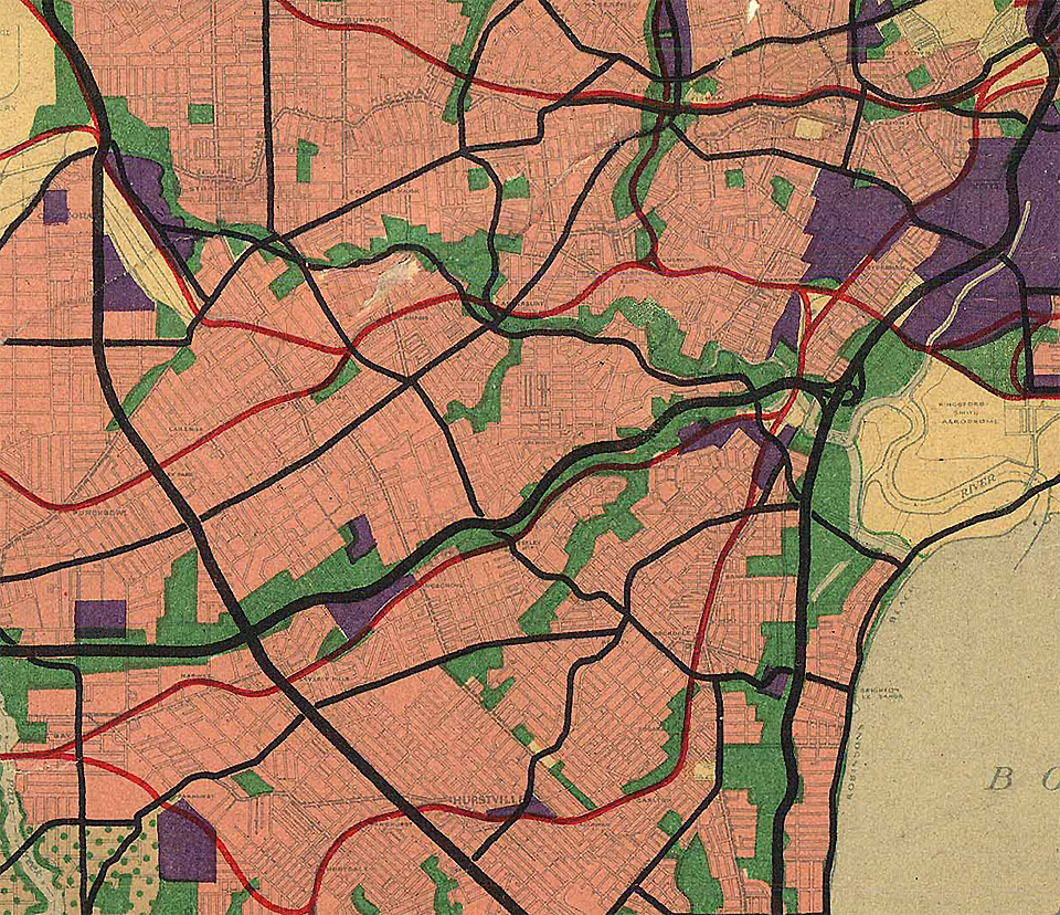
[media]In the Cumberland County Council's comprehensive plan for Sydney, two major road reservations were established, a county road along the banks of the Cooks River, and the south-western expressway beside the railway along the Wolli Creek valley. It appeared that the Cooks River and Wolli Creek were destined to become highway corridors.
References
New South Wales Legislative Assembly, Sydney Water Supply: Report of the Commission Appointed to Inquire into the Supply of Water to Sydney and Suburbs, 1869
Sharon Beder, 'From Sewage Farms to Septic Tanks: Trials and Tribulations in Sydney', Journal of the Royal Australian Historical Society, vol 79, parts 1 and 2, 1993
WV Aird, The Water Supply, Sewerage and Drainage of Sydney, Metropolitan Water Sewerage and Drainage Board, Sydney, 1961
Notes
[1] The Sydney Gazette, quoted in 'Report of the Cooks River Project', Cooks River Environment Survey and Landscape Design, Chippendale, 1976, p 5
[2] Evidence of Thomas Holt MLC, 7 September 1869 reported in New South Wales Legislative Assembly, Sydney Water Supply: Report of the Commission Appointed to Inquire into the Supply of Water to Sydney and Suburbs, 1869 recorded in NSW Parliament Legislative Assembly, Votes and Proceedings of the Legislative Assembly During the Session, vol 2, Sydney, 1869
[3] WV Aird, The Water Supply, Sewerage and Drainage of Sydney, Metropolitan Water Sewerage and Drainage Board, Sydney, 1961
[4] Sharon Beder, 'From Sewage Farms to Septic Tanks: Trials and Tribulations in Sydney', Journal of the Royal Australian Historical Society, vol 79, parts 1 and 2, 1993
[5] WV Aird, The Water Supply, Sewerage and Drainage of Sydney, Metropolitan Water Sewerage and Drainage Board, Sydney, 1961
[6] The Sydney Gazette, 18 June 1833


